Bear Flat, Arizona facts for kids
Quick facts for kids
Bear Flat, Arizona
|
|
|---|---|

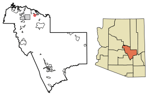
Location of Bear Flat in Gila County, Arizona.
|
|
| Country | United States |
| State | Arizona |
| County | Gila |
| Area | |
| • Total | 0.16 sq mi (0.41 km2) |
| • Land | 0.16 sq mi (0.41 km2) |
| • Water | 0.00 sq mi (0.00 km2) |
| Elevation | 4,964 ft (1,513 m) |
| Population
(2020)
|
|
| • Total | 11 |
| • Density | 69.18/sq mi (26.68/km2) |
| Time zone | UTC-7 (Mountain (MST)) |
| Area code(s) | 928 |
| GNIS feature ID | 40865 |
Bear Flat is a small community located in Gila County, Arizona, in the United States. It is known as a census-designated place (CDP). This means it's an area that the government counts for population information, but it's not an officially organized city or town.
Bear Flat is nestled in the valley of Tonto Creek. It is about 18 miles east of the town of Payson. In 2010, 18 people lived there. By 2020, the population was 11.
Where is Bear Flat?
Bear Flat is located in the state of Arizona. It sits in a valley near Tonto Creek. The area is quite small.
According to the U.S. Census Bureau, Bear Flat covers about 0.16 square miles (0.41 square kilometers). All of this area is land, with no large bodies of water. The elevation of Bear Flat is 4,964 feet (1,513 meters) above sea level.
Who Lives in Bear Flat?
The word "demographics" means information about the people who live in a place. Bear Flat is a very small community.
The population of Bear Flat has changed over time:
- In 2010, the population was 18 people.
- In 2020, the population was 11 people.
Bear Flat was first recognized as a census-designated place (CDP) in the 2010 U.S. Census. This means it was officially counted as a specific community for the first time then.
See also
 In Spanish: Bear Flat (Arizona) para niños
 | Janet Taylor Pickett |
 | Synthia Saint James |
 | Howardena Pindell |
 | Faith Ringgold |


