Bearskin Lake (Minnesota) facts for kids
Quick facts for kids Bearskin Lake |
|
|---|---|
| West Bearskin Lake, Birch Lake, Muko-waiani | |
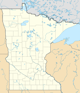
| Location | Cook County, Minnesota |
| Group | Boundary Waters Canoe Area |
| Coordinates | 48°03′58″N 90°25′36″W / 48.066°N 90.426765°W |
| Type | oligotrophic, glacial |
| Basin countries | United States |
| Surface area | 493 acres (200 ha) |
| Average depth | 31 ft (9.4 m) |
| Max. depth | 78 ft (24 m) |
| Residence time | 17 years |
Bearskin Lake is a beautiful, clear lake in Minnesota, United States. It's located near the Boundary Waters Canoe Area (BWCA), a huge wilderness area. Bearskin Lake is a glacial lake, which means it was formed by giant sheets of ice (glaciers) thousands of years ago.
This lake is also known as an oligotrophic lake. This fancy word means its water is very clean and clear, with low levels of nutrients. This makes it a special place! The name Bearskin Lake comes from the Ojibwe language name Muko-waiani.
Bearskin Lake is also home to Camp Menogyn, a YMCA camp that you can only reach by boat. It's a great spot for outdoor adventures!
Why Bearskin Lake is Important to Science
The mud, or sediment, at the bottom of Bearskin Lake is super clean. Because it's so pure, scientists use it for important tests.
Testing for Pollution
The sediment from Bearskin Lake is used as a "control" in tests that check for pollution. Think of it like this: when scientists want to see how harmful dirty mud is, they compare it to the perfectly clean mud from Bearskin Lake. This helps them understand how much pollution is in other lakes and rivers.
Developing New Methods
The United States Environmental Protection Agency (EPA) is a government group that works to protect our environment. They used the clean sediment from Bearskin Lake to create and improve their methods for testing how toxic, or harmful, different types of pollution are. So, Bearskin Lake helps keep our waters safe!
 | John T. Biggers |
 | Thomas Blackshear |
 | Mark Bradford |
 | Beverly Buchanan |


