Beinn a' Bhathaich Àrd facts for kids
Quick facts for kids Beinn a' Bhathaich Àrd |
|
|---|---|

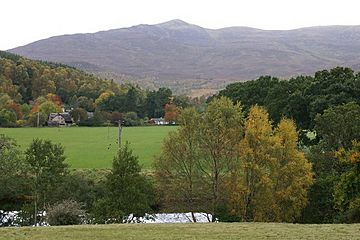
View of Beinn a' Bhathaich Àrd from near Struy
|
|
| Highest point | |
| Elevation | 862 m (2,828 ft) |
| Prominence | 241 m (791 ft) |
| Listing | Marilyn, Corbett |
| Naming | |
| English translation | Mountain of the high byre |
| Language of name | Gaelic |
| Geography | |
| Parent range | Northwest Highlands |
| OS grid | NH 36061 43474 |
| Topo map | OS Landranger 26, Explorer 431 |
Beinn a' Bhathaich Àrd is a mountain located in the Scottish Highlands of Scotland. It stands on the northern side of Glen Strathfarrar. This mountain is a well-known landmark in the area.
Contents
Discover Beinn a' Bhathaich Àrd
Beinn a' Bhathaich Àrd is a special mountain. It might not be the tallest, but its location makes it easy to spot. People often see it from many miles away.
Where is This Mountain?
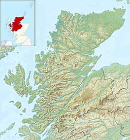
The mountain is at the eastern end of Glen Strathfarrar. It is about 5 kilometers northwest of the village of Struy. You can also find it 16 kilometers west of Beauly. Its position makes it a prominent feature. You can see it from places like The Aird and Inverness. It's even visible from the Kessock Bridge.
What Does the Name Mean?
The name Beinn a' Bhathaich Àrd comes from Gaelic. It means "Mountain of the high byre." A "byre" is a barn for cows. This name suggests there might have been a high barn or shelter on the mountain long ago.
How High is Beinn a' Bhathaich Àrd?
This mountain reaches a height of 862 meters (2,828 feet) above sea level. It is classified as a Marilyn and a Corbett. These are different types of hills based on their height and how much they rise above the surrounding land.
Climbing the Mountain
Most people who want to climb Beinn a' Bhathaich Àrd start their journey from a small place called Inchmore. Inchmore is a hamlet located right at the foot of Strathfarrar. It offers a good starting point for exploring the mountain.
 | Roy Wilkins |
 | John Lewis |
 | Linda Carol Brown |


