Bellot Strait facts for kids
Quick facts for kids Bellot Strait |
|
|---|---|

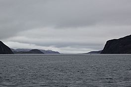
Bellot Strait viewed from its western end
|
|
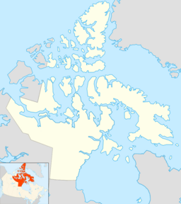
| Coordinates | 72°00′N 94°45′W / 72.000°N 94.750°W |
| Type | Strait |
| Etymology | Named after Joseph René Bellot |
| Max. length | 25 km (16 mi) |
| Max. width | 2 km (1.2 mi) |
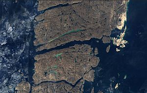
Bellot Strait is a narrow waterway located in Nunavut, Canada. It separates Somerset Island to its north from the Murchison Promontory of Boothia Peninsula to its south. The Boothia Peninsula is the northernmost part of mainland North America.
This strait is about 2 kilometers (1.2 miles) wide and 25 kilometers (15.5 miles) long. It connects several bodies of water. To its east are the Gulf of Boothia, Prince Regent Inlet, and Brentford Bay. To its west are Peel Sound and Franklin Strait.
Exploring Bellot Strait's Geography
The land on both sides of Bellot Strait is quite high. On the north side, the land rises steeply to about 450 meters (1,476 feet). The south shore is even higher, reaching approximately 750 meters (2,460 feet).
The water in the strait can move very fast. Currents can reach speeds of up to 8 knots (about 15 kilometers per hour or 9 miles per hour). These currents often change direction, making navigation tricky. The strait is also frequently filled with small icebergs. These icebergs can be dangerous for ships trying to pass through.
A Look at Bellot Strait's History
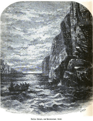
The first Europeans to see Bellot Strait were William Kennedy and Joseph René Bellot. They were explorers who reached the strait by dogsled in 1852. This journey proved that Somerset Island was indeed an island. It also showed that Prince Regent Inlet had a difficult way out to the west. The strait was later named after Joseph René Bellot.
In 1858, another explorer named Francis Leopold McClintock tried to sail through the strait. However, he had to give up his attempt. The first ship to successfully cross the strait was the Aklavik in 1937. This ship belonged to the Hudson's Bay Company and was piloted by Scotty Gall. It traveled from west to east.
Later, in 1942, Henry Larsen also crossed the strait. He did this as part of the first successful west-to-east journey through the entire Northwest Passage.
A trading post called Fort Ross was built on the northern shore of the strait in 1937. It operated for 11 years. Today, the building has been repaired and strengthened. It now serves as a safe place for researchers and crews of small boats passing through the strait.
See also
 In Spanish: Estrecho de Bellot para niños
 | John T. Biggers |
 | Thomas Blackshear |
 | Mark Bradford |
 | Beverly Buchanan |


