Belmar, Nebraska facts for kids
Quick facts for kids
Belmar, Nebraska
|
|
|---|---|
 |
|
| Country | United States |
| State | Nebraska |
| County | Keith |
| Area | |
| • Total | 4.58 sq mi (11.87 km2) |
| • Land | 4.58 sq mi (11.87 km2) |
| • Water | 0.00 sq mi (0.00 km2) |
| Elevation | 3,343 ft (1,019 m) |
| Population
(2020)
|
|
| • Total | 199 |
| • Density | 43.43/sq mi (16.77/km2) |
| Time zone | UTC-7 (Mountain (MST)) |
| • Summer (DST) | UTC-6 (MDT) |
| ZIP code |
69147
|
| FIPS code | 31-04055 |
| GNIS feature ID | 2583874 |
Belmar is a small community in Keith County, Nebraska, in the United States. It is known as a census-designated place, which means it's a special area used for counting people by the government. In 2010, about 216 people lived there.
A Look at Belmar's Past
Belmar started to grow when the Union Pacific Railroad built its tracks through the area. It's thought that the community was named after someone important from the railroad company.
A post office opened in Belmar in 1910. It helped people send and receive mail for many years before closing in 1941.
Where is Belmar Located?
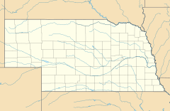
Belmar is in the northwestern part of Keith County. It sits on the north side of Lake McConaughy, which is a large lake formed by the North Platte River.
Nebraska Highway 92 goes right through Belmar. If you go west on this highway for about 12 miles, you'll reach Lewellen. If you go east for about 6 miles, you'll find Lemoyne. The main town of Ogallala, which is the county seat for Keith County, is about 24 miles southeast. You can get there by taking Highways 92 and 61.
The U.S. Census Bureau says that the Belmar area covers about 11.9 square kilometers (about 4.58 square miles). All of this area is land.
How Many People Live Here?
| Historical population | |||
|---|---|---|---|
| Census | Pop. | %± | |
| 2020 | 199 | — | |
| U.S. Decennial Census | |||
In 2020, the population of Belmar was 199 people. This information comes from the official count done by the U.S. government.
See also
 In Spanish: Belmar (Nebraska) para niños
 | Frances Mary Albrier |
 | Whitney Young |
 | Muhammad Ali |


