Belmont, Virginia facts for kids
Quick facts for kids
Belmont, Virginia
|
|
|---|---|
| Country | |
| State | |
| County | |
| Area | |
| • Total | 2.73 sq mi (7.08 km2) |
| • Land | 2.70 sq mi (7.00 km2) |
| • Water | 0.03 sq mi (0.08 km2) |
| Elevation | 295 ft (90 m) |
| Population
(2010)
|
|
| • Total | 5,966 |
| • Density | 2,208/sq mi (852.4/km2) |
| Time zone | UTC−5 (Eastern (EST)) |
| • Summer (DST) | UTC−4 (EDT) |
| ZIP code |
20147 (Ashburn)
|
| FIPS code | 51-06275 |
| GNIS feature ID | 2584805 |
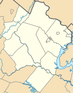
Belmont is a small community in Loudoun County, Virginia, in the United States. It's known as a census-designated place (CDP). This means it's an area that the government counts as a separate place for population statistics, even if it's not an official town.
In 2010, about 5,966 people lived in Belmont. It is located about 5 miles (8 km) southeast of Leesburg, which is the main town of Loudoun County. It's also about 31 miles (50 km) northwest of Washington, D.C..
Contents
History of Belmont
The Belmont Manor House is a very old building in Belmont. It was built a long time ago, between 1799 and 1802. A son of Richard Henry Lee, who was an important person in American history, built this house. Today, the Belmont Manor House is the clubhouse for a special golf community that has gates for entry.
Where is Belmont Located?
Belmont is situated along the east side of Belmont Ridge Road. This road is also known as State Route 659. The community is found between two other important roads: State Route 7 and State Route 267. State Route 267 is also called the Dulles Toll Road.
Belmont's Borders
The northern edge of Belmont reaches up to State Route 7. To the south, it includes Middlebury Street and the Washington and Old Dominion Trail. On its eastern side, Belmont is bordered by Stubble Road, Claiborne Parkway, and Ashburn Road.
Communities Inside Belmont
Belmont is made up of two main neighborhoods, or subdivisions. The larger one is called Belmont Country Club. It is located in the eastern part of Belmont. The smaller neighborhood is called Belmont Greene, and it's in the western part of the community.
What is the Land Like in Belmont?
Belmont covers a total area of about 7.1 square kilometers (2.7 square miles). Most of this area is land. Only a small part, about 0.08 square kilometers (0.03 square miles), is water.
Waterways in Belmont
Most of the water in Belmont flows east through small streams. These streams eventually lead to Broad Run, which is a larger stream that flows north. Broad Run then joins the Potomac River. The westernmost part of Belmont has water that flows west into Goose Creek. Goose Creek also flows north and eventually connects to the Potomac River.
See also
 In Spanish: Belmont (Virginia) para niños
 | Isaac Myers |
 | D. Hamilton Jackson |
 | A. Philip Randolph |


