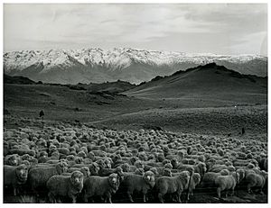
Bendigo, New Zealand facts for kids
Bendigo is a small settlement and a historic area in Central Otago, located on the South Island of New Zealand. It's about 20 kilometres north of Cromwell, near the top of Lake Dunstan. Bendigo sits on the banks of Bendigo Creek, which flows into the Clutha River.
Before Europeans arrived, Māori people didn't live in Bendigo permanently, but they did use the area. An old Māori trail passed through here. People have found pieces of pounamu (greenstone) weapons, a canoe paddle, and even parts of moa eggshells. This suggests it was a temporary camping spot for Māori travellers.
Contents
Discovering Gold in Bendigo
Bendigo became famous in the 1860s during the exciting Otago Gold Rush. Gold was first found in Bendigo Creek in 1862. The goldfields around Bendigo quickly became one of New Zealand's richest areas. Miners found a lot of gold, sometimes between 15 and 50 ounces (about 0.4 to 1.4 kilograms) each week!
From Alluvial Gold to Quartz Reefs
At first, miners found "alluvial gold," which means gold mixed in with river gravel. This type of gold was easy to find but ran out quickly. Then, in 1863, a man named Thomas Logan discovered gold in "quartz reefs." These are veins of rock deep underground that contain gold. Many mine shafts were dug into the rock during the 1860s. By the mid-1870s, this reef was known as New Zealand's richest. Gold mining continued in Bendigo until the 1940s. The name "Bendigo" itself came from an Australian town with the same name. Gold miners from Australia's goldfields brought the name with them.
Exploring the Bendigo Historic Reserve
The old goldfields, even though the gold ran out, have been mostly kept safe. They now form the 1,085-hectare Bendigo Historic Reserve. This reserve is a great place to visit! It has many walking trails where you can see the remains of old mine shafts, water races (channels built to carry water for mining), and stamping batteries (machines used to crush rock to get gold). You can also see the ruins of buildings from the deserted settlement.
Bendigo's Modern Economy: Wine and Tourism
Today, Bendigo's economy is all about tourism and wine. The area around Bendigo is a very important part of the Central Otago wine region. Many top wineries and vineyards are located here. Just like other parts of this wine region, the main type of grape grown in Bendigo is pinot noir.
Wineries in Bendigo
- Aurora Vineyard
- Clutha Ridge
- Lamont
- Folding Hill
- Misha's Vineyard
- Moko Hills
- Mondillo
- Mud House Wines
- Prophet’s Rock
- Quartz Reef
- Zebra NZ Vineyards
Wineries Near Tarras and Māori Point
- Māori Point Vineyard
- Swallows Crossing Vineyard
- Tarras Vineyards
Climate in Bendigo
| Climate data for Bendigo (1991–2020) | |||||||||||||
|---|---|---|---|---|---|---|---|---|---|---|---|---|---|
| Month | Jan | Feb | Mar | Apr | May | Jun | Jul | Aug | Sep | Oct | Nov | Dec | Year |
| Mean daily maximum °C (°F) | 24.8 (76.6) |
24.5 (76.1) |
21.8 (71.2) |
17.7 (63.9) |
12.9 (55.2) |
8.8 (47.8) |
8.2 (46.8) |
11.7 (53.1) |
15.3 (59.5) |
17.8 (64.0) |
20.6 (69.1) |
22.8 (73.0) |
17.2 (63.0) |
| Daily mean °C (°F) | 18.1 (64.6) |
17.6 (63.7) |
15.0 (59.0) |
11.3 (52.3) |
7.4 (45.3) |
4.3 (39.7) |
3.6 (38.5) |
5.9 (42.6) |
9.1 (48.4) |
11.5 (52.7) |
14.0 (57.2) |
16.4 (61.5) |
11.2 (52.1) |
| Mean daily minimum °C (°F) | 11.4 (52.5) |
10.8 (51.4) |
8.2 (46.8) |
4.8 (40.6) |
1.9 (35.4) |
−0.2 (31.6) |
−1.1 (30.0) |
0.1 (32.2) |
2.9 (37.2) |
5.2 (41.4) |
7.4 (45.3) |
10.1 (50.2) |
5.1 (41.2) |
| Average rainfall mm (inches) | 39.0 (1.54) |
31.9 (1.26) |
45.1 (1.78) |
27.5 (1.08) |
30.7 (1.21) |
35.0 (1.38) |
30.9 (1.22) |
25.7 (1.01) |
18.0 (0.71) |
34.6 (1.36) |
29.1 (1.15) |
42.9 (1.69) |
390.4 (15.39) |
| Source: NIWA | |||||||||||||
 | Sharif Bey |
 | Hale Woodruff |
 | Richmond Barthé |
 | Purvis Young |


