Benton, Pennsylvania facts for kids
Quick facts for kids
Benton, Pennsylvania
|
||
|---|---|---|
|
Borough
|
||
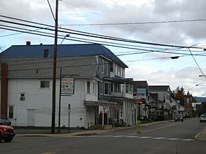
View north on PA 487 in Benton in October 2012
|
||
|
||
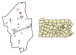
Location of Benton in Columbia County, Pennsylvania (left) and of Columbia County in Pennsylvania (right)
|
||
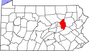
Map showing Columbia County in Pennsylvania
|
||
| Country | United States | |
| State | Pennsylvania | |
| County | Columbia | |
| Settled | 1833 | |
| Incorporated | 1894 | |
| Government | ||
| • Type | Borough Council | |
| Area | ||
| • Total | 0.61 sq mi (1.59 km2) | |
| • Land | 0.60 sq mi (1.55 km2) | |
| • Water | 0.02 sq mi (0.05 km2) | |
| Elevation | 765 ft (233 m) | |
| Population
(2020)
|
||
| • Total | 823 | |
| • Density | 1,378.56/sq mi (532.32/km2) | |
| Time zone | UTC-5 (Eastern (EST)) | |
| • Summer (DST) | UTC-4 (EDT) | |
| ZIP Code |
17814
|
|
| Area code(s) | 570 | |
| FIPS code | 42-05680 | |
| GNIS feature ID | 1215122 | |
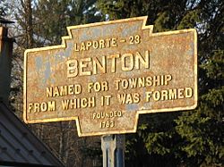
Benton is a small town, also called a borough, located in Columbia County, Pennsylvania, United States. It is part of Northeastern Pennsylvania. In 2020, about 824 people lived there. Benton is also part of the Bloomsburg-Berwick micropolitan area.
Contents
Discover Benton, Pennsylvania
Where is Benton?
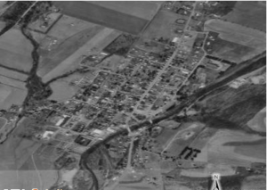
Benton is in the northern part of Columbia County. It is surrounded by a separate area called Benton Township. The borough covers about 1.59 square kilometers (0.61 square miles). Most of this area is land.
A stream called Fishing Creek flows through the eastern side of Benton. This creek eventually joins the Susquehanna River.
A Look Back: Benton's History
The first families settled in the Benton area in 1792. A school opened here in 1799. Around 1860, industries like tanning (making leather) and lumber (wood) started to grow north of the town. By 1868, Benton had about fifty houses.
Fires and Floods
Benton has faced many challenges. In 1910, a big fire destroyed over sixty buildings. Two teenagers accidentally started the fire with firecrackers in a hay barn. At that time, the town did not have a water system to fight fires.
Because of this, the Benton Dam was built in 1915. But more disasters followed. Another fire hit the town just one year later, burning more homes. In 1962, another fire destroyed a distillery and its warehouse.
In 2011, Benton was also hit by a flood. On April 15, 2019, an EF2 tornado touched down in Benton. It damaged nine trailers and up to 50 homes and businesses. Despite these tough times, Benton has always worked to rebuild and continues to grow.
Getting Around Benton
Roads and Highways
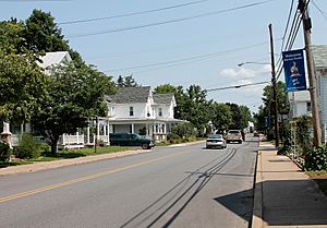
Two main highways run through Benton and serve as its Main Street:
- Pennsylvania Route 239 goes east for about 14 miles to US 11 in Shickshinny. It also goes northwest about 13 miles to PA 42.
- Pennsylvania Route 487 goes north about 13 miles to Ricketts Glen State Park. It also goes south about 17 miles to Bloomsburg, which is the main town of Columbia County.
Benton is also about 14 miles north of Interstate 80, a major highway.
Airports and Trains
The closest airport with regular flights is Williamsport Regional Airport. However, travelers often go to Trenton–Mercer Airport or Philadelphia International Airport for lower prices.
From 1888 to 1972, Benton had a train service. It was part of the Bloomsburg and Sullivan Railroad, which later became part of the Reading Railroad.
People of Benton
| Historical population | |||
|---|---|---|---|
| Census | Pop. | %± | |
| 1880 | 191 | — | |
| 1900 | 635 | — | |
| 1910 | 719 | 13.2% | |
| 1920 | 696 | −3.2% | |
| 1930 | 733 | 5.3% | |
| 1940 | 786 | 7.2% | |
| 1950 | 890 | 13.2% | |
| 1960 | 981 | 10.2% | |
| 1970 | 1,027 | 4.7% | |
| 1980 | 981 | −4.5% | |
| 1990 | 958 | −2.3% | |
| 2000 | 955 | −0.3% | |
| 2010 | 824 | −13.7% | |
| 2020 | 824 | 0.0% | |
| 2021 (est.) | 824 | 0.0% | |
| Sources: | |||
In 2000, there were 955 people living in Benton. The population density was about 1,503 people per square mile. Most of the people living in Benton were White (99.69%).
About 25.9% of the population was under 18 years old. The average age in Benton was 36 years.
Learning in Benton
Benton is part of the Benton Area School District. This district has two schools:
- L.R. Appleman Elementary School (for grades K-6)
- Benton Middle-Senior High School (for grades 7-12)
There are also 24 colleges within 50 miles of Benton. The closest large college is the Bloomsburg University of Pennsylvania, about 13.4 miles away. Bucknell University is considered a top-rated college nearby.
See also
 In Spanish: Benton (Pensilvania) para niños


