Fishing Creek (North Branch Susquehanna River tributary) facts for kids
Quick facts for kids Fishing Creek |
|
|---|---|
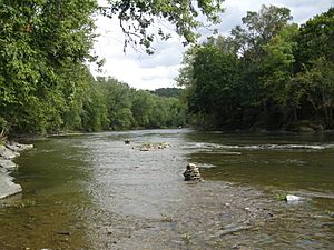
Fishing Creek near the Rupert Covered Bridge No. 56 between Montour Township and Bloomsburg
|
|
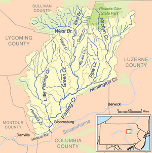
Map of the Fishing Creek watershed
|
|
| Country | United States |
| State | Pennsylvania |
| Counties | Columbia, Luzerne, Lycoming, Montour, and Sullivan |
| Physical characteristics | |
| Main source | Confluence of the East and West Branches Sugarloaf Township, Columbia County 920 ft (280 m) 41°16′31″N 076°22′32″W / 41.27528°N 76.37556°W |
| River mouth | Confluence with the Susquehanna River Rupert 456 ft (139 m) 40°58′38″N 076°28′02″W / 40.97722°N 76.46722°W |
| Length | 29.98 mi (48.25 km) |
| Basin features | |
| Basin size | 385 sq mi (1,000 km2) |
| Tributaries | |
Fishing Creek is a 29.98-mile (48.25 km) long river in Columbia County, Pennsylvania, United States. It flows into the Susquehanna River near Rupert and Bloomsburg. The area of land that drains into Fishing Creek, called its watershed, covers 385 square miles (1,000 km2).
Long ago, Native Americans lived near Fishing Creek. Some arrived around 8000 BCE. Later, between 3000 and 2000 BCE, some spent winters in the valley to hunt. In more recent centuries, the area has been home to many businesses, mills, and dams. Fishing Creek flows through parts of five Pennsylvania counties: Columbia, Montour, Sullivan, Luzerne, and Lycoming.
The main streams that flow into Fishing Creek are Hemlock Creek, Little Fishing Creek, Green Creek, Huntington Creek, West Branch Fishing Creek, and East Branch Fishing Creek. People enjoy canoeing, birdwatching, and fishing here. The creek is famous for its trout, including brook, brown, and rainbow trout. Many other types of fish live here too. You can also find northern hardwood trees and ruffed grouse in the surrounding areas.
Sometimes, parts of Fishing Creek have a lot of algae. This happens because of leaky septic systems in the watershed. The water quality can change. The water's pH (how acidic or basic it is) ranges from 4.9 to 8.5. The amount of oxygen in the water ranges from 5 to 17.5 milligrams per liter. On average, the creek flows at 615 cubic feet per second (17.4 m3/s). The land around the creek has gravel, shale, and different types of soil.
Contents
The Creek's Journey
Fishing Creek starts 920 feet (280 m) above sea level. This is in Sugarloaf Township, where the East Branch and West Branch Fishing Creeks meet. It flows south through Sugarloaf Township for about 2 miles (3.2 km). Then, it turns east and meets Coles Creek, which is its first named tributary. Coles Creek joins Fishing Creek 26.34 miles (42.39 km) before it reaches its end.
After this, Fishing Creek turns sharply south into Benton Township. It flows next to Pennsylvania Route 487 for about four or five miles. Near Benton, West Creek joins it from the west. Fishing Creek then goes under Pennsylvania Route 239 and continues south. It passes through Maple Grove and into Fishing Creek Township and Stillwater. In Stillwater, Raven Creek flows into it. A bit further south, Huntington Creek joins the creek. Fishing Creek then flows past communities like Zaners and Forks.
When Fishing Creek leaves Fishing Creek Township, it flows southwest past Knob Mountain into Orange Township. It passes near Orangeville and then makes a sharp turn to the northwest. Soon after, Green Creek joins it 10.84 miles (17.45 km) from its mouth. The creek then turns west and later south again. It flows along the border between Orange and Mount Pleasant Townships. Here, it passes Kocher Park. Near Lightstreet, it turns west into Mount Pleasant Township. It flows near Interstate 80 for 2 to 3 miles (3.2–4.8 km).
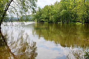
Near the border of Mount Pleasant Township and Bloomsburg, Little Fishing Creek joins Fishing Creek 3.86 miles (6.21 km) from its mouth. The creek then turns south, flowing next to Bloomsburg. As it flows between Bloomsburg and Fernville, it turns sharply west. It picks up Hemlock Creek, which is 1.52 miles (2.45 km) from the mouth. Soon after, Fishing Creek turns southeast under U.S. Route 11. It flows next to Pennsylvania Route 42 for over 1 mile (1.6 km). Finally, it meets Montour Run and then flows into the Susquehanna River between Bloomsburg and Rupert. The Rupert Covered Bridge No. 56 crosses the creek here. The mouth of the creek is 456 feet (139 m) above sea level.
Main Streams Joining Fishing Creek
Fishing Creek has several important streams that flow into it, called tributaries. The main ones are Hemlock Creek, Little Fishing Creek, Green Creek, Huntington Creek, and the East and West Branch Fishing Creeks.
- West Branch Fishing Creek starts on North Mountain and flows east.
- East Branch Fishing Creek also starts on North Mountain in Sullivan County and is about 4.4 miles (7.1 km) long.
- Huntington Creek begins in State Game Lands number 57. It flows southwest through Luzerne County and then next to Knob Mountain before joining Fishing Creek. This creek drains the eastern part of the Fishing Creek watershed. Four covered bridges cross Huntington Creek.
- Green Creek starts near Waller and flows south to Orangeville, where it joins Fishing Creek. It drains the central part of the watershed.
- Little Fishing Creek starts in Lycoming County. It flows through rural areas and then next to Pennsylvania Route 42. It drains the western part of the watershed. Four covered bridges cross Little Fishing Creek.
Other smaller streams that join Fishing Creek include Coles Creek, West Creek, Raven Creek, Montour Run, Deerlick Run, and Stony Brook.
The Land Around Fishing Creek
The land area that drains into Fishing Creek, called its watershed, covers most of Columbia County north of the Susquehanna River. It also includes parts of southern Sullivan County, western Luzerne County, and small areas of Montour and Lycoming Counties.
The upper part of the watershed is mostly forest (85%) and farmland (13%). Near the creek's source, a small part is residential. Closer to Benton, some areas are more urban. The watershed is made up of several smaller watersheds. The largest are Huntington Creek (114 square miles), Little Fishing Creek (68.1 square miles), Green Creek (36.9 square miles), and West Branch Fishing Creek (32.9 square miles).
The Turkey Hill Oxbow Lake
An oxbow lake is a U-shaped lake formed when a wide bend of a river is cut off from the main river. In northern Bloomsburg and Scott Township, there's a small oxbow lake of Fishing Creek called the Turkey Hill Oxbow. It's located between Interstate 80 and the forests of Turkey Hill.
This area is on a flood plain, which means it can flood. It has grasses, wet forests, and open water. When there's a lot of rain, the Turkey Hill Oxbow lake fills with water from Fishing Creek. During dry times, it only has water in a few spots. The land around the oxbow is often steep and covered with forests. You can find trees like hemlock, black birch, yellow birch, and different types of oak and maple trees. Many wildflowers grow here too, like white baneberry and blue cohosh. Animals like pickerel frogs, green frogs, wood ducks, and snapping turtles live around the pools of water.
History of Fishing Creek
Early People and Settlements
Native Americans first arrived in Pennsylvania a very long time ago. By 8000 BCE, nomadic groups reached the area near Fishing Creek's mouth. Between 3000 and 2000 BCE, some Native Americans started spending winters in the Fishing Creek valley to hunt deer and bears. They would return to the Susquehanna River in the summer. Around 1000 BCE, the first permanent Native American villages were built at the mouth of Fishing Creek. Tribes like the Shawnee and Susquehannock Indians lived here. Old paths used by Native Americans ran along the creek.
European Settlers and Industries
European settlers began moving into the Fishing Creek area in 1769. In that same year, the Penn family bought a large piece of land upstream from Benton. In 1778, a fort was built by Moses Van Campen on Fishing Creek to protect the settlers. People started settling in the Fishing Creek valley in the late 1700s. The first sawmill on the upper part of Fishing Creek was built in the late 1790s.
More mills were built in the early 1800s, including a flour and grist mill in 1818. This mill burned down several times but was always rebuilt. Iron ore was found in the area in 1822, and a furnace that burned anthracite coal was built near Bloomsburg in 1844. From about 1840 to 1900, making wagons was an important business in the upper Fishing Creek area.
During the American Civil War (1864), there was a suspected uprising called the Fishing Creek Confederacy. It was thought to be a group of soldiers who had left the army and people who avoided being drafted. About a thousand soldiers searched the Fishing Creek valley but didn't find many deserters. However, about 100 people from Columbia County were arrested, though most were later released.
In 1877, the Bloomsburg Water Company started using Fishing Creek as its water source. A railroad, the Bloomsburg and Sullivan Railroad, was built next to the creek in 1888. In the 1930s, during the Great Depression, a beach was built on the creek near Fernville. After a big flood in 1972 from Hurricane Agnes, a warning system was put in place for flash floods. In 2002, a piece of land on Fishing Creek near Lightstreet was turned into Frank W. Kocher Memorial Park, which is now over 7 acres (2.8 ha). Today, the Benton Foundry is the only major industry in the watershed.
How Fishing Creek Flows and Changes
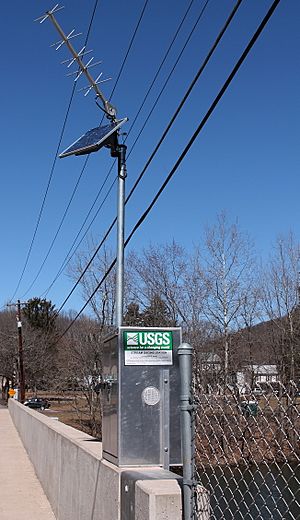
Scientists have set up stations to measure how much water flows in Fishing Creek and what its quality is like.
Water Flow (Discharge)
Just downstream from Orangeville, Fishing Creek's average water flow, or discharge, is about 615 cubic feet per second (17.4 m3/s). The lowest flow recorded was 90 cubic feet per second (2.5 m3/s), and the highest was 2,580 cubic feet per second (73 m3/s). In summer, the East and West Branches of Fishing Creek can sometimes dry up for over 100 days.
Water Acidity (pH)
The pH level tells us how acidic or basic the water is. For Fishing Creek, the pH usually ranges from 5.6 to 7.25 near Benton, and from 5.8 to 8.5 near Bloomsburg. A pH of 7 is neutral. Fish need the pH to be in a certain range to be healthy. The East Branch Fishing Creek can sometimes get quite acidic (as low as 4.9), which is close to what brook trout can handle. The water can become acidic because of acid rain.
Things Dissolved in the Water
The amount of dissolved oxygen in Fishing Creek is important for fish and other water life. It usually ranges from about 5 to 17.5 milligrams per liter. The total amount of dissolved solids in the water near Bloomsburg can range from very low to 166 milligrams per liter.
Sometimes, there's a small amount of dissolved aluminum in the water. In the East Branch Fishing Creek, aluminum levels can get high enough to be harmful to fish. These levels are highest in March and April when the ground thaws.
Dams on the Creek
There are five dams on Fishing Creek.
- Boone's Dam is the furthest downstream, in Montour Township. It is 4.5 feet (1.4 m) high.
- Diverting Dam is in Bloomsburg, 2 feet (0.61 m) high. It was built to power nearby furnaces.
- An unnamed dam in Mount Pleasant Township is 5 feet (1.5 m) high.
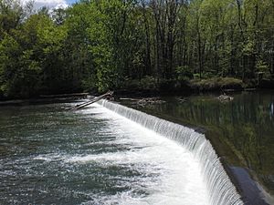
- The Benton Dam (11 feet (3.4 m) high) and the Mill Dam (6 feet (1.8 m) high) are in Benton Township and Benton.
- The Jonestown Dam is on Huntington Creek, a tributary, and is 8 feet (2.4 m) high.
Water Temperature
The water temperature in Fishing Creek changes with the seasons. In summer, West Creek can reach 77 °F (25 °C), and Fishing Creek near Benton can reach 75 °F (24 °C). In winter, the main creek is around 32 °F (0 °C), and West Branch Fishing Creek can drop to 28 °F (−2 °C), making it the coldest stream in the watershed. The average temperature for the creek is about 53.65 °F (12.03 °C).
The Land and Rocks of Fishing Creek
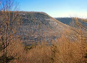
The Fishing Creek watershed has been shaped by glaciation, which means ancient glaciers moved through the area. This left behind rocky material called glacial till near the source and glacial outwash in the lower parts. The watershed is in two main geological areas: the Deep Valley section of the Allegheny Plateau (with deep valleys and rounded mountains) and the Susquehanna Lowlands Section (with less steep valleys). There are also flat areas along the creek called flood plains.
The bottom of Fishing Creek has red and brown shale in some places. Other parts of the watershed have gray sandstone or conglomerates (rocks made of pebbles). There are also deposits of iron ore, limestone, and marble. Most of the rocks in the watershed formed during the Devonian Period, but some northern parts have rocks from the Mississippian Period. Fishing Creek is a freestone stream, meaning its water comes from rain and melting snow, not underground springs.
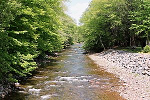
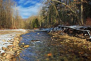
The creek has areas of deep water called pools followed by shallow, fast-moving areas called riffles. This mix of pools and riffles is great for fly-fishing.
Soils Around the Creek
The main soil type near Fishing Creek is called the Albrights series. It has a sticky, reddish-brown, gravelly silt loam on top. Other soils like the Leck Kill-Meckesville-Calvin series and Barbour series are also found. These soils are generally fertile and good for farming. In 1914, farmers found that these soils produced large amounts of crops like potatoes, corn, oats, wheat, and hay.
Animals and Plants of Fishing Creek
Water Life
The bottom of Fishing Creek is often covered with a lot of benthic algae, which are tiny water plants. This is often due to leaky septic systems. For example, in one spot, over 60% of the creek bed is covered in algae.
Thirty-six different kinds of macroinvertebrates (small creatures without backbones, like insects and worms) live in Fishing Creek. These creatures are important because they are food for fish and show how healthy the water is. The most types of macroinvertebrates are found near Grassmere Park.
Fishing Creek is a popular spot for fishing. The Fishing Creek Sportsman's Association stocks the creek with brook trout, rainbow trout, and brown trout. Some of these trout can grow very large! All the streams in the watershed are good for trout. Besides trout, you can also find sculpin and cutlips minnow in large numbers. It can be hard for fish to lay their eggs in the creek because of water quality issues near Benton and sometimes a lack of food.
Land Animals and Plants
Northern hardwood trees are common in the Fishing Creek watershed. You can find ruffed grouse (a type of bird) along Little Fishing Creek. There are also some Japanese knotweed, which is an invasive plant that can take over areas, along the creek.
Habitat Health
In 2011, scientists studied how good the habitat was for animals and plants in Fishing Creek. They rated most of the creek and its tributaries as "optimal," meaning it's a very good place for living things. Some parts were rated "suboptimal," and a small part of West Creek was rated "marginal."
Groups like the Fishing Creek Sportsman's Association are working to protect Fishing Creek. They suggest planting trees along the banks (called riparian buffers), fixing leaky septic systems, and protecting the area from hydraulic fracturing (a way to get natural gas from the ground).
Fun Things to Do at Fishing Creek
The Fishing Creek Watershed Association is planning to open a public section of the creek that is over 6500 feet (1980 meters) long, with a park of 92 acres (37.2 ha). There are other public areas along the creek too.
- The Power Dam is 2 miles (3.2 km) upstream of Benton. It has the remains of an old concrete dam.
- The Benton Overlook is 1 mile (1.6 km) into Benton and offers views near the creek.
- A public site at the Zaners Bridge in Zaner has an old abandoned railroad path.
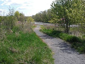
The Grassmere Park Campground was set up in the early 1900s on Fishing Creek. Further downstream, near Lightstreet, is Kocher Park, which is over 7 acres (2.8 ha). People often go there for canoeing, walking their dogs, birdwatching, and fishing.
The western part of Pennsylvania State Game Lands Number 13 is in a deep valley carved by West Branch Fishing Creek. These game lands cover 50,000 acres and have many forest roads and old paths. There's a hiking trail called Waterfall Wonderland, which has amazing views of several waterfalls. It's a beautiful place to explore nature.
The Jakey Hollow Natural Area is on a small stream that flows into Little Fishing Creek. It's near Mordansville and has very old forests. It's one of the smallest natural areas in Pennsylvania.
 | Georgia Louise Harris Brown |
 | Julian Abele |
 | Norma Merrick Sklarek |
 | William Sidney Pittman |


