
Montour County, Pennsylvania facts for kids
Quick facts for kids
Montour County
|
||
|---|---|---|

Montour County Courthouse in Danville
|
||
|
||

Location within the U.S. state of Pennsylvania
|
||
 Pennsylvania's location within the U.S. |
||
| Country | ||
| State | ||
| Founded | May 3, 1850 | |
| Named for | Andrew Montour | |
| Seat | Danville | |
| Largest borough | Danville | |
| Area | ||
| • Total | 132 sq mi (340 km2) | |
| • Land | 130 sq mi (300 km2) | |
| • Water | 2.1 sq mi (5 km2) 1.6%% | |
| Population | ||
| • Estimate
(2020)
|
18,136 | |
| • Density | 140/sq mi (50/km2) | |
| Time zone | UTC−5 (Eastern) | |
| • Summer (DST) | UTC−4 (EDT) | |
| Congressional district | 9th | |
Montour County is a small county in Pennsylvania. About 18,136 people lived there in 2020. Its main town, called the county seat, is Danville.
The county is named after Andrew Montour. He was a famous interpreter who helped George Washington during the French and Indian War. Montour County is the smallest county in Pennsylvania. It covers about 132 square miles. It is located in the central part of Pennsylvania.
Montour County is part of a larger area called the Bloomsburg-Berwick Metropolitan Statistical Area.
Contents
History of Montour County
During the American Revolutionary War, Fort Bosley was the only fortified place in the county. It was located near Derry Township and Washingtonville.
Geography and Nature
Montour County covers about 132 square miles. Most of this area, 130 square miles, is land. The rest, about 2.1 square miles, is water. This makes it the smallest county by land area in Pennsylvania.
Almost half of Montour County, about 45%, is covered by woods. All the water in the county flows into the Susquehanna River. Other important streams in the county are Chillisquaque Creek and Mahoning Creek.
What is the Climate Like?
Montour County has a humid continental climate. This means it has warm summers and cold winters. In Danville, the average temperature in January is about 26.9°F. In July, it's about 72.3°F.
Neighboring Counties
Montour County shares borders with these other counties:
- Lycoming County (to the north)
- Columbia County (to the east)
- Northumberland County (to the south and west)
Main Roads and Highways
Several major roads pass through Montour County. These roads help people travel around the county and to other areas:
 I-80
I-80 US 11
US 11 PA 44
PA 44 PA 45
PA 45 PA 54
PA 54 PA 254
 PA 642
Geology and Landforms
Montour County is part of the Ridge-and-Valley Appalachians. This is a region of the Appalachian Mountains with many ridges and valleys. About 65% of the soil in the county drains water well.
The Muncy Hills are in the northern part of the county. Montour Ridge is in the southern part, close to the Susquehanna River. Montour Ridge is also the highest point in the county, at 1,425 feet above sea level. The lowest point is 440 feet above sea level, by the Susquehanna River.
The rocks in Montour County are sedimentary rocks. They formed during the Devonian Period or the Silurian Period. Devonian Period rocks make up two-thirds of the county. These rocks are found in the Muncy Hills and the lowlands in the south.
Silurian Period rocks make up the other third of the county. These rocks are common on Montour Ridge and near Washingtonville.
How the Land Was Formed
Montour County has three main anticlines (upward folds) and synclines (downward folds). These are the White Deer Anticline, the Lackawanna Syncline, and the Milton Anticline. They run from northeast to southwest. They were formed about 200 million years ago by strong pressure and uplift.
During the Pleistocene Period, a large glacier reached Montour County. This glacier helped shape the land. There are also alluvial deposits in many river valleys. These are recent deposits of sand, silt, and clay left by water.
Water Supply
Montour County gets its water mainly from the Susquehanna River. Many people in rural areas use wells and springs for their water. Danville mostly uses the Susquehanna River.
Population and People
| Historical population | |||
|---|---|---|---|
| Census | Pop. | %± | |
| 1850 | 13,239 | — | |
| 1860 | 13,053 | −1.4% | |
| 1870 | 15,344 | 17.6% | |
| 1880 | 15,468 | 0.8% | |
| 1890 | 15,645 | 1.1% | |
| 1900 | 15,526 | −0.8% | |
| 1910 | 14,868 | −4.2% | |
| 1920 | 14,080 | −5.3% | |
| 1930 | 14,517 | 3.1% | |
| 1940 | 15,466 | 6.5% | |
| 1950 | 16,001 | 3.5% | |
| 1960 | 16,730 | 4.6% | |
| 1970 | 16,508 | −1.3% | |
| 1980 | 16,675 | 1.0% | |
| 1990 | 17,735 | 6.4% | |
| 2000 | 18,239 | 2.8% | |
| 2010 | 18,267 | 0.2% | |
| 2020 | 18,136 | −0.7% | |
| U.S. Decennial Census 1790-1960 1900-1990 1990-2000 2010-2017 2010-2020 |
|||
In 2000, there were 18,236 people living in Montour County. There were 7,085 households. About 4,817 of these were families. The county had about 140 people per square mile.
Most people in the county were White (96.67%). About 1.01% were Black or African American. About 1.28% were Asian. A small number were Native American or from other backgrounds. About 0.92% of the population was Hispanic or Latino.
Many people in Montour County have German (33.2%) or American (13.2%) roots. Other common backgrounds include Irish, English, Italian, and Polish.
Who Lives in Montour County?
About 30% of households had children under 18 living with them. More than half (56.3%) were married couples. About 8.9% had a female head of household without a husband.
The average household had 2.43 people. The average family had 2.98 people.
In terms of age, 24.4% of the population was under 18. About 17.1% were 65 years or older. The average age in the county was 40 years. For every 100 females, there were about 90.5 males.
2020 Census Information
| Race | Num. | Perc. |
|---|---|---|
| White (NH) | 16,105 | 88.8% |
| Black or African American (NH) | 320 | 1.7% |
| Native American (NH) | 27 | 0.2% |
| Asian (NH) | 668 | 3.7% |
| Pacific Islander (NH) | 0 | 0% |
| Other/Mixed (NH) | 529 | 3% |
| Hispanic or Latino | 487 | 2.7% |
Economy of Montour County
Montour County has about 350 farms. Most of these farms raise beef cattle, hogs, and dairy cows. Limestone is also mined in some parts of the county.
Education in Montour County

The Central Susquehanna Intermediate Unit #16 helps children in Montour County. They offer many services. These include support for special education and early learning programs. They also provide speech and hearing therapy. These services are free for families if their child qualifies.
Danville Area Head Start is another program for young children.
Public School Districts
Children in Montour County attend schools in these public school districts:
- Danville Area School District (also serves parts of Northumberland County)
- Warrior Run School District (also serves parts of Northumberland and Union Counties)
Private Schools
Here are some private schools in Montour County, as reported in 2014:
- Alternative Education Program - Danville
- Breezy Meadow - Danville
- Chillisquaque Valley Parochial School - Bloomsburg
- County Line Parochial School - Danville
- Creek Side School - Turbotville
- Danville Child Development Center - Danville
- Danville Mennonite School - Danville
- Delong Alternative Educ Program - Washingtonville
- Limestone Mennonite Parochial School - Milton
- Ridgeview Amish School - Watsontown
- St Cyril Kindergarten - Danville
- St Joseph School - Danville
- The Learning Tree Child Care Center, LLC - Danville
Local Library
- Thomas Beaver Free Library - Danville
Communities in Montour County

Pennsylvania has different types of towns and areas. Montour County has boroughs and townships.
Boroughs
- Danville (This is the county seat, the main town)
- Washingtonville
Townships
- Anthony Township
- Cooper Township
- Derry Township
- Liberty Township
- Limestone Township
- Mahoning Township
- Mayberry Township
- Valley Township
- West Hemlock Township
Unincorporated Communities
These are smaller communities that are not officially boroughs or townships:
- Exchange
- Kaseville
- Limestoneville
- Mausdale
- Mechanicsville
- Mexico
- Mooresburg
- Ottawa
- Ridgeville
Largest Communities by Population
The table below shows the largest communities in Montour County based on the 2010 census.
† county seat
| Rank | City/Town/etc. | Municipal type | Population (2010 Census) |
|---|---|---|---|
| 1 | † Danville | Borough | 4,699 |
| 2 | Washingtonville | Borough | 273 |
Images for kids
-
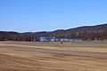
Scenery of southern Montour County
-

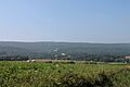
Scenery of northern Montour County
-
Montour Ridge in Liberty Township


See also
 In Spanish: Condado de Montour para niños
