Washingtonville, Pennsylvania facts for kids
Quick facts for kids
Washingtonville, Pennsylvania
|
|
|---|---|
|
Borough
|
|

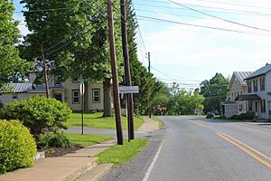
Entering Washingtonville from Strawberry Ridge Road
|
|

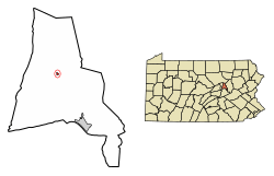
Location of Washingtonville in Montour County, Pennsylvania.
|
|
| Country | United States |
| State | Pennsylvania |
| County | Montour |
| Settled | 1775 |
| Founded as Washington | September 27, 1796 |
| Name Change to Washingtonville | September 8, 1828 |
| Incorporated (borough) | April 28, 1870 |
| Area | |
| • Total | 0.05 sq mi (0.14 km2) |
| • Land | 0.05 sq mi (0.14 km2) |
| • Water | 0.00 sq mi (0.00 km2) |
| Elevation
(center of borough)
|
520 ft (160 m) |
| Highest elevation
(hill on western borough boundary)
|
570 ft (170 m) |
| Lowest elevation
(Chillisquaque Creek)
|
495 ft (151 m) |
| Population
(2020)
|
|
| • Total | 200 |
| • Estimate
(2021)
|
202 |
| • Density | 5,092.59/sq mi (1,950.85/km2) |
| Time zone | Eastern (EST) |
| • Summer (DST) | EDT |
| ZIP code |
17884
|
| Area code(s) | 570 |
| FIPS code | 42-81424 |
Washingtonville is a small town, also called a borough, located in Montour County, Pennsylvania, in the United States. In 2020, about 200 people lived there. It's part of a larger area that includes the towns of Bloomsburg and Berwick.
History of Washingtonville
This small town is named after the first American president, George Washington. Long ago, even before the town was officially started during the American Revolutionary War, a place called Fort Bosley stood nearby. It was located along the eastern side of Chillisquaque Creek.
In the early 1900s, a very rich man named Frank DeLong often visited Washingtonville to relax. He loved the town so much that he gave money to build a new school. At the time, this school was thought to be one of the best in the entire country! He also changed an old church into a special memorial for his mother.
Today, the old school building is used as a nursing home. The memorial still stands and holds many interesting historical items. Recently, people found parts of an old log cabin from the 1700s. This shows that people lived in Washingtonville a very long time ago.
Geography of Washingtonville
Washingtonville is a very small town. It covers an area of about 0.1 square miles (0.14 square kilometers), and all of it is land. The town is located where two main roads, Route 54 and Route 254, meet.
On its western side, Washingtonville is next to the Chillisquaque Creek. The eastern part of the town is on a small hill. Most of the land in Washingtonville is used for homes where people live.
People of Washingtonville
| Historical population | |||
|---|---|---|---|
| Census | Pop. | %± | |
| 1870 | 172 | — | |
| 1880 | 203 | 18.0% | |
| 1890 | 171 | −15.8% | |
| 1900 | 212 | 24.0% | |
| 1910 | 183 | −13.7% | |
| 1920 | 177 | −3.3% | |
| 1930 | 182 | 2.8% | |
| 1940 | 175 | −3.8% | |
| 1950 | 194 | 10.9% | |
| 1960 | 198 | 2.1% | |
| 1970 | 174 | −12.1% | |
| 1980 | 218 | 25.3% | |
| 1990 | 228 | 4.6% | |
| 2000 | 201 | −11.8% | |
| 2010 | 273 | 35.8% | |
| 2020 | 200 | −26.7% | |
| 2021 (est.) | 202 | −26.0% | |
| Sources: | |||
In 2000, about 201 people lived in Washingtonville. These people lived in 82 different homes. About 29% of these homes had children under 18 living there. The average home had about 2 to 3 people.
The population includes people of different ages. About 24% of the people were under 18 years old. About 9.5% were 65 years old or older. The average age of people in Washingtonville was 35 years.
See also
 In Spanish: Washingtonville (Pensilvania) para niños
 | Dorothy Vaughan |
 | Charles Henry Turner |
 | Hildrus Poindexter |
 | Henry Cecil McBay |


