Hemlock Creek (Fishing Creek tributary) facts for kids
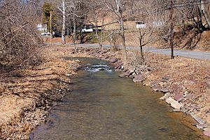
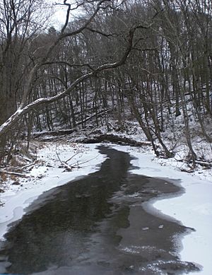
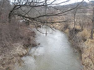
Hemlock Creek is a stream in Columbia County, Pennsylvania, in the United States. It is about 7.6 miles (12.2 kilometers) long. This creek flows into Fishing Creek. Hemlock Creek is mostly in Madison and Hemlock Townships. It has two main smaller streams that flow into it: West Hemlock Creek and Frozen Run. The creek also flows through a place called Montour Ridge. In the past, many mills and iron mines were found near Hemlock Creek. The area that drains into the creek, called its watershed, is about 16 square miles (41 square kilometers) and is in Columbia and Montour Counties.
Contents
Where Hemlock Creek Flows
Hemlock Creek starts in Madison Township. This is a few miles north of a community called Columbia Hill. The creek flows towards the southeast, running alongside Pennsylvania Route 44. After a few miles, it enters Hemlock Township.
It keeps flowing next to Pennsylvania Route 44. Here, its first smaller stream, West Hemlock Creek, joins it. Then, Hemlock Creek flows into Buckhorn. It continues southwest past Frosty Valley. This is where its second smaller stream, Frozen Run, flows into it. Finally, the creek heads southeast into Fernville. There, it empties into Fishing Creek.
Smaller Streams (Tributaries)
The main smaller streams that feed into Hemlock Creek are West Hemlock Creek and Frozen Run. West Hemlock Creek also has several smaller streams that don't have names.
Frozen Run begins in the western part of Hemlock Township. It flows east through Frosty Valley. It then joins Hemlock Creek in Buckhorn. West Hemlock Creek also starts in western Hemlock Township. It joins the main Hemlock Creek in Buckhorn too.
Water and Flow (Hydrology)
The average amount of rainfall each year is about 37.7 inches (95.8 centimeters). The average amount of water that runs off the land each year is about 0.11 inches (2.8 millimeters).
A lot of sediment (like tiny bits of soil or rock) flows through Hemlock Creek every day. Most of this sediment comes from farm fields. Some also comes from the creek banks. A smaller amount comes from hay fields or pastures. Even less comes from developed areas, forests, or unpaved roads. Too much sediment can make the water cloudy. It can also harm fish and other living things in the creek.
The Creek's Drainage Area (Watershed)
The watershed of Hemlock Creek is about 16 square miles (41 square kilometers). A watershed is the entire area of land where all the water drains into a specific creek or river. Almost all of this watershed is in Columbia County. However, a small part of it is in Montour County.
Interstate 80 and Pennsylvania Route 44 are the main roads in the southern and western parts of the watershed. There are also many smaller township roads in the area.
Agricultural land is the most common way the land is used in the Hemlock Creek watershed. About 56% of the watershed is used for farming. Forests cover 40% of the land. Developed areas, like towns and buildings, make up 4% of the watershed.
Land and Rocks (Geography and Geology)
The place where Hemlock Creek starts is about 500 feet (152 meters) higher than where it ends. The highest points in the watershed are in the western part. The watershed is located in a type of landscape called the ridge and valley geographical province. This means there are many long, parallel ridges and valleys.
In the higher areas of the Hemlock Creek watershed, half of the rocks are sedimentary rocks. These rocks are layered together. Many of the rocks in the watershed are from the Catskill Formation and the Hamilton Group. You can also find sandstone and shale rocks from other formations.
The most common type of soil in the Hemlock Creek watershed is called the Berks-Weikert-Bedington soil series. This soil is a silt loam and contains shale. Other types of soil are also found in different parts of the watershed.
In the 1800s, people found fossil ore near Hemlock Creek. This ore contained different materials like hydrogen peroxide, silica, alumina, and water.
Hemlock Creek cuts a wide valley through Montour Ridge. This shows how the creek has shaped the land over a long time.
History of Hemlock Creek
Hemlock Creek was known by its current name in the very first surveys of the area. This was when it was part of Wyoming Township.
Elisha Barton was an early settler in the Hemlock Creek area. He arrived in 1781. He owned land between where Hemlock Creek ends and Buckhorn. Peter Brugler was another early settler. He came to the Hemlock Creek watershed between 1788 and 1790. He owned a large amount of land, including some along West Hemlock Creek.
A mill was built on West Hemlock Creek. This mill was used to make boards and timber. It was the first mill of its kind in Hemlock Township. Elisha Barton also built a mill on the north bank of Hemlock Creek. This was about 0.5 miles (0.8 kilometers) from where the creek ends.
This mill was later torn down and rebuilt in 1842 by Isiah Barton. It was then called the Red Mill. In 1885, Isiah McKelvy bought the mill and added new machinery. The mill was still working as late as the 1910s.
Another mill was built further up Hemlock Creek in 1812 by a man named Pepper. It stopped working before the 1910s. The White Mill was also built by the Barton family in 1842. This mill was near Bloomsburg. It was known for having the largest timbers of any mill in Columbia County. The White Mill was updated in 1882 and renamed Montour Mills.
The Irondale Mine was also operated near Hemlock Creek in the past.
Living Things (Biology)
In the parts of Hemlock Creek where farming happens, there are very few or no riparian buffers. Riparian buffers are areas of trees and plants along the banks of a stream. They help protect the water. Also, farm animals can sometimes get into the creek in certain places.
Because of these issues, all the streams in the watershed are considered "impaired" by the EPA. This means the water quality is not as good as it should be.
 | Aaron Henry |
 | T. R. M. Howard |
 | Jesse Jackson |


