Huntington Creek (Pennsylvania) facts for kids
Huntington Creek is a stream in Pennsylvania, USA. It flows through Luzerne and Columbia counties. This creek is about 29.5 miles (47.5 kilometers) long. It eventually flows into Fishing Creek (North Branch Susquehanna River).
Contents
The Creek's Journey
Huntington Creek starts in Lake Township, Luzerne County. It flows west-southwest for a bit, then enters Ross Township. Here, the creek turns south and its valley gets wider. It then turns west, crossing Pennsylvania Route 118. After that, it flows southwest and gets its first named smaller stream, Mitchler Run.
Soon after, another stream called Laurel Run joins it. The creek then turns sharply south, picking up Shingle Run. It makes another sharp turn west and receives Arnold Creek. As Huntington Creek continues west, its valley gets deeper and wider, and Lick Branch flows into it.
The creek then enters Fairmount Township. It passes Jackson Hill and picks up Phillips Creek before turning south. Its valley becomes much wider here. Next, the creek enters Huntington Township. Here, a major stream called Kitchen Creek joins it. The creek continues south past Harveyville, where its valley becomes narrower.
It then turns southeast for a few miles, picking up Rogers Creek. It passes Huntington Mills and crosses Pennsylvania Route 239. For the next few miles, the creek turns west and flows next to Huntington Mountain. A few miles later, Kingsbury Brook joins it, and the creek leaves Luzerne County.
After leaving Luzerne County, Huntington Creek enters Fishing Creek Township, Columbia County. About a mile downstream, it flows through Jonestown. Here, Pine Creek, its last named stream, joins it. After flowing next to Huntington Mountain and Knob Mountain for a few miles, Huntington Creek meets Fishing Creek near a place called Forks.
Huntington Creek joins Fishing Creek about 15.10 miles (24.30 kilometers) before Fishing Creek reaches its own end.
Smaller Streams (Tributaries)
The main smaller streams that flow into Huntington Creek are Kitchen Creek and Pine Creek.
- Kitchen Creek joins Huntington Creek about 16.02 miles (25.78 kilometers) upstream from its end. The area that drains into Kitchen Creek is about 20.10 square miles (52.06 square kilometers).
- Pine Creek joins Huntington Creek about 4.26 miles (6.86 kilometers) upstream from its end. The area that drains into Pine Creek is about 30.7 square miles (79.5 square kilometers).
Water and Weather
When Huntington Creek joins Fishing Creek, it doubles the amount of water in Fishing Creek.
The amount of rain and snow that falls in the area around Huntington Creek each year is usually between 35 inches (89 centimeters) and 45 inches (114 centimeters).
Land and Rocks
The land near where Huntington Creek ends is about 620 feet (189 meters) above sea level. Where the creek begins, the land is much higher, between 1,620 feet (494 meters) and 1,640 feet (500 meters) above sea level.
The creek starts on North Mountain. The area it flows through also has a terminal moraine, which is a ridge of rocks and dirt left behind by a glacier.
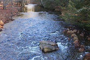
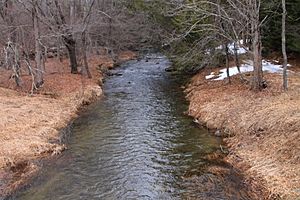
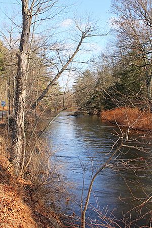
The creek's path goes through rock formations made of shale and sandstone. In some places, the creek's channel splits and braids, like braided hair. There are also fallen trees and other things in the water. The creek's path is curvy. It also has flat areas next to it called alluvial floodplains, which are formed by river sediments. In the upper parts of the creek's area, you can find lakes and swamps that were made by glaciers. Some parts of the creek, especially closer to its end, have wide, flat lands.
The Creek's Area (Watershed)
The entire area that drains water into Huntington Creek is called its watershed. This watershed covers about 114.00 square miles (295.2 square kilometers). It includes parts of three counties: Columbia, Luzerne, and Sullivan.
Huntington Creek is mostly surrounded by farms, hills covered with pine trees, and Huntington Mountain. There are a few small villages and some summer homes near Jonestown. The area around the creek does not have many people living there. In 1921, a book described the watershed as "broken, mountainous country." There are no big highways very close to the creek.
There are three dams on Huntington Creek. The biggest dam is above Jonestown and is 6 feet (1.8 meters) tall. Another dam, 3 feet (0.9 meters) tall, is located about 0.5 miles (0.8 kilometers) downstream from Huntington Mills. The smallest dam is in Huntington Mills and is 2 feet (0.6 meters) tall.
History and Industries
In the early 1900s, businesses in the Huntington Creek area included paper mills and agriculture (farming). The creek's water power helped run a paper mill and several small gristmills, which ground grain into flour.
In 1921, some of the larger communities in the Huntington Creek watershed were Harveyville (with 230 people), Huntington Mills (229 people), and Jonestown (205 people).
Many bridges cross Huntington Creek. Some of these are special covered bridges. In Columbia County, there were once two twin covered bridges over the creek. They were called Twin Bridges-West Paden Covered Bridge No. 121 and Twin Bridges-East Paden Covered Bridge No. 120. They were built in 1850. These were the last twin covered bridges in Pennsylvania until a big flood on June 28, 2006, washed away the West Paden Bridge. Luckily, the West Paden Bridge was rebuilt in 2008. Another covered bridge, the Josiah Hess Covered Bridge No. 122, also crosses the creek in Columbia County. It was built in 1875.
In Luzerne County, two covered bridges historically crossed Huntington Creek: the Bittenbender Covered Bridge and the Huntington Mills Covered Bridge. The Bittenbender bridge was also destroyed in the flood of June 28, 2006. The Huntington Mills Covered Bridge was destroyed at an unknown time.
Besides covered bridges, many other types of bridges cross Huntington Creek. In Luzerne County, some bridges were built in 1890 and 1891, then two more in 1910. Later, two bridges were built in 1969 and 1970, followed by one in 1985 and another in 1994. Three more bridges were built in 2000 and 2001. The newest bridge in that county was built in 2007. The oldest bridges are metal truss bridges, which use a framework of connected elements. Newer ones are prestressed box beam bridges, which are very strong. Also, three bridges were built over the creek in Columbia County in 1959 and 1961.
Animals and Nature
Fish like the eastern mudminnow live in Huntington Creek.
Huntington Creek is listed as a Natural Heritage Area on the Luzerne County Natural Areas Inventory. This means it's an important place for nature. The creek is also known as a high-quality coldwater fishery. This means its cold water is very good for fish that need cool temperatures.
Fun Activities
Edward Gertler, in his book Keystone Canoeing, says that Huntington Creek is great for people who are new to canoeing. You can canoe on the creek when snow melts or a few days after heavy rain. Gertler describes the scenery along the creek as "good." You can canoe for about 17.1 miles (27.5 kilometers) on the creek.
Kitchen Creek, one of the streams that flows into Huntington Creek, goes through Ricketts Glen State Park.
 | Bessie Coleman |
 | Spann Watson |
 | Jill E. Brown |
 | Sherman W. White |


