Lick Branch (Huntington Creek tributary) facts for kids
Quick facts for kids Lick Branch |
|
|---|---|

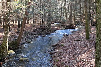
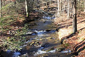
Lick Branch looking downstream
|
|
| Physical characteristics | |
| Main source | steep valley in the foothills of North Mountain in Ross Township, Luzerne County, Pennsylvania between 1,300 and 1,320 feet (400 and 400 m) |
| River mouth | Huntington Creek in Ross Township, Luzerne County, Pennsylvania 899 ft (274 m) 41°16′27″N 76°12′49″W / 41.2741°N 76.2137°W |
| Length | 2.6 mi (4.2 km) |
| Basin features | |
| Progression | Huntington Creek → Fishing Creek → Susquehanna River → Chesapeake Bay |
| Basin size | 2.34 sq mi (6.1 km2) |
Lick Branch is a small stream, also called a tributary, that flows into Huntington Creek. You can find it in Luzerne County, Pennsylvania, in the United States. It's about 2.6 miles (4.2 kilometers) long. It flows through two areas called Ross Township and Fairmount Township.
The land area that drains into Lick Branch, called its watershed, is about 2.34 square miles (6.1 square kilometers). Interestingly, no other streams flow into Lick Branch. The Pennsylvania Fish and Boat Commission says Lick Branch is special. It's considered "Class A Wild Trout Waters" because it's a great home for wild brook trout along its whole length.
Contents
Journey of Lick Branch
Lick Branch starts in a deep, steep valley. This valley is in the foothills of North Mountain. It's just south of Pennsylvania Route 118 in western Ross Township.
The stream first flows southwest and then enters Fairmount Township. In Fairmount Township, it turns south, then south-southeast. It then flows back into Ross Township, where its valley gets even deeper.
In Ross Township, the stream keeps flowing south-southwest for over a mile. Its valley continues to deepen as it goes. Finally, it turns southeast and then south. It leaves its valley and meets up with Huntington Creek. Lick Branch joins Huntington Creek about 19.64 miles (31.61 kilometers) upstream from where Huntington Creek ends.
No Other Streams Join Lick Branch
Lick Branch is unique because no other streams, big or small, flow into it. It's a stream that flows all by itself!
Water, Land, and Rocks
The water in Lick Branch has a certain amount of alkalinity, which is a measure of how well it can balance acids. The alkalinity here is 9 milligrams per liter.
The lowest point of Lick Branch, where it meets Huntington Creek, is about 899 feet (274 meters) above sea level. The highest point, where the stream begins, is between 1300 and 1320 feet (396 and 402 meters) above sea level.
Most of the land around Lick Branch is covered by something called Wisconsinan Till. This is a type of soil and rock left behind by glaciers. Most of this till is expected to be more than 6 feet (1.8 meters) thick.
Near where the stream meets Huntington Creek, and in a few spots in the middle, there are areas of alluvium. This is soil and sediment carried and deposited by flowing water. In the stream's valley, this alluvium is about 6 feet (1.8 meters) thick. Closer to Huntington Creek's valley, the alluvium can be 10 feet (3 meters) thick or even more. There's also a wetland (a marshy area) near the stream's beginning.
Long ago, before glaciers covered the area, another stream called Phillips Creek tried to flow down the valley where Lick Branch is now. But a large amount of till, left by the glaciers, blocked its path. This forced Phillips Creek to flow in a different direction, which is its path today.
Lick Branch's Home Area
The watershed of Lick Branch covers an area of about 2.34 square miles (6.1 square kilometers). Both the start and end points of the stream are located in the Sweet Valley area, according to the United States Geological Survey maps.
Only 3 percent of Lick Branch's length flows through public land. This means that 97 percent of the stream is on private land. This private land is usually not open to the public.
History of Lick Branch
Lick Branch has had its name for a long time. It appeared on a map made by the Pennsylvania Fish Commission as early as 1958. The stream's name was officially added to the Geographic Names Information System on August 2, 1979. This system helps keep track of names for places like streams. Its special ID number in this system is 1179276.
In 1999, the Pennsylvania Fish and Boat Commission gave Lick Branch a special title. They officially named it "Class A Wild Trout Waters." This means it's a very important stream for wild trout.
Wildlife and Fish
The Pennsylvania Fish and Boat Commission considers Lick Branch to be "Class A Wild Trout Waters" for brook trout. This special designation applies to the entire stream, from where it starts to where it ends.
Lick Branch is one of six streams that flow directly into Huntington Creek and are also designated as Class A Wild Trout Waters. The other five important streams for wild trout are Mitchler Run, Shingle Run, Arnold Creek, Phillips Creek, and a part of Kitchen Creek.
 | Stephanie Wilson |
 | Charles Bolden |
 | Ronald McNair |
 | Frederick D. Gregory |


