East Branch Fishing Creek facts for kids
Quick facts for kids East Branch Fishing Creek |
|
|---|---|

East Branch Fishing Creek
|
|

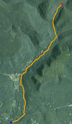
Satellite map of East Branch Fishing Creek. The red dot is the stream's source and blue dot is its mouth.
|
|
| Physical characteristics | |
| Main source | Confluence of Sullivan Branch and Big Run |
| River mouth | West Branch Fishing Creek |
| Length | 4.4 mi (7.1 km) |
| Basin features | |
| Tributaries |
|
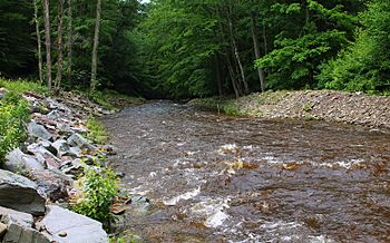
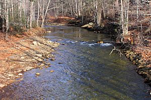
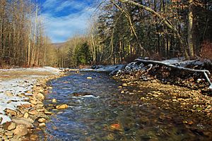
The East Branch Fishing Creek is a small tributary (a stream that flows into a larger river) of Fishing Creek. It flows through Columbia County and Sullivan County in Pennsylvania, United States. This creek is about 4.4 miles (7.1 km) long. The water in the creek and its smaller streams (tributaries) is often acidic and contains aluminum. People first settled in this area in the late 1700s.
Contents
Where East Branch Fishing Creek Flows
East Branch Fishing Creek mainly flows towards the west. It starts in State Game Lands #13, which is a bit west of Ricketts Glen State Park. The creek begins where two smaller streams, Sullivan Branch and Big Run, join together.
First, it flows south for about one mile. Then, it meets Heberly Run, which is its longest tributary. After that, Lead Run joins the creek. The creek then turns southwest and heads towards Jamison City.
Soon after, Trout Run, one of its shorter named tributaries, flows into it. In Jamison City, Blackberry Run and a few other small streams join the creek. Finally, East Branch Fishing Creek flows into West Branch Fishing Creek. The creek drops about 1,500 feet (460 m) in height from where it starts to where it ends.
Water Quality of the Creek
The water in the East Branch Fishing Creek area is generally acidic. This might be because there are acidic bogs (wet, spongy areas) nearby. It is a freestone stream, meaning its water comes mainly from rain and melting snow, not from underground springs.
The average pH (a measure of how acidic or basic water is) in the streams of this area ranges from 4.32 to 5.76. A lower pH means the water is more acidic. For example, the pH of East Branch Fishing Creek itself is around 5.34 near Lead Run and 5.63 at its mouth.
The water also contains aluminum. The amount of aluminum varies, but it's generally present.
Scientists have studied the water quality of East Branch Fishing Creek and its tributaries. They found that:
- 27% of the stream miles have "good" water quality.
- 30% have "fair" water quality.
- 14% have "poor" water quality.
- 3% have "very poor" water quality.
- 26% have "severe" water quality.
The best water quality is usually found in Big Run, Quinn Run, and at the mouth of East Branch Fishing Creek. The lowest quality water is often in Meeker Run, Blackberry Run, Sullivan Branch, Ore Run, and Lead Run.
The average water temperature in East Branch Fishing Creek in 2009 was between 9.1 °C (48.4 °F) and 11.3 °C (52.3 °F).
Rocks and Soil Around the Creek
The ground under the East Branch Fishing Creek area is mostly made of sandstone and other sedimentary rocks layered together. Unlike many places in Pennsylvania, there isn't much limestone rock here. Most of the area is part of the Appalachian Plateau, which is a high, flat region. A smaller part is in the Ridge and Valley Province, which has long ridges and valleys.
Several types of rock formations are found here:
- The Burgoon Sandstone is mostly in the northern, eastern, and western parts.
- The Huntley Mountain Formation is in the southeastern part and along most of the main tributaries.
- The Catskill Formation is mainly along the main part of the creek.
- The Mauch Chunk Formation is in a small northern area.
There are ten main types of soil in the East Branch Fishing Creek area. Most of these soils are strongly acidic, except for the soil right along East Branch Fishing Creek itself. These different soil types are found in various parts of the watershed.
The Creek's Watershed
The area that drains into East Branch Fishing Creek is called its watershed. This watershed is entirely within Sullivan and Columbia Counties. It covers an area of 19.5 square miles and includes about 34.16 stream miles of waterways.
In 2010, about 100 people lived in this watershed. Most of the land, about 93%, is covered by forest. About 7% is grassland, and a very small amount is used for farming or is water/wetlands.
History of the Area
One of the first people to settle near East Branch Fishing Creek was Thomas Fritz, who arrived in 1795 from Philadelphia.
In 1864, during the American Civil War, a group of Union Army soldiers came to the East Branch Fishing Creek area. They were looking for people who had avoided joining the army. This event is sometimes called the Fishing Creek Confederacy.
In 1907, the town of Jamison City received fish and fish eggs from East Branch Fishing Creek to help stock their waters. Even a United States president, Theodore Roosevelt, had a large mountain resort (a place for vacations) covering 700 acres near the creek.
Animals and Plants
A large part of the East Branch Fishing Creek watershed, about 23.8 stream miles, is considered a high-quality cold-water fishery. This means it's a good place for fish that prefer cold water. However, because the tributary Heberly Run has low pH (acidic water), not many fish live there.
 | William M. Jackson |
 | Juan E. Gilbert |
 | Neil deGrasse Tyson |


