Berens River facts for kids
Quick facts for kids Berens River |
|
|---|---|
|
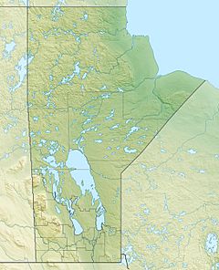
Location of the mouth of the Berens River in Manitoba
|
|
| Country | Canada |
| Provinces | |
| Physical characteristics | |
| Main source | Unnamed lake Kenora District, Ontario 407 m (1,335 ft) 51°28′03″N 92°38′18″W / 51.46750°N 92.63833°W |
| River mouth | Lake Winnipeg Census Division 19, Northern Region, Manitoba 217 m (712 ft) 52°21′25″N 97°03′04″W / 52.35694°N 97.05111°W |
| Basin features | |
| River system | Nelson River drainage basin |
| Tributaries |
|
The Berens River is a river in Canada. It flows through the provinces of Manitoba and Ontario. The river starts from a lake in Ontario. It then flows west and empties into Lake Winnipeg. This happens near the village and First Nation of Berens River, Manitoba. The Berens River has many lakes and fast-flowing sections called rapids along its path.
Contents
A River's Long History
The Berens River has been important for a very long time. For thousands of years, First Nations people have used it. It was a traditional area for hunting and fishing.
European explorers first traveled on the river in 1767. They came from the Severn River and went down to Lake Winnipeg. The river was named after Joseph Berens. He was a governor of the Hudson's Bay Company (HBC) at that time.
Trading Posts and Routes
The Hudson's Bay Company and the Northwest Company set up trading posts. These posts were built near the mouth of the river. Some were also further upstream. The first post was built in 1814. The Berens River system became an important route for trade.
Nature Along the Berens River
The Berens River is special because it is still very natural. It is one of the last freshwater rivers in southern Canada. There is not much development along its banks. There are also no major roads nearby.
This area is a home for woodland caribou. These animals need large, undisturbed forests to live. The Berens River area provides this important habitat for them.
Getting Around the River
Getting around the Berens River area can be tricky. There are not many permanent roads.
Future Bridge Plans
In 2009, the Ontario Government announced plans for a new bridge. This bridge would be built on an existing winter road. Winter roads are temporary roads made of ice and snow. They can only be used in winter.
The new bridge would connect to an all-weather road. This road leads to Ontario Highway 125 in the south. It would also connect to several First Nations communities in the north. These communities include Deer Lake First Nation, North Spirit Lake First Nation, and Sandy Lake First Nation. The bridge would be built east of Berens Lake.
Communities Along the River
Several communities are located along or near the Berens River.
- Berens River, Manitoba
- Little Grand Rapids, Manitoba: This community is on Family Lake. It is about 115 kilometers (71 miles) southeast of the river's mouth.
- Poplar Hill First Nation, Ontario
- Pikangikum First Nation, Ontario
Rivers Joining the Berens
Many smaller rivers and creeks flow into the Berens River. These are called tributaries.
- Keeper River (joins from the left)
- Crooked Mouth River (joins from the right)
- Pikangikum Lake (a lake on the river's course)
- Dowling River (flows into Pikangikum Lake from the left)
- Throat River (joins from the right)
- Windfall Creek (joins from the left)
- Owl Creek (joins from the left)
- Mamakwash River (joins from the left)
- Whitefish River (joins from the right)
- Serpent River (joins from the left)
 | Sharif Bey |
 | Hale Woodruff |
 | Richmond Barthé |
 | Purvis Young |


