Beyers Lakes facts for kids
Quick facts for kids Beyers Lakes |
|
|---|---|
 |
|
| Location | Nevada County, California |
| Coordinates | 39°23′06″N 120°33′18″W / 39.38500°N 120.55500°W |
| Basin countries | United States |
| Surface elevation | 6,860 feet (2,090 m) |
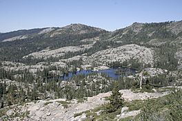
The Beyers Lakes are a group of lakes found in the Tahoe National Forest in California. They are a beautiful natural spot for exploring the outdoors.
Where are the Beyers Lakes?
These lakes are located in Nevada County, California. They sit at an elevation of about 6,860 feet (2,091 meters) above sea level. This high elevation means they are often surrounded by stunning mountain views.
How to Reach the Lakes
You can get to the Beyers Lakes by following the Beyers Lakes Trail. This trail connects from the Grouse Ridge Trail. To start on the Grouse Ridge Trail, you can begin at the Eagle Lakes trailhead, which is off Interstate 80. Another way to reach it is from the Grouse Ridge Campground.
Geography of the Lakes
The Beyers Lakes are nestled below a mountain area known as the Black Buttes of Grouse Ridge. They are an important part of the Fordyce Creek watershed. This means that water from the lakes flows into Fordyce Creek. Eventually, this water drains into Lake Spaulding.
See also
 In Spanish: Lagos Beyers para niños
 | Sharif Bey |
 | Hale Woodruff |
 | Richmond Barthé |
 | Purvis Young |


