Bierre-lès-Semur facts for kids
Quick facts for kids
Bierre-lès-Semur
|
|
|---|---|
|
Part of Le Val-Larrey
|
|
| Country | France |
| Region | Bourgogne-Franche-Comté |
| Department | Côte-d'Or |
| Arrondissement | Montbard |
| Canton | Semur-en-Auxois |
| Commune | Le Val-Larrey |
| Area
1
|
8.28 km2 (3.20 sq mi) |
| Population
(2019)
|
94 |
| • Density | 11.35/km2 (29.40/sq mi) |
| Time zone | UTC+01:00 (CET) |
| • Summer (DST) | UTC+02:00 (CEST) |
| Postal code |
21390
|
| Elevation | 307–386 m (1,007–1,266 ft) (avg. 360 m or 1,180 ft) |
| 1 French Land Register data, which excludes lakes, ponds, glaciers > 1 km2 (0.386 sq mi or 247 acres) and river estuaries. | |
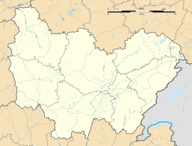
Bierre-lès-Semur (pronounced bee-air leh seh-moor) was once a small commune (a type of town or village) in eastern France. It was located in the Côte-d'Or department, which is like a county or region. On January 1, 2019, Bierre-lès-Semur joined with another area to form a new, larger commune called Le Val-Larrey.
People Living Here
The number of people living in Bierre-lès-Semur changed over the years. For example, in 1962, about 100 people lived there. By 2019, just before it merged, the population was 94 people. This shows a slight decrease in the number of residents over time.
See also

- In Spanish: Bierre-lès-Semur para niños

All content from Kiddle encyclopedia articles (including the article images and facts) can be freely used under Attribution-ShareAlike license, unless stated otherwise. Cite this article:
Bierre-lès-Semur Facts for Kids. Kiddle Encyclopedia.


