Biggar Water facts for kids
Quick facts for kids Biggar Water |
|
|---|---|

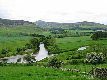
Confluence of the Biggar Water and Tweed
|
|
| Country | Scotland, United Kingdom |
| Council area | South Lanarkshire |
| Physical characteristics | |
| River mouth | Confluence with the River Tweed 55°36′11″N 3°22′38″W / 55.603074°N 3.377176°W |
Biggar Water is a river found in the beautiful Southern Uplands of Scotland. It flows through areas like Lanarkshire and Peeblesshire. This river is an important part of the larger River Tweed system.
Discovering Biggar Water
Biggar Water is a natural waterway in southern Scotland. It helps feed one of Scotland's most famous rivers, the River Tweed. Understanding its path helps us learn about the local geography.
Where Does Biggar Water Begin?
The river starts its journey as a smaller stream called Biggar Burn. It rises in the north-east part of the area known as Biggar, South Lanarkshire. This is near the town of Biggar.
The Biggar Burn flows for about 6.75 miles (nearly 7 miles). It generally moves towards the south-west. As it gets closer to the town of Biggar, it becomes known as Biggar Water.
Biggar Water's Journey to the Tweed
After changing its name, Biggar Water continues its flow. It travels about 5 miles (8 kilometers) towards the east. This part of its journey takes it through scenic Scottish countryside.
Finally, Biggar Water meets the River Tweed. This meeting point is called a confluence. It happens about 0.75 miles (1.2 kilometers) north-east of a place called Drumelzier in Peeblesshire. Here, Biggar Water adds its waters to the larger Tweed system.


