Bigge Island facts for kids
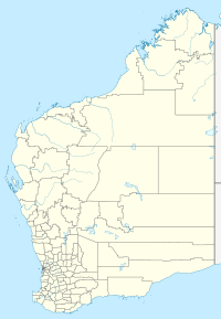
Bigge Island is a cool island located off the coast of the Kimberley region in Western Australia. It's part of the Shire of Wyndham-East Kimberley. This island is a special place, known for its unique wildlife and ancient rock art.
Contents
Discover Bigge Island
Bigge Island is about 6 kilometers (4 miles) away from the mainland. A narrow stretch of water called Scott Strait separates it from the main land. You can find it between two larger water areas, York Sound and Montague Sound. It's also about 19 kilometers (12 miles) north of a place called Cape Pond.
What's Bigge Island Like?
Bigge Island is the second largest island in the Bonaparte Archipelago. Only Augustus Island is bigger. Bigge Island covers a huge area of about 178 square kilometers (69 square miles).
The island has a very interesting shape. It's about 22 kilometers (14 miles) long and 6 kilometers (4 miles) wide. Its coastline is very bumpy, with many shallow bays and reefs. Boomerang Bay is the biggest bay, found on the western side of the island.
Island Landscape
The land on Bigge Island is rugged and rocky. It's made up of different kinds of rocks like sandstone and dolerite. You'll see many deep cracks and valleys in the rocks. These cracks help plants grow all over the island.
The highest point on Bigge Island is Savage Hill. It's on the south coast, right across from Scott Strait. Savage Hill stands about 143 meters (469 feet) tall. The very northern tip of the island is called Cape Chateaurenaud.
Other islands close to Bigge Island include Prudhoe Island, Purrungku Island, Capstan Island, and the Maret Islands.
Who Are the Traditional Owners?
The original people of this area are the Uunguu peoples. They are part of the Wunambal language group. They call Bigge Island Wuyurru.
You can find amazing Indigenous Australian rock art on the island. These paintings are on the cliffs and inside caves around Wary Bay. Some of the art shows early meetings between Indigenous people and newcomers. These are called first contact art. There are also paintings of special figures known as Wandjina. The Wunambal people created all this incredible rock art.
Amazing Animals
Bigge Island is a safe home for many animals. There are no wild predators like foxes or cats that hunt other animals. This makes it a perfect habitat for rare mammals.
Some of the special animals that live here include the Monjon, the Ilangnalya, and the Northern quoll. These animals are vulnerable in other places, but they thrive on Bigge Island.
 | William Lucy |
 | Charles Hayes |
 | Cleveland Robinson |


