Birds Branch (Ararat River tributary) facts for kids
Quick facts for kids Birds Branch |
|
|---|---|
|
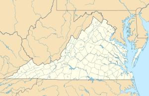
Location of Birds Branch mouth
|
|
| Other name(s) | Tributary to Ararat River |
| Country | United States |
| State | Virginia |
| County | Patrick |
| Physical characteristics | |
| Main source | divide of tributary to Reed Island Creek about 1.5 miles west of Groundhog Mountain peak 2,600 ft (790 m) 36°38′28″N 080°32′39″W / 36.64111°N 80.54417°W |
| River mouth | Ararat River about 1 mile west of Ararat, Virginia 1,240 ft (380 m) 36°36′02″N 080°31′50″W / 36.60056°N 80.53056°W |
| Length | 3.06 mi (4.92 km) |
| Basin features | |
| Progression | south |
| River system | Yadkin River |
| Basin size | 2.00 square miles (5.2 km2) |
| Tributaries |
|
| Bridges | Doe Run Road, Marigold Lane |
Birds Branch is a small stream, about 3.06 miles (4.92 km) long, located in Patrick County, Virginia. It flows into the Ararat River, which is part of the larger Yadkin River system.
About Birds Branch
Birds Branch is considered a "2nd order tributary." This means it's a stream that forms when two smaller streams (called 1st order streams) join together. It then flows into a larger river, the Ararat River.
Where Birds Branch Starts and Ends
Birds Branch begins high up in Patrick County, Virginia. Its source is about 1.5 miles (2.4 km) west of the top of Groundhog Mountain. The water here is about 2,600 feet (792 meters) above sea level.
From its starting point, Birds Branch flows south. It travels for about 3 miles (4.9 km) before it reaches its end. The stream joins the Ararat River about 1 mile (1.6 km) west of a town called Ararat, Virginia. At this point, the elevation is about 1,240 feet (378 meters).
The Area Around Birds Branch
The area that Birds Branch drains is called its watershed. This watershed covers about 2.00 square miles (5.18 square kilometers). This means all the rain that falls in this area will eventually flow into Birds Branch.
On average, this region gets about 52.0 inches (132 cm) of rain each year. A large part of the watershed, about 62%, is covered by forests. This helps keep the water clean and provides homes for many animals. Birds Branch also has some smaller streams that flow into it, including one called Dry Run.
There are a couple of bridges that cross Birds Branch, including Doe Run Road and Marigold Lane.
 | Delilah Pierce |
 | Gordon Parks |
 | Augusta Savage |
 | Charles Ethan Porter |


