
Patrick County, Virginia facts for kids
Quick facts for kids
Patrick County
|
||
|---|---|---|

Bull Mountain in Patrick County
|
||
|
||

Location within the U.S. state of Virginia
|
||
 Virginia's location within the U.S. |
||
| Country | ||
| State | ||
| Founded | 1791 | |
| Named for | Patrick Henry | |
| Seat | Stuart | |
| Largest town | Stuart | |
| Area | ||
| • Total | 486 sq mi (1,260 km2) | |
| • Land | 483 sq mi (1,250 km2) | |
| • Water | 2.8 sq mi (7 km2) 0.6% | |
| Population
(2020)
|
||
| • Total | 17,608 | |
| • Density | 36.23/sq mi (13.989/km2) | |
| Time zone | UTC−5 (Eastern) | |
| • Summer (DST) | UTC−4 (EDT) | |
| Congressional district | 9th | |


Patrick County is a place in Virginia, located in the southern part of the state. It's called a county and is found right on Virginia's border with North Carolina. In 2020, about 17,608 people lived here. The main town, or county seat, is Stuart. Patrick County has both rolling hills and mountains, making it a beautiful area.
Contents
History of Patrick County
Patrick County was created in 1791. Before that, it was part of Henry County. Henry County itself was named after a famous American, Patrick Henry.
Long ago, during the French and Indian War (1754-1763), one of Virginia's first forts was in this area. It was called Fort Mayo and was built by early settlers. In 1756, George Washington even visited Fort Mayo. This fort helped protect the frontier from attacks.
One important early settler was Colonel Abraham Penn. He was born in 1743. He was a brave leader in the local militia, which was like a citizen army. He fought in the Battle of Point Pleasant in 1774.
Colonel Penn also helped lead the American Revolution in his area. He gathered about 300 militiamen to help fight the British. He was even at Yorktown when the British surrendered.
After the war, Colonel Penn helped organize Patrick County. He served as a justice for many years. A community called Penn's Store and the Abram Penn Highway are named after him. He passed away in 1801.
In 2004, a private plane crashed on Bull Mountain. Sadly, ten people died, including a race car driver named Ricky Hendrick. In 2023, the governor of Virginia declared a state of emergency because of wildfires in the Tuggles Gap area.
Geography and Nature
Patrick County covers about 486 square miles (1,259 square kilometers). Most of this is land, with a small amount of water. It's part of a larger region called "Greater Appalachia."
The county has two main types of land. About one-third is in the Piedmont region, which has rolling hills. The other two-thirds are in the beautiful Blue Ridge Mountains. The famous Blue Ridge Parkway runs along the western edge of the county.
Neighboring Counties
- Carroll County, Virginia - to the west
- Floyd County, Virginia - to the northwest
- Franklin County, Virginia - to the northeast
- Henry County, Virginia - to the east
- Stokes County, North Carolina - to the south
- Surry County, North Carolina - to the southwest
Protected Natural Areas
- Blue Ridge Parkway (part)
- Rocky Knob Recreation Area (part)
Main Roads and Highways

 US 58
US 58 Blue Ridge Parkway
 SR 8
SR 8 SR 40
SR 40 SR 57
SR 57 SR 103
People of Patrick County
| Historical population | |||
|---|---|---|---|
| Census | Pop. | %± | |
| 1800 | 4,331 | — | |
| 1810 | 4,695 | 8.4% | |
| 1820 | 5,089 | 8.4% | |
| 1830 | 7,395 | 45.3% | |
| 1840 | 8,032 | 8.6% | |
| 1850 | 9,609 | 19.6% | |
| 1860 | 9,359 | −2.6% | |
| 1870 | 10,161 | 8.6% | |
| 1880 | 12,833 | 26.3% | |
| 1890 | 14,147 | 10.2% | |
| 1900 | 15,403 | 8.9% | |
| 1910 | 17,195 | 11.6% | |
| 1920 | 16,850 | −2.0% | |
| 1930 | 15,787 | −6.3% | |
| 1940 | 16,613 | 5.2% | |
| 1950 | 15,642 | −5.8% | |
| 1960 | 15,282 | −2.3% | |
| 1970 | 15,282 | 0.0% | |
| 1980 | 17,647 | 15.5% | |
| 1990 | 17,473 | −1.0% | |
| 2000 | 19,407 | 11.1% | |
| 2010 | 18,490 | −4.7% | |
| 2020 | 17,608 | −4.8% | |
| U.S. Decennial Census 1790-1960 1900-1990 1990-2000 2010 2020 |
|||
How Many People Live Here?
The U.S. Census counts how many people live in an area. In 2020, Patrick County had 17,608 residents. This number helps us understand the community.
| Race / Ethnicity | Pop 2010 | Pop 2020 | % 2010 | % 2020 |
|---|---|---|---|---|
| White alone (NH) | 16,680 | 15,577 | 90.21% | 88.47% |
| Black or African American alone (NH) | 1,085 | 831 | 5.87% | 4.72% |
| Native American or Alaska Native alone (NH) | 50 | 24 | 0.27% | 0.14% |
| Asian alone (NH) | 42 | 43 | 0.23% | 0.24% |
| Pacific Islander alone (NH) | 0 | 3 | 0.00% | 0.02% |
| Some Other Race alone (NH) | 8 | 72 | 0.04% | 0.41% |
| Mixed Race/Multi-Racial (NH) | 181 | 491 | 0.98% | 2.79% |
| Hispanic or Latino (any race) | 444 | 567 | 2.40% | 3.22% |
| Total | 18,490 | 17,608 | 100.00% | 100.00% |
Note: The US Census counts Hispanic/Latino as an ethnic group. This table separates them from racial groups.
In 2010, there were 18,490 people living in Patrick County. Most people were White, with smaller numbers of Black or African American, Native American, and Asian residents. About 2.4% of the population was Hispanic or Latino.
Special Features of Patrick County
Part of the Rocky Knob wine region is in Patrick County. This area is known for growing grapes and making wine. The county was also important in the life of Reverend Bob Childress. His story is told in a book called "The Man Who Moved a Mountain."
Things to Do and See (Tourism)
Patrick County is a great place to visit in Virginia. It has one of Virginia's last remaining covered bridges. The land here goes from 900 feet (274 meters) high to over 3,000 feet (914 meters), offering amazing views.
Patrick County is known as Virginia's entrance to the Blue Ridge Parkway. It's close to Mabry Mill, which is a very popular spot on the parkway for photos. The county is also home to Fairy Stone State Park.

The county hosts the longest-running beach music festival on the East Coast. It's also where the famous NASCAR team, the Wood Brothers, started. There are many fun activities for all ages throughout the year.
Schools and Education
Patrick County Public Schools has seven public schools. Four schools teach grades K-7, one teaches K-3, and another teaches grades 4–7. Patrick County High School is for students in grades 8–12.
In 2008, Stuart Elementary School won the Governor's VIP award. More recently, Stuart Elementary and Woolwine Elementary were named "Distinguished Title I schools." In 2006, Patrick County Public Schools was recognized as a high-achieving school district. All schools in the county have received "full accreditation" from the State of Virginia.
Towns and Communities
Main Town
Census-Designated Place
Other Communities
- Ararat
- Claudville
- Critz
- Fairystone
- Mayberry
- Meadows of Dan
- Penns Store
- Russell Creek
- Vesta
- Woolwine
Famous People from Patrick County
- J.E.B. Stuart: A famous cavalry commander during the Confederate era. He was born in Patrick County in 1833.
- Rev. Bob Childress: A Presbyterian minister whose life story is told in a book. He helped build several "rock churches" in the area.
- Herb Hash: A Major League Baseball player for the Boston Red Sox in the late 1930s and early 1940s. He was born in Woolwine.
- Gerald L. Baliles: He served as the Governor of Virginia from 1986 to 1990.
- Mary Sue Terry: She was the Attorney General of Virginia from 1986 to 1993. She was the first woman to hold this job in Virginia.
- Robert Lee Tudor: A member of the New York State Assembly in the early 1900s. He was born in Critz in 1874.
- Martin Clark: A well-known author and a judge in Virginia.
- Brad Clontz: A Major League Baseball pitcher for several teams, including the Atlanta Braves.
- Wood Brothers Racing: A famous NASCAR racing team that started in Patrick County.
- Tim Goad: A former American Football League defensive player for teams like the New England Patriots.
- Richard Joshua Reynolds: The founder of R.J. Reynolds Tobacco Co. He was born near Critz in 1850.
- J.J. Webster: Served as a County Commissioner for Rockingham County, North Carolina. He was born in Patrick County in 1898.
Images for kids
-
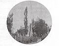
Poplar Grove, the home of Col. Abram Penn in Patrick County

See also
 In Spanish: Condado de Patrick para niños
