
Surry County, North Carolina facts for kids
Quick facts for kids
Surry County
|
|||
|---|---|---|---|

Surry County Courthouse
|
|||
|
|||

Location within the U.S. state of North Carolina
|
|||
 North Carolina's location within the U.S. |
|||
| Country | |||
| State | |||
| Founded | April 1, 1771 | ||
| Named for | Surrey, England | ||
| Seat | Dobson | ||
| Largest community | Mount Airy | ||
| Area | |||
| • Total | 536.66 sq mi (1,389.9 km2) | ||
| • Land | 532.65 sq mi (1,379.6 km2) | ||
| • Water | 4.01 sq mi (10.4 km2) 0.75% | ||
| Population
(2020)
|
|||
| • Total | 71,359 | ||
| • Estimate
(2023)
|
71,462 | ||
| • Density | 133.97/sq mi (51.73/km2) | ||
| Time zone | UTC−5 (Eastern) | ||
| • Summer (DST) | UTC−4 (EDT) | ||
| Congressional district | 5th | ||


Surry County is a county located in the state of North Carolina, in the United States. In 2020, about 71,359 people lived here. The main town where the county government is located is Dobson. The biggest community in Surry County is Mount Airy.
Surry County is part of a larger area called the Mount Airy, NC Micropolitan Statistical Area. This area is also included in the Greensboro–Winston-Salem–High Point, NC Combined Statistical Area.
Contents
History of Surry County
_-_Surry_County_-_Surry_County_-_ED_86-1_to_55_-_NARA_-_22118060.jpg)
Surry County was created in 1771. It was formed from a part of Rowan County. At that time, North Carolina was still a British colony. The county was named after Surrey, a county in England. This was the birthplace of William Tryon, who was the governor of North Carolina from 1765 to 1771.
In 1777, parts of Surry County and another area became Wilkes County. The first permanent courthouse was built in 1779 in a place called Richmond. Today, this area is part of Forsyth County.
However, in 1789, the eastern part of Surry County became Stokes County. This meant the Richmond courthouse was no longer in the center of Surry County. So, in 1790, the county seat moved to Rockford. It stayed there for over 50 years.
Later, in 1850, the southern part of the county became Yadkin County. Because of these changes, a new county seat was needed. The town of Dobson was started in 1853 to be the new county seat.
Geography and Nature of Surry County
Surry County covers a total area of about 536.66 square miles (1,390 square kilometers). Most of this area, about 532.65 square miles (1,379.5 square kilometers), is land. The rest, about 4.01 square miles (10.4 square kilometers), is water.
The county is generally considered part of the Piedmont Triad area. Surry County is also located in the Yadkin Valley AVA. This is a special area known for growing grapes and making wine. Wines made from grapes grown here can have "Yadkin Valley" on their label.
Mountains and Hills
Surry County is unique because it's in two different natural regions. The eastern two-thirds of the county is in the Piedmont region. This area has gently rolling hills and valleys. It also includes a small part of the Sauratown Mountains. Surry County is where the Sauratown Mountain range ends.
The western third of the county is in the Appalachian Mountains region, specifically the Blue Ridge Mountains. These mountains are very noticeable in the western part of the county. The mountain passes, called "gaps," can have strong winds. These winds can sometimes be so powerful that they affect cars and even large trucks. The highest point in Surry County is Fisher Peak, which is about 3,570 feet (1,088 meters) above sea level.
However, the most famous mountain in Surry County is Pilot Mountain. It's a tall, isolated mountain that stands out from the land around it. Pilot Mountain rises about 2,421 feet (738 meters) high and can be seen from many miles away. It's a well-known landmark in North Carolina.
Rivers and Streams
Surry County has many creeks and streams. There are three main rivers: the Ararat, the Fisher, and the Mitchell. All three flow south and join the Yadkin River. The Yadkin River forms the southern border of Surry County. The Yadkin River is part of the larger Pee Dee River system, which flows into the Atlantic Ocean.
- Ararat River
- Bear Creek
- Big Creek
- Camp Creek
- Fisher River
- Flat Shoal Creek
- Grassy Creek
- Hogan Creek
- King Creek
- Little Fisher Creek
- Mill Creek
- Mitchell River
- Pauls Creek
- Pheasant Creek
- Pilot Creek
- Ramey Creek
- Stewarts Creek
- Toms Creek
- Yadkin River
Parks and Protected Areas
Surry County has several important natural and historical sites.
National Protected Areas
- Blue Ridge Parkway (part)
- Cumberland Knob Recreation Area (part)
State and Local Protected Areas
- Horne Creek Living Historical Farm
- Mitchell River Game Land (part)
- Pilot Mountain State Park
- Raven Knob Scout Reservation (part)
Neighboring Counties
Surry County shares borders with several other counties:
- Patrick County, Virginia – northeast
- Carroll County, Virginia – north
- Grayson County, Virginia – northwest
- Stokes County – east
- Forsyth County – southeast
- Yadkin County – south
- Wilkes County – southwest
- Alleghany County – west
Main Roads and Transportation


 I-74 / Future I-74
 I-77
I-77 US 21
US 21
US 21 Bus. US 52
US 52
US 52 Bus. US 601

US 601 Bus. NC 18
NC 18 NC 89
NC 89 NC 103
 NC 104
 NC 268
NC 268 Bus.
Airports
- Mount Airy/Surry County Airport
- Elkin Municipal Airport
People and Population
| Historical population | |||
|---|---|---|---|
| Census | Pop. | %± | |
| 1790 | 7,192 | — | |
| 1800 | 9,505 | 32.2% | |
| 1810 | 10,366 | 9.1% | |
| 1820 | 12,320 | 18.9% | |
| 1830 | 14,504 | 17.7% | |
| 1840 | 15,079 | 4.0% | |
| 1850 | 18,443 | 22.3% | |
| 1860 | 10,380 | −43.7% | |
| 1870 | 11,252 | 8.4% | |
| 1880 | 15,302 | 36.0% | |
| 1890 | 19,281 | 26.0% | |
| 1900 | 25,515 | 32.3% | |
| 1910 | 29,705 | 16.4% | |
| 1920 | 32,464 | 9.3% | |
| 1930 | 39,749 | 22.4% | |
| 1940 | 41,783 | 5.1% | |
| 1950 | 45,593 | 9.1% | |
| 1960 | 48,205 | 5.7% | |
| 1970 | 51,415 | 6.7% | |
| 1980 | 59,449 | 15.6% | |
| 1990 | 61,704 | 3.8% | |
| 2000 | 71,219 | 15.4% | |
| 2010 | 73,673 | 3.4% | |
| 2020 | 71,359 | −3.1% | |
| 2023 (est.) | 71,462 | −3.0% | |
| U.S. Decennial Census 1790–1960 1900–1990 1990–2000 2010 2020 |
|||
What the 2020 Census Shows
| Race | Number | Percentage |
|---|---|---|
| White (not Hispanic) | 57,771 | 80.96% |
| Black or African American (not Hispanic) | 2,413 | 3.38% |
| Native American | 130 | 0.18% |
| Asian | 370 | 0.52% |
| Pacific Islander | 11 | 0.02% |
| Other/Mixed | 2,168 | 3.04% |
| Hispanic or Latino | 8,496 | 11.91% |
In 2020, the census counted 71,359 people living in Surry County. There were 28,408 households and 19,539 families.
Economy of Surry County
The North Carolina Department of Commerce looks at how well counties are doing economically. In 2024, Surry County was ranked among the top 20 counties in North Carolina that are doing well. This means it's considered a "tier 1" county. This ranking is partly because the average income for households in the county is lower than in some other areas.
Education in Surry County
Surry County has three different school systems: Surry County Schools, Mount Airy City Schools, and Elkin City Schools.
Surry County Schools
High Schools
- Surry Early College High School of Design (located on the Surry Community College campus)
- East Surry High School
- North Surry High School
- Surry Central High School
Middle Schools
- Central Middle School
- Gentry Middle School
- Meadowview Magnet Middle School
- Pilot Mountain Middle School
Elementary Schools
- Cedar Ridge Elementary School
- Copeland Elementary School
- Dobson Elementary School
- Flat Rock Elementary School
- Franklin Elementary School
- Mountain Park Elementary School
- Pilot Mountain Elementary School
- Rockford Elementary School
- Shoals Elementary School
- Westfield Elementary School
- White Plains Elementary School
Mount Airy City Schools
- Mount Airy High School
- Mount Airy Middle School
- Jones Intermediate School
- Tharington Primary School
Elkin City Schools
The Elkin City Schools system has three schools. They teach students from pre-kindergarten all the way to twelfth grade. These schools are Elkin Elementary School, Elkin Middle School, and Elkin High School.
Colleges and Universities
Surry Community College is the only college in the county. It is part of the North Carolina Community College System.
Media in Surry County
Newspapers
Surry County has three local newspapers: The Mount Airy News (from Mount Airy), The Pilot (from Pilot Mountain), and The Tribune (from Elkin). A larger daily newspaper, the Winston-Salem Journal, also covers news and events in the county.
Radio Stations
WIFM in Elkin is a full-time FM radio station. The county also has three AM stations: WYZD in Dobson, and WSYD and WPAQ in Mount Airy. WSYD and WPAQ also broadcast on FM repeaters 24 hours a day, covering most of the county. There are no local broadcast television stations in Surry County.
Surry County is part of the Piedmont Triad area for radio and television. However, many broadcasts from the Charlotte area can also be received here.
Culture and Local Traditions
Surry County is famous for being the home of the made-up town of Mayberry. This town was featured in "The Andy Griffith Show", a popular TV show from 1960 to 1968. Andy Griffith, who starred in the show, reportedly used many ideas from his own hometown in his TV town.
Today, visitors can experience what it might have been like to live in Mayberry. They can visit the Andy Griffith Museum, see Andy's childhood home, get a haircut at a place like Floyd's barbershop, or even ride in a replica Mayberry Squad Car. You can also grab a bite to eat at Snappy Lunch. Every September, the city hosts "Mayberry Days," a celebration where fans of the show can come and enjoy the town together.
A special dish called "sonker" is made in Surry County and nearby areas. It's believed to have started in the county in the mid-1800s. Sonker is similar to a cobbler. It's a baked dessert made with dough and a fruit or sweet potato filling. It's usually served with "dip," which is a vanilla cream sauce. Since 1980, Mount Airy has hosted an annual sonker festival.
Another local favorite is "ground steak." This is mainly a sandwich made with ground beef or chuck, flour, salt, and pepper. It's unique to Surry County and has been popular with locals since the Great Depression.
Communities in Surry County

Cities and Towns
- Mount Airy (the largest community)
- Dobson (the county seat)
- Elkin (also partly in Wilkes County)
- Pilot Mountain
Census-Designated Places (CDPs)
These are areas identified by the U.S. Census Bureau for statistical purposes.
Townships
- Bryan
- Dobson
- Eldora
- Elkin
- Franklin
- Long Hill
- Marsh
- Mount Airy
- Pilot
- Rockford
- Shoals
- Siloam
- South Westfield
- Stewarts Creek
- Westfield
Unincorporated Communities
These are smaller communities that are not officially part of a city or town.
- Albion
- Ararat
- Ash Hill
- Bannertown
- Blackwater
- Blevins Store
- Boones Hill
- Bottom
- Burch
- Cedar Hill
- Combstown
- Copeland
- Crooked Oak
- Crutchfield
- Devotion
- Fairview
- Franklin
- Hills Grove
- Holly Springs
- Indian Grove
- Jenkinstown
- Ladonia
- Level Cross
- Little Richmond
- Long Hill
- Mount Herman
- Mountain Park
- Mulberry
- New Hope
- Oak Grove
- Pine Hill
- Pine Ridge
- Poplar Springs
- Red Brush
- Rockford
- Round Peak
- Salem
- Salem Fork
- Sheltontown
- Shoals
- Siloam
- Slate Mountain
- State Road
- Stony Knoll
- Turkey Ford
- Union Cross
- Union Hill
- Westfield
- White Sulphur Springs
- Woodville
- Zephyr
Images for kids
-
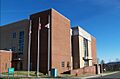
Surry County Courthouse
-
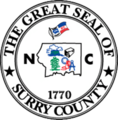
Surry County Seal
-
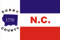
Surry County Flag
See also
 In Spanish: Condado de Surry (Carolina del Norte) para niños
