Birrego, New South Wales facts for kids
Quick facts for kids BirregoNew South Wales |
|
|---|---|

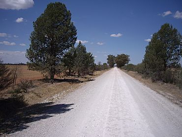
Birrego to Sandigo road
|
|
| Postcode(s) | 2652 |
| Location |
|
| LGA(s) | Narrandera Shire |
| County | Mitchell |
| State electorate(s) | Cootamundra |
| Federal Division(s) | Riverina |
Birrego is a small rural area located in the central part of the Riverina region in New South Wales, Australia. It's found near the town of Boree Creek. The land here is mostly flat and is mainly used for growing crops like wheat and other grains.
Contents
Discovering Birrego
Birrego is a quiet place where farming is the main activity. It's known for its wide-open spaces and the important role it plays in Australia's food production. Even though it's a small locality, it's part of a larger network of farming communities in the Riverina.
Where is Birrego Located?
Birrego is situated in a key farming area of New South Wales. By road, it is about 13 kilometres (8 miles) south of Sandigo. It's also about 31 kilometres (19 miles) southeast of Morundah. For a longer trip, Birrego is about 90 kilometres (56 miles) from the larger city of Wagga Wagga and 546 kilometres (339 miles) from Sydney, the capital of New South Wales.
What's the Land Like in Birrego?
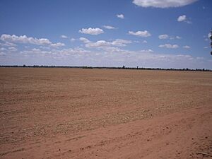
The countryside around Birrego is very flat. This makes it perfect for large-scale farming. Farmers in this area primarily grow grains, which are important for feeding people and animals. You can often see vast fields of wheat stretching across the landscape.
A Glimpse into Birrego's History
Like many small rural places, Birrego once had its own post office. The Birrego Post Office first opened its doors on 27 September 1921. It served the local community for many years, helping people send and receive mail. However, as times changed and services became more centralised, the post office eventually closed in 1959.
 | Precious Adams |
 | Lauren Anderson |
 | Janet Collins |


