Blackjack Mountains, Arizona facts for kids
Quick facts for kids Blackjack Mountains |
|
|---|---|

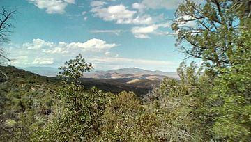
View of the Blackjack Mountains, AZ from a distance. They are center right, in the distance.
|
|
| Highest point | |
| Elevation | 6,942 ft (2,116 m) |
| Prominence | 2,580 ft (790 m) |
| Geography | |
| Location | Gila County, Arizona |
The Blackjack Mountains are a mountain range located in Gila County, Arizona. These mountains reach their highest point at a place called Apache Peaks. This peak stands tall at about 6,942 feet (2,116 meters) above sea level.
The Blackjack Mountains are part of the beautiful Tonto National Forest. They are found north of the town of Globe, Arizona.
Contents
Exploring the Blackjack Mountains
The Blackjack Mountains are a notable feature in the landscape of central Arizona. They are not just a single mountain but a group of peaks and ridges. This range offers a rugged and natural environment.
Where Are the Mountains Located?
You can find the Blackjack Mountains in Gila County, Arizona. This area is known for its diverse landscapes. The mountains are nestled within the vast Tonto National Forest. This forest is one of the largest national forests in the United States. It covers a huge area of Arizona.
The mountains are situated to the north of Globe, Arizona. Globe is a historic mining town. The location of the Blackjack Mountains makes them a significant part of the region's geography.
What Makes Apache Peaks Special?
The highest point in the Blackjack Mountains is called Apache Peaks. This peak reaches an elevation of 6,942 feet. It also has a prominence of 2,580 feet. Prominence is a measure of how much a peak stands out from its surroundings. It shows how high a mountain rises above the lowest point connecting it to a higher peak.
Apache Peaks is quite important in Arizona. It is ranked as the 36th most prominent peak in the entire state. This means it really stands out among Arizona's many mountains.
Understanding Topographic Isolation
Apache Peaks also has something called topographic isolation. This means how far away the nearest higher peak is. For Apache Peaks, this distance is about 17.88 miles (29 kilometers). The closest mountain that is taller than Apache Peaks is found to the south. This taller peak is located in the Pinal Mountains.
Topographic isolation helps us understand how isolated a mountain peak truly is. It shows how much it stands alone compared to other higher mountains nearby.
 | Delilah Pierce |
 | Gordon Parks |
 | Augusta Savage |
 | Charles Ethan Porter |

