Blue Berry Hill, Texas facts for kids
Quick facts for kids
Blue Berry Hill, Texas
|
|
|---|---|
 |
|
| Country | United States |
| State | Texas |
| County | Bee |
| Area | |
| • Total | 2.9 sq mi (7.6 km2) |
| • Land | 2.9 sq mi (7.6 km2) |
| • Water | 0 sq mi (0.0 km2) |
| Elevation | 272 ft (83 m) |
| Population
(2020)
|
|
| • Total | 844 |
| • Density | 287.6/sq mi (111.1/km2) |
| Time zone | UTC-6 (Central (CST)) |
| • Summer (DST) | UTC-5 (CDT) |
| Zip Code |
78102
|
| FIPS code | 48-08830 |
| GNIS feature ID | 1852687 |
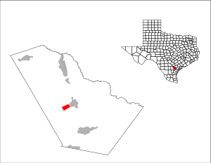
Blueberry Hill is a small community in Bee County, Texas, United States. It's known as a census-designated place (CDP). This means it's an area that looks like a town but isn't officially a city.
In 2020, about 844 people lived in Blueberry Hill. It is located right next to the town of Beeville. Blueberry Hill doesn't have its own shops or services. Things like drinking water and trash collection are handled by the city of Beeville. Even the mail for Blueberry Hill uses "Beeville" addresses.
Where is Blueberry Hill?
Blueberry Hill is located southwest of Beeville. You can find it at these coordinates: 28°23′21″N 97°46′54″W / 28.38917°N 97.78167°W. A major road, U.S. Route 59, runs along the southern edge of the community.
This highway goes west for about 21 miles to George West. If you head northeast on the highway, you'll go through Beeville. It's about 32 miles to Goliad in that direction. The 351 Bypass, which goes around Beeville, forms the northeastern border of Blueberry Hill. Beeville is a smaller town, located about an hour and 45 minutes southeast of San Antonio.
The United States Census Bureau says that Blueberry Hill covers a total area of 7.6 square kilometers. All of this area is land, with no water.
Who Lives in Blueberry Hill?
Blueberry Hill was first counted as a special census area in the year 2000. Here's how the population has changed over the years:
| Historical population | |||
|---|---|---|---|
| Census | Pop. | %± | |
| 2000 | 982 | — | |
| 2010 | 866 | −11.8% | |
| 2020 | 844 | −2.5% | |
| U.S. Decennial Census 1850–1900 1910 1920 1930 1940 1950 1960 1970 1980 1990 2000 2010 2020 |
|||
Schools in Blueberry Hill
Students living in Blueberry Hill attend schools that are part of the Beeville Independent School District.
See also
 In Spanish: Blue Berry Hill para niños
 | Dorothy Vaughan |
 | Charles Henry Turner |
 | Hildrus Poindexter |
 | Henry Cecil McBay |

