Bluebell, Utah facts for kids
Quick facts for kids
Bluebell, Utah
|
|
|---|---|

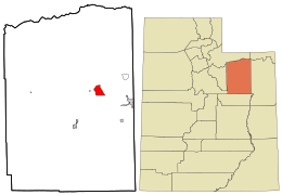
Location in Duchesne County and the state of Utah
|
|
| Country | United States |
| State | Utah |
| County | Duchesne |
| Area | |
| • Total | 9.76 sq mi (25.28 km2) |
| • Land | 9.74 sq mi (25.23 km2) |
| • Water | 0.02 sq mi (0.05 km2) |
| Elevation | 6,221 ft (1,896 m) |
| Population
(2010)
|
|
| • Total | 293 |
| • Density | 30/sq mi (11.6/km2) |
| Time zone | UTC-7 (Mountain (MST)) |
| • Summer (DST) | UTC-6 (MDT) |
| ZIP code |
84007
|
| FIPS code | 49-06590 |
| GNIS feature ID | 2584756 |
Bluebell is a small community in eastern Duchesne County, Utah, United States. It's known as a census-designated place. This means it's a specific area with a name and boundaries, mainly for counting people in a census. It's not an officially incorporated city or town.
Bluebell is located on the Uintah and Ouray Indian Reservation. In 2010, about 293 people lived there. You can find Bluebell along local roads, just east of State Route 87. It's northeast of Duchesne, which is the main town in Duchesne County. Bluebell sits about 6,201 feet (1,890 meters) above sea level. Even though it's not an official town, Bluebell has its own post office with the ZIP code 84007.
Climate
Bluebell has a type of weather called a semi-arid climate. This means it's a bit dry, like a desert, but it still gets more rain than a true desert. On climate maps, this kind of weather is often shown as "BSk."
See also
- In Spanish: Bluebell (Utah) para niños
 | William M. Jackson |
 | Juan E. Gilbert |
 | Neil deGrasse Tyson |

