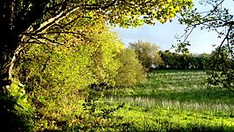
Bluestack Way facts for kids
Quick facts for kids Bluestack Way |
|
|---|---|
 |
|
| Length | 65 km (40 mi) |
| Location | County Donegal, Ireland |
| Designation | National Waymarked Trail |
| Trailheads | County Donegal, Ardara |
| Use | Hiking |
| Elevation gain/loss | +1,230 m (4,035 ft) |
| Difficulty | Moderate |
| Season | Any |
| Surface | Bog roads, moorland, tarmac roads |
The Bluestack Way (Irish: Bealach na gCruach) is a special long walking path in County Donegal, Ireland. It goes right through the beautiful Bluestack Mountains.
This trail is about 65 kilometers (40 miles) long. It starts in Donegal Town and finishes in Ardara. Most people take about three days to walk the whole path. It is known as a National Waymarked Trail, which means it's an official, well-marked route for hikers.
Contents
Discovering the Bluestack Way
The Bluestack Way is perfect for anyone who loves hiking and exploring nature. It offers a moderate challenge, meaning it's not too hard but still a good workout. You'll walk on different types of ground, like bog roads, open moorland, and even some paved roads.
How the Trail Began
The idea for the Bluestack Way came from a local group called the Bluestack Environmental Group. They wanted to create a path for people to enjoy the mountains. The trail officially opened in the year 2000.
Building the trail got help from different places. Some money came from the European Union's Peace and Reconciliation Fund. Workers from a special employment program also helped build the path. In 2010, experts looked at the trail and thought it was good enough to become an even higher standard of trail in Ireland. They also suggested adding smaller, circular walks off the main route.
Your Journey on the Trail
The Bluestack Way takes you on an exciting journey through County Donegal.
- It begins in Donegal Town.
- From there, it heads north towards a lovely lake called Lough Eske.
- Next, the path crosses over the Bluestack Mountains.
- You'll then reach the village of Glenties.
- Finally, from Glenties, the trail follows the Owenea River until it ends in Ardara.
Connecting Continents
The Bluestack Way might become part of a much bigger trail called the International Appalachian Trail (IAT). This huge trail is an extension of the famous Appalachian Trail in North America. The IAT aims to connect all the lands that were once part of the ancient Pangaea supercontinent, including Ireland. This means the Bluestack Way could one day be linked to trails across the Atlantic Ocean!
 | James Van Der Zee |
 | Alma Thomas |
 | Ellis Wilson |
 | Margaret Taylor-Burroughs |

