Bluewing Creek facts for kids
Quick facts for kids Bluewing Creek |
|
|---|---|
|
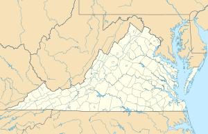
Location of Bluewing Creek mouth
|
|
| Other name(s) | Tributary to Hyco River |
| Country | United States |
| State | Virginia North Carolina |
| County | Halifax (VA) Person (NC) |
| Physical characteristics | |
| Main source | unnamed tributary to Mayo Reservoir divide about 2.5 miles southeast of Triple Springs, North Carolina 581 ft (177 m) 36°27′41″N 078°50′05″W / 36.46139°N 78.83472°W |
| River mouth | Hyco River about 3 miles southeast of Centerville, Virginia 319 ft (97 m) 36°37′17″N 078°50′16″W / 36.62139°N 78.83778°W |
| Length | 12.20 mi (19.63 km) |
| Basin features | |
| Progression | generally north |
| River system | Roanoke River |
| Basin size | 26.42 square miles (68.4 km2) |
| Tributaries |
|
| Bridges | Olive Branch Road, Tatum Road, NC 49, High View Church Road, VA 96, North Fork Church Road |
Bluewing Creek is a stream about 12 miles (19.6 km) long. It flows into the Hyco River in Halifax County, Virginia. This creek is quite unique because it is the only stream with this exact name in the entire United States.
Contents
What is Bluewing Creek?
Bluewing Creek is known as a "3rd order tributary." This means it's a stream that forms when two smaller streams (called "2nd order" streams) join together. Those 2nd order streams themselves formed from even smaller streams (called "1st order" streams). So, Bluewing Creek is a medium-sized stream that collects water from many smaller branches.
Where Does Bluewing Creek Flow?
The creek starts from a pond located about 2.5 miles southeast of a place called Triple Springs in North Carolina. From there, it flows mostly north. Its journey ends when it joins the Hyco River. This meeting point is about 3 miles southeast of Centerville, a town in Virginia.
Other Names for the Creek
Over time, Bluewing Creek has been known by a few different names. These names include:
- Big Bluewing Creek
- Blewing Creek
- Blue Wing Creek
The Bluewing Creek Area
The land area that Bluewing Creek drains is called its watershed. This watershed covers about 26.42 square miles (68.4 km²). A watershed is like a big bowl where all the rain and snow that falls eventually flows into the creek.
About 57% of this area is covered by forests. The region gets about 45.8 inches (116 cm) of rain each year.
 | William L. Dawson |
 | W. E. B. Du Bois |
 | Harry Belafonte |


