Bolivar, New York facts for kids
Quick facts for kids
Bolivar, New York
|
|
|---|---|

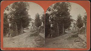
Wine Celler, Pleasant Valley, N.Y.
|
|
| Motto(s):
"Land of the Deer and the Derrick"
|
|
| Country | United States |
| State | New York |
| County | Allegany |
| Government | |
| • Type | Town Council |
| Area | |
| • Total | 35.88 sq mi (92.93 km2) |
| • Land | 35.87 sq mi (92.90 km2) |
| • Water | 0.01 sq mi (0.03 km2) |
| Population
(2020)
|
|
| • Total | 2,051 |
| • Estimate
(2021)
|
2,030 |
| • Density | 58.21/sq mi (22.48/km2) |
| Time zone | UTC-5 (Eastern (EST)) |
| • Summer (DST) | UTC-4 (EDT) |
| FIPS code | 36-003-07201 |
Bolivar is a small town located in Allegany County, New York, United States. It's named after Simón Bolívar, a famous South American leader. In 2020, about 2,051 people lived here.
The town of Bolivar is on the southern edge of Allegany County. It is located east of the city of Olean. There is also a small village called Bolivar within the town.
Bolivar became very important during the oil boom in the late 1800s. It was known as "the heart of the Allegany Oil Field." During a short oil boom in the 1880s, it was said to be one of the richest places per person in the United States! Even after the first boom slowed down, new ways of getting oil from the ground helped the industry grow again around 1920.
Contents
Geography of Bolivar
Bolivar covers an area of about 92.9 square kilometers (35.9 square miles). Only a tiny part of this area is water.
The southern border of the town is also the border with Pennsylvania.
Roads and Railways
New York State Route 275 ends at New York State Route 417 in the village of Bolivar.
In the past, Bolivar had several important railroads. From 1881 to 1947, the Pittsburg, Shawmut & Northern Railroad served the area. Other railroads like the Bradford, Eldred & Cuba Railroad System and the Olean, Bradford & Salamanca Railway also connected Bolivar to other places. These railways were very important for transporting oil and goods.
Neighboring Areas
To the south of Bolivar is Potter County, Pennsylvania. The town shares its eastern border with Alma. To the west, it borders the town of Genesee. The town of Wirt is located to the north.
Population Changes Over Time
| Historical population | |||
|---|---|---|---|
| Census | Pop. | %± | |
| 1830 | 449 | — | |
| 1840 | 408 | −9.1% | |
| 1850 | 708 | 73.5% | |
| 1860 | 959 | 35.5% | |
| 1870 | 959 | 0.0% | |
| 1880 | 1,029 | 7.3% | |
| 1890 | 2,233 | 117.0% | |
| 1900 | 2,035 | −8.9% | |
| 1910 | 2,282 | 12.1% | |
| 1920 | 1,979 | −13.3% | |
| 1930 | 2,813 | 42.1% | |
| 1940 | 2,628 | −6.6% | |
| 1950 | 2,680 | 2.0% | |
| 1960 | 2,441 | −8.9% | |
| 1970 | 2,391 | −2.0% | |
| 1980 | 2,496 | 4.4% | |
| 1990 | 2,361 | −5.4% | |
| 2000 | 2,223 | −5.8% | |
| 2010 | 2,189 | −1.5% | |
| 2020 | 2,051 | −6.3% | |
| 2021 (est.) | 2,030 | −7.3% | |
| U.S. Decennial Census | |||
The population of Bolivar has changed a lot over the years. In 1830, there were only 449 people. The population grew a lot during the oil boom in the late 1800s, reaching over 2,200 people by 1890. Since then, the number of people living in Bolivar has slowly decreased. In 2020, the population was 2,051.
In 2000, there were 2,223 people living in Bolivar. Most families were married couples living together. About 37.7% of households had children under 18. The average age of people in the town was 36 years old.
Places in the Town of Bolivar
The Town of Bolivar includes several smaller communities and interesting spots:
- Bolivar – This is the main village. You can find it in the northwest part of the town where Routes 275 and 417 meet.
- Hoben – A small community located east of South Bolivar. It's near the southern border of the town.
- Honeoye Creek – A stream that flows through the southern part of the town.
- Kossuth – Another small community on Route 417, right in the middle of the town.
- Little Genesee Creek – This stream flows through the northwest part of the town, passing by Richburg and the village of Bolivar.
- Richburg – Part of the village of Richburg is on the northern border of the town. It's northeast of Bolivar village.
- Sawyer – A small community located on Route 417, east of Kossuth.
- South Bolivar – This community is near the Pennsylvania border. It was also known as "Honeoye Corners" because it's close to Honeoye Creek.
- Vosburg – A location on Route 417, right at the eastern edge of the town.
See also
 In Spanish: Bolívar (pueblo) para niños


