Bond-South City, Florida facts for kids
Quick facts for kids
Bond-South City
|
|
|---|---|
|
Former CDP
|
|
| Country | United States |
| State | Florida |
| County | Leon |
| Population
(1960)
|
|
| • Total | 1,148 |
| Time zone | UTC-5 (Eastern (EST)) |
| • Summer (DST) | UTC-4 (EDT) |
| ZIP codes |
32301, 32310
|
Bond-South City was a special kind of place in Leon County, Florida. It was called a "census-designated place" (CDP). This means it was an area that the government counted for population, but it wasn't an official town or city.
Bond-South City was made up of two smaller communities. These were known as Bond and South City. The area was counted during the 1950 and 1960 population counts.
What Was Bond-South City?
A census-designated place, or CDP, is like a neighborhood or a group of neighborhoods. It has a name and people living there. But it doesn't have its own local government. It's different from a city or town that has a mayor and city council.
The government uses CDPs to collect information. This helps them understand how many people live in different areas. It also helps them see how populations change over time.
How Its Population Changed
In 1950, Bond-South City had a population of 4,611 people. This was the first time it was counted as a CDP. However, its population changed quite a bit.
The nearby city of Tallahassee started to grow. Tallahassee began to "annex" parts of Bond-South City. Annexing means a city takes over land next to it. This land then becomes part of the city.
Because of this, the population of Bond-South City went down. By 1960, only 1,148 people lived there. Tallahassee kept growing and eventually took over all of Bond-South City. This means Bond-South City no longer exists as a separate CDP today.
| Historical population | |||
|---|---|---|---|
| Census | Pop. | %± | |
| 1950 | 4,611 | — | |
| 1960 | 1,148 | −75.1% | |
| source: | |||
The table above shows how the population changed. You can see the big drop from 1950 to 1960. This was due to Tallahassee expanding its borders.
Where Was Bond-South City Located?
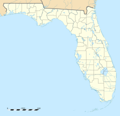
Bond-South City was located in Leon County, Florida. It was just south of the main city of Tallahassee. To its south was another community called Woodville.
An important landmark in the area was Florida A & M University. This university is often called FAMU. It is a large and well-known school. FAMU actually sat between the two communities of Bond and South City.
The main roads in the area were Adams Street and Monroe Street. These roads run from north to south. They helped people travel through Bond-South City. These roads are still important parts of the area today.
 | Kyle Baker |
 | Joseph Yoakum |
 | Laura Wheeler Waring |
 | Henry Ossawa Tanner |


