Bonito Lake facts for kids
Quick facts for kids Bonito Lake |
|
|---|---|
 |
|
| Location | Lincoln County, New Mexico |
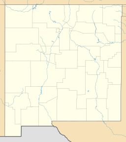
| Coordinates | 33°27′21″N 105°43′54″W / 33.45583°N 105.73167°W |
| Type | reservoir |
| Primary inflows | Bonito Creek |
| Primary outflows | Bonito Creek |
| Basin countries | United States |
| Max. length | 2,800 ft (850 m) |
| Max. depth | 70 ft (21 m) |
| Surface elevation | 7,380 ft (2,250 m) |
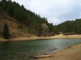
Bonito Lake is a beautiful mountain lake in the Sierra Blanca mountains of New Mexico. It's a popular spot for fishing and camping. Even though it's surrounded by the Lincoln National Forest, the lake itself is owned by the city of Alamogordo, New Mexico. It provides drinking water for the city.
Because it's so high up in the mountains, the lake stays cold all year. This makes it a great home for lots of rainbow trout. Around the lake, you'll find several places to camp. There are also many hiking trails and small streams to explore.
Contents
How Bonito Lake Was Made
The area around Bonito Lake is now part of the Lincoln National Forest. But a long time ago, in the late 1800s, the Southern Pacific Railroad owned most of the water rights here.
In 1907, the railroad built a small dam. It was in a place called South Fork Canyon. From this dam, they built a long wooden pipeline. It stretched for 132 miles (212 km) all the way to Pastura, New Mexico. This pipeline carried water for their steam trains. If you hike along the trail in South Fork Canyon today, you can still see parts of the old dam and the wooden pipeline.
By the 1920s, the railroad needed even more water. They asked the government of New Mexico if they could build a bigger dam. Engineers looked at the canyon and found the best spot. It was downstream from a small town called Bonito. This spot was narrow and would let the dam hold water from two streams that joined together.
However, building the dam there meant the town of Bonito would be flooded. So, the people living in Bonito were given new land. The entire town was moved to a new location further down the canyon.
The new dam was finished in 1931. By 1933, the lake was completely full. When it's at its biggest, the lake holds about 1,500 acre-feet of water.
From Trains to Drinking Water
By the 1950s, trains no longer used steam. They used diesel engines instead. This meant the railroad didn't need the lake's water anymore. So, the railroad sold Bonito Lake to the city of Alamogordo, New Mexico.
Alamogordo needed a good source of drinking water for its people. A 90-mile (140 km) pipeline was built to carry water from Bonito Lake to Alamogordo's "La Luz" water treatment plant.
Today, the lake and the mountains around it are very popular. People come here for fishing, camping, and hiking.
Little Bear Fire and Lake Closure
In 2012, a big wildfire called the Little Bear Fire happened. It caused a lot of damage to Bonito Lake and the area around it. Since the fire, the lake has been closed for fishing. The campgrounds around the lake are also closed.
The fire caused a lot of dirt and ash to wash into the lake. This happened because the fire damaged the land above the lake. In the summer of 2015, engineers started to drain the lake. They wanted to clean out the dirt and ash. This process is called dredging.
The lake is still closed, and no one knows exactly when it will reopen. It might be as late as 2019 or 2020.
On September 26, 2017, the city leaders of Alamogordo approved a big plan. They agreed to an $8.6 million contract to drain, dredge, and fix the lake. City engineers thought it would take about 24 months for all the work to be done. After that, the lake could finally reopen.
See also
 In Spanish: Lago Bonito para niños
 | Claudette Colvin |
 | Myrlie Evers-Williams |
 | Alberta Odell Jones |


