Sierra Blanca (New Mexico) facts for kids
Quick facts for kids Sierra Blanca Peak |
|
|---|---|
 |
|
| Highest point | |
| Elevation | 11,981 ft (3,652 m) NAVD 88 |
| Prominence | 5,533 ft (1,686 m) |
| Listing |
|
| Geography | |
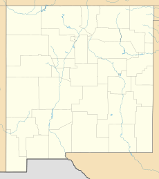
| Location | Lincoln / Otero counties, New Mexico, U.S. |
| Topo map | USGS Sierra Blanca Peak |
| Geology | |
| Age of rock | 26 to 38 million years |
| Mountain type | Stratovolcano complex |
| Climbing | |
| Easiest route | Hike south from ski area |
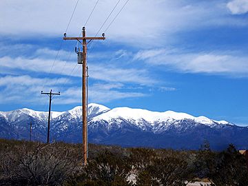
The Sierra Blanca (which means White Mountains in Spanish) is a group of volcanic mountains. You can find them in Lincoln and Otero counties in the southern part of New Mexico. This mountain range stretches about 40 miles (64 km) from north to south and 20 miles (32 km) wide.
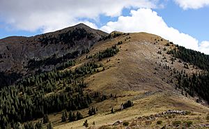
Sierra Blanca Peak is the tallest mountain in this range. It stands at 11,981 feet (3,652 meters) high. This makes it the highest peak in southern New Mexico. It's also the 40th highest mountain in the whole state. It is the most southerly place in the continental United States that is over 11,000 feet (3,353 meters) tall.
The peak is located on the Mescalero Apache Indian Reservation. It's about 10 miles (16 km) west of Ruidoso. It's also about 30 miles (48 km) north of Alamogordo.
Exploring the Sierra Blanca Mountains
Most of the Sierra Blanca mountain range is part of the Lincoln National Forest. A special part of it is protected as the White Mountain Wilderness Area. The southern half of the range, including Sierra Blanca Peak, is on the Mescalero Apache Indian Reservation.
The Mescalero Apache people consider Sierra Blanca Peak a very sacred place. If you want to visit the peak, you need to get a special permit from the tribe. South of the range, you'll find the Sacramento Mountains. To the north is Carrizozo Mountain, and to the northeast are the Capitan Mountains. On the west side, the mountains rise high above the Tularosa Basin.
The Sierra Blanca mountains are where several rivers begin. These include the Rio Ruidoso, Rio Tularosa, and Rio Bonito. Many smaller streams, called arroyos, also flow from the mountains into the Tularosa Basin.
Sierra Blanca Peak is so tall that you can see it from many miles away. It's especially clear from the Tularosa Basin. You can even see it from Sandia Crest near Albuquerque. It's one of the southernmost places in the U.S. where you can find alpine ecosystems. These are special environments found in very high, cold places.
The town of Ruidoso is in the eastern foothills of the Sierra Blanca range. This area is popular for hiking and camping. Sierra Blanca Peak is also the stunning background for Ski Apache. This is the southernmost major ski resort in North America. Ski Apache is mostly on land within the Lincoln National Forest. The Mescalero Apache Tribe runs it.
How Sierra Blanca Peak Formed
Sierra Blanca is a huge area made of different kinds of volcanic rocks. These include ash, lava flows, and rock that pushed up from inside the Earth. It's a very old volcano that has been worn down over time. It's the largest volcanic area east of the Rio Grande river.
Volcanic eruptions here started about 38 million years ago. They continued for about 12 million years. Most of these eruptions created large lava flows and broken rock pieces called breccias. Many rock walls, called dikes, also formed throughout the area. The last activity created the rock that makes up Sierra Blanca Peak today. After the volcanoes stopped, the mountains were shaped by Pleistocene ice, large cracks in the Earth's crust, and erosion.
See also
 In Spanish: Sierra Blanca (Nuevo México) para niños
 | Emma Amos |
 | Edward Mitchell Bannister |
 | Larry D. Alexander |
 | Ernie Barnes |


