Bouère facts for kids
Quick facts for kids
Bouère
|
|
|---|---|
| Country | France |
| Region | Pays de la Loire |
| Department | Mayenne |
| Arrondissement | Château-Gontier |
| Canton | Grez-en-Bouère |
| Area
1
|
42.54 km2 (16.42 sq mi) |
| Population
(2006)
|
930 |
| • Density | 21.86/km2 (56.62/sq mi) |
| Time zone | UTC+01:00 (CET) |
| • Summer (DST) | UTC+02:00 (CEST) |
| INSEE/Postal code |
53036 /53290
|
| Elevation | 41–117 m (135–384 ft) (avg. 81 m or 266 ft) |
| 1 French Land Register data, which excludes lakes, ponds, glaciers > 1 km2 (0.386 sq mi or 247 acres) and river estuaries. | |
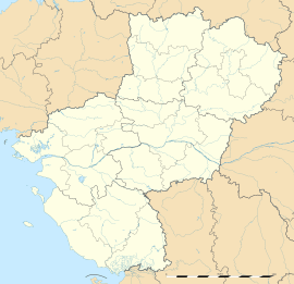
Bouère is a small town, also known as a commune, located in the northwest part of France. It is found in the Pays de la Loire region, within the Mayenne department. As of 2006, about 930 people lived in Bouère. It's a quiet place, typical of the French countryside.
Contents
Exploring Bouère: What is a Commune?
A commune is the smallest administrative area in France. Think of it like a local government area, similar to a township or a small municipality. Each commune has its own mayor and local council. They manage things like local schools, roads, and public services for the people who live there.
Where is Bouère Located?
Bouère is situated in the western part of France. It's part of the Mayenne department, which is known for its green landscapes and historic towns. The Pays de la Loire region is famous for its beautiful castles and the Loire River.
What is the Mayenne Department?
The Mayenne is one of France's 96 departments. These departments are like counties or states in other countries. They help organize the country's administration. The Mayenne department is named after the Mayenne River, which flows through it.
What is the Pays de la Loire Region?
The Pays de la Loire is one of France's 18 administrative regions. Regions are larger areas that group several departments together. This region is well-known for its rich history, especially its many châteaux (castles) along the Loire Valley.
Life in Bouère: Population and Area
Bouère is a small commune with a population of around 930 people, based on 2006 data. It covers an area of about 42.54 square kilometers (which is about 16.4 square miles). This means it's a fairly spread-out area with a low population density, giving it a peaceful, rural feel.
How Many People Live in Bouère?
The number of people living in a commune is called its population. In 2006, Bouère had 930 residents. This number can change over time as people move in or out, or as families grow.
How Big is Bouère?
The area of Bouère is 42.54 square kilometers. This measurement tells us the total land size of the commune. Understanding the area helps us imagine how much space there is for homes, farms, and natural landscapes.
Government and Administration
Like all French communes, Bouère has a local government. The mayor is the head of the commune's administration. They work with a council to make decisions for the town.
Who is the Mayor of Bouère?
The mayor is the elected leader of the commune. They are responsible for managing local services and representing the people of Bouère. The term "2008–2015" in the infobox refers to the period when a specific mayor was in office. Mayors are elected by the citizens of the commune.
What is an Arrondissement?
An arrondissement is a smaller administrative division within a department. It's like a district. Bouère is part of the Château-Gontier arrondissement. Arrondissements help organize the work of the government at a local level.
What is a Canton?
A canton is another type of administrative division, often used for elections. Bouère is part of the Grez-en-Bouère canton. Cantons are usually smaller than arrondissements and group together several communes.
See also
 In Spanish: Bouère para niños
 | Calvin Brent |
 | Walter T. Bailey |
 | Martha Cassell Thompson |
 | Alberta Jeannette Cassell |


