Bouès facts for kids
Quick facts for kids Bouès |
|
|---|---|
| Country | France |
| Physical characteristics | |
| Main source | Plateau de Lannemezan |
| River mouth | Arros 43°33′53″N 0°5′50″E / 43.56472°N 0.09722°E |
| Length | 63 km (39 mi) |
| Basin features | |
| Progression | Arros→ Adour→ Atlantic Ocean |
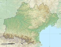
The Bouès is a river in southwestern France. It is a "tributary" of the Arros river. A tributary is a smaller river or stream that flows into a larger river. The Bouès flows into the Arros from its right side. This river is about 63 kilometers (39 miles) long. It is part of the larger Adour river system in France.
Contents
The Bouès River's Journey
The Bouès river starts near a town called Capvern. This area is west of Lannemezan. The river gets some of its water from the Neste Canal. This canal helps to feed the river.
Where the River Flows
As the Bouès river flows, it travels north. It goes through a valley that is quite narrow. Eventually, the Bouès joins the Arros river. This meeting point is located downstream from Marciac. The area where the two rivers meet is known as Rivière-Basse. This is a historical region in France.
Towns Along the Bouès
The Bouès river flows through two important areas in France. These are called "départements."
Hautes-Pyrénées
The river first flows through the Hautes-Pyrénées department. Some of the towns it passes are:
- Capvern
- Lutilhous
- Bernadets-Dessus
- Sère-Rustaing
- Vidou
Gers
After that, the Bouès enters the Gers department. Here, it flows near towns such as:
- Miélan
- Tillac (Gers)
- Marciac
Smaller Rivers Joining the Bouès
Several smaller rivers and streams flow into the Bouès. These are also called tributaries. They add more water to the Bouès as it travels.
- Cabournieu (joins from the right side, near Monpardiac)
- Laüs or Lahus (joins from the left side, near Laguian-Mazous)
- Lis or Lys (joins from the right side)
See also
 In Spanish: Boues para niños
 | Audre Lorde |
 | John Berry Meachum |
 | Ferdinand Lee Barnett |


