
Adour facts for kids
Quick facts for kids Adour |
|
| River | |
 The Adour river at Bayonne
|
|
| Country | France |
|---|---|
| Regions | Occitanie, Nouvelle-Aquitaine |
| Departments | Hautes-Pyrénées, Gers, Landes, Pyrénées-Atlantiques |
| Communes | Bagnères-de-Bigorre, Tarbes, Maubourguet, Riscle, Aire-sur-l'Adour, Dax, Tarnos, Bayonne |
| Tributaries | |
| - left | Échez, Lées, Gabas, Louts, Luy, Gaves Réunis, Bidouze, Nive |
| - right | Arros, Midouze, Luzou |
| Cities | Tarbes, Dax, Bayonne |
| Source | Arbizon |
| - location | Massif de l'Arbizon, Hautes-Pyrénées, France |
| - elevation | 2,831 m (9,288 ft) |
| - coordinates | 42°52′32″N 0°16′21″W / 42.87556°N 0.27250°W |
| Mouth | Atlantic Ocean |
| - location | near Bayonne, Pyrénées-Atlantiques, France |
| - elevation | 0 m (0 ft) |
| - coordinates | ACoordinates: Unknown argument format Invalid arguments have been passed to the {{#coordinates:}} function |
| Length | 309 km (192 mi) |
| Basin | 16,912 km² (6,530 sq mi) |
| Discharge | for Saint-Vincent-de-Paul |
| - average | 86.60 m³/s (3,058 cu ft/s) |
The Adour is a major river in southwestern France. It flows through the Occitanie and Nouvelle-Aquitaine regions. The river starts high up in the Pyrenees mountains, at the Arbizon mountain. It then travels across the land before emptying into the Atlantic Ocean near the city of Bayonne.
Contents
Geography of the Adour River
The Adour river is about 309 km (192 mi) long. Its drainage basin (the area of land where all water flows into this river) covers about 16,912 km2 (6,530 sq mi). This is a very large area!
Where the Adour Flows
The Adour river begins as the Adour de Payolle on the north side of the Arbizon mountain. In the Campan valley, three smaller streams, called Adour de Payolle, Adour de Gripp, and Adour de Lesponne, come together. They meet at a place called Campan to form the main Adour river.
The Adour first flows north through the Hautes-Pyrénées area and then into Gers. After that, it turns west and enters the Landes department. Near Port-de-Lanne, another river system called the Gaves réunis joins the Adour. Finally, the Adour flows into the Bay of Biscay, which is part of the Atlantic Ocean. This happens between Anglet and Tarnos.
The river is deep and wide enough for ships to travel on for about 72 km (45 mi) from its mouth. This makes it important for transport!
Rivers Joining the Adour
Many smaller rivers and streams flow into the Adour. These are called tributaries. Here are some of the important ones that are longer than 50 km:
Rivers joining from the left side:
- Échez (64.1 km long)
- Lées (56.1 km long)
- Gabas (116.7 km long)
- Louts (86 km long)
- Luy (154.5 km long)
- Gaves réunis (10 km long, but includes the Gave de Pau which is 193.1 km)
- Bidouze (82.2 km long)
- Nive (78.9 km long)
Rivers joining from the right side:
- Arros (130.28 km long)
- Midouze (151.5 km long)
Cities and Towns Along the Adour
The Adour river passes through several departments and towns in France. Here are some of them:
- Hautes-Pyrénées: Campan, Bagnères-de-Bigorre, Tarbes, Maubourguet
- Gers: Riscle
- Landes: Aire-sur-l'Adour, Dax, Tarnos
- Pyrénées-Atlantiques: Bayonne
How Much Water Flows in the Adour?
The amount of water flowing in a river is called its discharge. For the Adour river, the average amount of water flowing past a point is about 86.60 m3/s (3,058 cu ft/s). This measurement is taken at Saint-Vincent-de-Paul.
Average monthly discharge (m3/s) at Saint-Vincent-de-Paul (1918 - 2017)
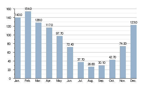
The amount of water in the Adour changes with the seasons. The river has the most water during winter and spring, from December to May. February usually has the highest water levels. The water level then drops quickly during the drier months, from July to October.
Gallery
-
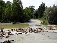
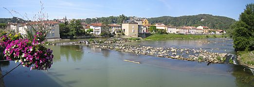
The Adour at Riscle
-
The Adour at Aire-sur-l'Adour
-
The Adour view from Saint-Maurice-sur-Adour
-
The Adour at Saint-Sever
-
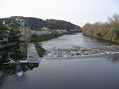
The Adour at Dax
-
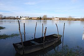
The Adour between Urt and Saint-Laurent-de-Gosse
-
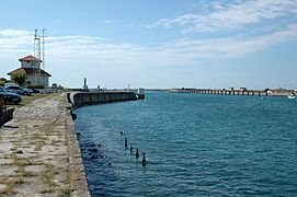
Bayonne, mouth of the Adour
-
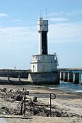
Bayonne, mouth of the Adour
-
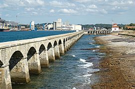
Bayonne, the commerce port
-
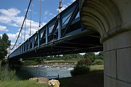
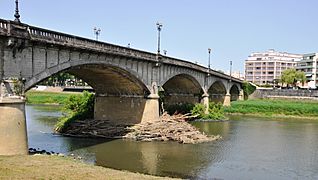
Adour seen from the bridge at Aire-sur-l'Adour


.jpg)
.jpg)

Related pages
Images for kids
-
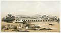
a scow on the Adour in Bayonne in 1843 by Eugène de Malbos.

See also
 In Spanish: Río Adur para niños
