
Gave de Pau facts for kids
Quick facts for kids Gave de Pau |
|
| River | |
 Gave de Pau in Lourdes
|
|
| Country | France |
|---|---|
| Regions | Occitanie, Nouvelle-Aquitaine |
| Departments | Hautes-Pyrénées, Pyrénées-Atlantiques, Landes |
| Communes | Argelès-Gazost, Lourdes, Pau, Orthez, Peyrehorade |
| Tributaries | |
| - left | Ouzoum, Bayse, Gave d'Oloron |
| Cities | Pau, Lourdes, Orthez |
| Source | Cirque de Gavarnie |
| - location | Pyrenees, Occitanie, France |
| - elevation | 2,600 m (8,530 ft) |
| - coordinates | 42°41′45″N 0°02′01″W / 42.69583°N 0.03361°W |
| Mouth | Gaves réunis |
| - location | Peyrehorade, Landes, France |
| - elevation | 4 m (13 ft) |
| - coordinates | 43°32′25″N 1°05′26″W / 43.54028°N 1.09056°W |
| Length | 190.7 km (118 mi) |
| Basin | 2,575 km² (994 sq mi) |
| Discharge | for Bérenx |
| - average | 81.2 m³/s (2,868 cu ft/s) |
The Gave de Pau is a river in southwestern France. It is a major branch, also called a tributary, of the Adour river.
The river gets its name from the city of Pau, which it flows through. The word gave is a special name for rivers in the western Pyrenees mountains. So, Gave de Pau means "the river of Pau" or "the river that flows through Pau." Many other rivers in this region also have "gave" as part of their names.
Contents
About the Gave de Pau River
The Gave de Pau is about 190.7 km (118.5 mi) long. This length includes its upper part, which is known as the Gave de Gavarnie. The river's drainage basin, which is the area of land where all the water flows into the river, covers about 2,575 km2 (994 sq mi).
The river's average flow of water is about 81.20 m3/s (2,868 cu ft/s) near Bérenx. This measurement tells us how much water passes a certain point in the river each second.
Where the River Starts and Ends
The Gave de Pau begins high up in the Cirque de Gavarnie. This is a large, natural amphitheater-like valley in the Parc national des Pyrénées (Pyrénées National Park). It starts in the commune of Gavarnie, in the Hautes-Pyrénées department, at an altitude of about 2,600 m (8,530 ft).
The very top part of the river is called Gave de Gavarnie. It officially becomes the Gave de Pau after it joins another river called the Bastan, near Luz-Saint-Sauveur.
Later on, the Gave de Pau meets its biggest tributary, the Gave d'Oloron, in Peyrehorade. From this point, the combined rivers are called Gaves Réunis, which means "United Gaves." Finally, the Gaves Réunis flows into the Adour river in the Landes department, at an altitude of about 3 m (10 ft).
Cities and Towns Along the River
The Gave de Pau flows through many towns and cities. Here are some of the main ones:
- In the Occitanie region:
* Hautes-Pyrénées: Gavarnie, Luz-Saint-Sauveur, Pierrefitte-Nestalas, Argelès-Gazost, Lourdes, Saint-Pé-de-Bigorre
- In the Nouvelle-Aquitaine region:
* Pyrénées-Atlantiques: Lestelle-Bétharram, Coarraze, Nay, Pau, Artix, Orthez * Landes: Labatut
Main Rivers Joining the Gave de Pau
Several smaller rivers, called tributaries, flow into the Gave de Pau. Here are some of the longer ones (over 29 km (18.0 mi)):
- Rivers joining from the left side:
* Ouzom - 33.2 km * Baïse - 40.6 km * Gave d'Azun - 29.1 km * Laâ - 29.5 km
- Rivers joining from the right side:
* Ousse - 42.4 km * Ousse des Bois - 32.3 km * Gave d'Oloron - 148.2 km
Gallery
-
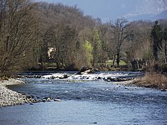
Gave de Pau near Nay, Pyrénées-Atlantiques
-
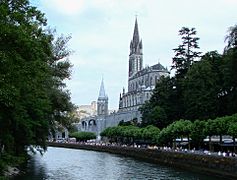
Gave de Pau at Lourdes, Hautes-Pyrénées
-
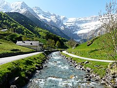
Gave de Gavarnie, several kilometres from the Cirque de Gavarnie
-
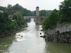
Orthez, bridge over the Gave de Pau
.JPG)

_(1).JPG)
.JPG)
Images for kids
-
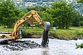
Maintenance work on the bed of the river

See also
 In Spanish: Gave de Pau para niños
