
Tarbes facts for kids
Quick facts for kids
Tarbes
Tarba
|
||
|---|---|---|
|
Prefecture and commune
|
||

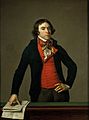
Tarbes, Musée des Beaux-Arts
|
||
|
||

Tarbes
Location in France

Tarbes
Location in Occitanie
|
||
| Country | France | |
| Region | Occitanie | |
| Department | Hautes-Pyrénées | |
| Arrondissement | Tarbes | |
| Canton | Chief town of 3 cantons | |
| Intercommunality | Le Grand Tarbes | |
| Area
1
|
15.33 km2 (5.92 sq mi) | |
| Population
(2014)
|
40,900 | |
| • Density | 2,668/km2 (6,910/sq mi) | |
| Demonym(s) | Tarbais(es) | |
| Time zone | UTC+01:00 (CET) | |
| • Summer (DST) | UTC+02:00 (CEST) | |
| INSEE/Postal code |
65440 /65000
|
|
| Elevation | 284–326 m (932–1,070 ft) (avg. 304 m or 997 ft) |
|
| Website | www.tarbes.fr | |
| 1 French Land Register data, which excludes lakes, ponds, glaciers > 1 km2 (0.386 sq mi or 247 acres) and river estuaries. | ||

Tarbes (which is Tarba in the Occitan language) is a city in southwestern France. It is located in the Hautes-Pyrénées department, which is part of the Occitanie region. Tarbes is also the main city, or capital, of the Hautes-Pyrénées department since 1790.
This city is the second largest metropolitan area in the old Midi-Pyrénées region. Only Toulouse is bigger. Tarbes is also part of the historical region called Gascony.
Contents
- What's in a Name? The History of Tarbes' Name
- A Look Back: The History of Tarbes
- Tarbes' Location: Where is it?
- People of Tarbes: Population and Demographics
- How Tarbes is Governed: Administration
- Getting Around: Transport in Tarbes
- Learning in Tarbes: Education
- Images for kids
- More to Explore: Related Pages
- See also
What's in a Name? The History of Tarbes' Name
The city of Tarbes was first mentioned in the 5th century. Back then, it was called Civitas Turba ubi castrum Bigorra. It was an important city in a region known as Novempopulania.
Later, in the 7th century, a historian named Gregory of Tours referred to the city as Talvam vicum. During the Middle Ages, the name changed several times. Some names used were Tarbe (in 1214), Tursa, Tarvia (in 1284), and Tarbia.
A Look Back: The History of Tarbes
Tarbes started as a small town around 300 years before Christ. It became a Roman settlement and was known as Tarba.
In 840, the town was destroyed by the Vikings. However, it was rebuilt by the Bishop of Bigorre or Tarbes. From the 12th century onwards, Tarbes became the main city of the County of Bigorre.
During the religious wars, the city's cathedral was burned down in 1569 by Protestants. But the bishop had it rebuilt by 1652. In 1790, Tarbes officially became the capital of the new Hautes-Pyrénées department.
Tarbes' Location: Where is it?
Tarbes is in the southwest of France. It sits at the foot of the Pyrenees mountains. The city is in a fertile plain in the valley of the Adour river.
It is about 20 km (12 mi) northeast of Lourdes. It's also 70 km (43 mi) southeast of Auch. The city covers an area of 15.33 km2 (5.92 sq mi). Its average height above sea level is 304 meters (997 feet). At the city hall, the height is 311 meters (1,020 feet).
Two rivers flow through Tarbes. The Adour river runs through the east side. The Échez river flows through the west side.
Cities and Towns Near Tarbes
Many towns and cities are located around Tarbes:
- To the north: Andrest and Bazet (on the way to Bordeaux)
- To the northeast: Orleix and Aureilhan (on the way to Auch)
- To the east: Séméac (on the way to Saint-Gaudens and Toulouse)
- To the southeast: Soues and Barbazan-Debat
- To the south: Laloubère and Horgues (on the way to Bagnères-de-Bigorre)
- To the southwest: Juillan, Ossun, Hibarette, and Odos (on the way to Lourdes and Argelès-Gazost)
- To the west: Ibos (on the way to Pau and Bayonne)
- To the northwest: Bordères-sur-l'Échez and Oursbelille
Tarbes' Weather: What's the Climate Like?
Tarbes has an oceanic climate. This means it has summers that are quite warm and winters that are mild. There is also a lot of rain throughout the year. This type of climate is known as Cfb in the Köppen climate classification system.
| Climate data for Tarbes, France (altitude 360m, 1981–2010) (Source: Météo-France, Infoclimat.fr) | |||||||||||||
|---|---|---|---|---|---|---|---|---|---|---|---|---|---|
| Month | Jan | Feb | Mar | Apr | May | Jun | Jul | Aug | Sep | Oct | Nov | Dec | Year |
| Mean daily maximum °C (°F) | 10.3 (50.5) |
11.3 (52.3) |
14.2 (57.6) |
15.8 (60.4) |
19.5 (67.1) |
22.8 (73.0) |
25.1 (77.2) |
25.2 (77.4) |
22.8 (73.0) |
19.0 (66.2) |
13.7 (56.7) |
11.0 (51.8) |
17.6 (63.6) |
| Mean daily minimum °C (°F) | 1.0 (33.8) |
1.5 (34.7) |
3.7 (38.7) |
5.6 (42.1) |
9.5 (49.1) |
12.8 (55.0) |
14.9 (58.8) |
14.9 (58.8) |
11.9 (53.4) |
8.7 (47.7) |
4.3 (39.7) |
1.8 (35.2) |
7.6 (45.6) |
| Average precipitation mm (inches) | 95.0 (3.74) |
81.1 (3.19) |
87.0 (3.43) |
111.7 (4.40) |
111.6 (4.39) |
78.0 (3.07) |
56.0 (2.20) |
68.1 (2.68) |
71.6 (2.82) |
88.1 (3.47) |
102.5 (4.04) |
96.7 (3.81) |
1,047.4 (41.24) |
| Source 1: climat.meteofrance.com | |||||||||||||
| Source 2: infoclimat.fr | |||||||||||||
People of Tarbes: Population and Demographics
The people who live in Tarbes are called Tarbais (for men) or Tarbaises (for women) in French.
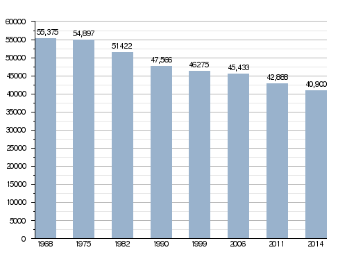
In 2014, the city of Tarbes had a population of 40,900 people. This means that its population density was about 2,668 inhabitants per square kilometer (6,910 per sq mi).
How Tarbes' Population Has Changed Over Time
How Tarbes is Governed: Administration
Tarbes has been the main administrative city, or prefecture, of the Hautes-Pyrénées department since 1790. It is also the capital of three special areas called Cantons:
- Tarbes-1: This part of Tarbes had 13,514 people in 2014.
- Tarbes-2: This part of Tarbes had 13,402 people in 2014.
- Tarbes-3: This part of Tarbes had 13,984 people in 2014.
Tarbes is also part of a group of communities called Le Grand Tarbes. This group works together on shared projects.
Friendly Cities: Sister Cities of Tarbes
Tarbes has special partnerships with other cities around the world. These are called sister cities:
 Huesca, Spain, since May 7, 1964.
 Altenkirchen, Germany, since June 24, 1972.
Getting Around: Transport in Tarbes
The Gare de Tarbes railway station connects Tarbes to other major cities. You can take a train directly to Paris, Bordeaux, Toulouse, and Bayonne.
There is also a motorway that links Tarbes to Bayonne and Toulouse. For air travel, the small Tarbes-Lourdes-Pyrénées Airport is only 10 kilometers (6 miles) from the city center.
Learning in Tarbes: Education
One important place for learning in Tarbes is the Institut national polytechnique de Toulouse. This institute is a part of a larger university system in Toulouse.
Images for kids
-
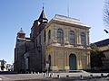
Notre-Dame-de-la-Sède cathedral, Tarbes
-
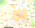
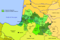
Map of the commune of Tarbes
-
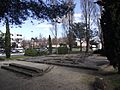
Foundations of an old villa in the Ormeau quarter
-
Map of the fiefs of Gascocony around 1150
-
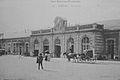
The Gare de Tarbes, around 1900
-
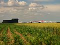
TARMAC and the fields around Ossun
-
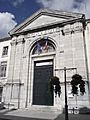
The Tribunal of Grand Instance (High Court) of Tarbes
-
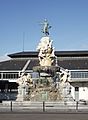
Fountain of the Quatre-Vallées
-
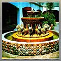
The Alhambra Fountain in Tarbes
-
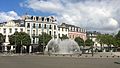
The fountain in the Place de Verdun
-
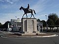
Equestrian statue of Ferdinand Foch
-
The Henri Duparc Conservatory
-
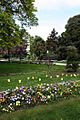
The Massey Garden
-
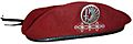
Red beret of the 1st Parachute Hussar Regiment
-
House of Martial Arts
-
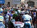
2006 Tour de France stage held in Tarbes with a large turn out
-
Bertrand Barère
-

Bernard Lapasset
-
Birthplace of Ferdinand Foch
-
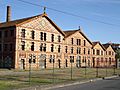
Building 119 became a cinema complex
-
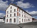
Building 103 became the municipal archives
-
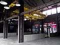
An overhead crane in building 117, which became a leisure complex
-
The Oustau ceramic factory in Aureilhan
-
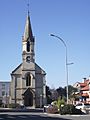
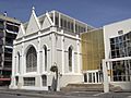
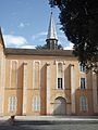
The Church of Saint-Anne
-
Carmel de Tarbes
-
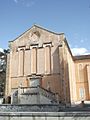
Carmel de Tarbes
-
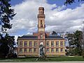
Massey Museum


.jpg)
.JPG)
.JPG)


.JPG)
.JPG)

.JPG)


.jpg)
.JPG)
.JPG)
.JPG)

.JPG)
.JPG)
.JPG)
More to Explore: Related Pages
See also
 In Spanish: Tarbes para niños
