Bowen River (Queensland) facts for kids
Quick facts for kids Bowen |
|
|---|---|

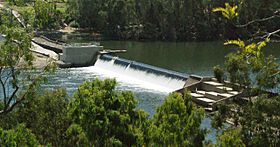
Bowen River Weir, 2010
|
|
|
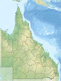
Location of Bowen River mouth in Queensland
|
|
| Country | Australia |
| State | Queensland |
| Region | North Queensland |
| Physical characteristics | |
| Main source | Normanby Range, Great Dividing Range near Turrawulla 260 m (850 ft) 21°09′27″S 148°13′59″E / 21.15750°S 148.23306°E |
| River mouth | Burdekin River south southeast of Ravenswood 50 m (160 ft) 20°23′40″S 147°20′55″E / 20.39444°S 147.34861°E |
| Length | 129 km (80 mi) |
| Basin features | |
| River system | Burdekin River |
| Basin size | 9,452 km2 (3,649 sq mi) |
| Tributaries |
|
The Bowen River is a river found in North Queensland, Queensland, Australia. It's an important waterway in the region.
Contents
Where Does the Bowen River Flow?
The Bowen River starts where two smaller rivers, the Broken River and the Little Bowen River, meet. This happens near Tent Hill in the Normanby Range, which is part of the Great Dividing Range.
From there, the Bowen River flows mostly north-west. It passes through Emu Plains and goes under the Bowen Developmental Road. Eventually, it joins the larger Burdekin River near Ravenswood.
The river is about 129 km (80 mi) long. During its journey, it drops about 98 metres (322 ft) in height.
What is the Bowen River Used For?
The area around the Bowen River is called its catchment area. This area covers about 9,452 square kilometres (3,649 sq mi). A small part of this area, about 236 square kilometres (91 sq mi), is made up of wetlands.
Most of the land around the river is used for raising cattle. The towns of Collinsville and Glendon get their drinking water from the Bowen River.
The Bowen River Weir
The Bowen River Weir is like a small dam built on the river. It helps control the water flow. This weir provides water for a coal mine, a power station, and the town of Collinsville.
The weir was built between April 1982 and August 1983. It cost about AUD$6.5 million. It is located about 25 kilometres (16 mi) south of Collinsville.
History of the Bowen River
The river got its name in 1861 from the Queensland Government. It was named after the town of Bowen. The town itself was named to honor Sir George Bowen, who was a Governor of Queensland.
Early Discoveries
In the 1860s, a man named Richard Daintree found valuable minerals along the Bowen River. He was the first to properly study the coal deposits near Collinsville.
Around 1865, the Bowen River Hotel was built. It stood on a steep bank of the river. Today, this old hotel is listed on the Queensland Heritage Register, which means it's an important historical site.
 | Selma Burke |
 | Pauline Powell Burns |
 | Frederick J. Brown |
 | Robert Blackburn |


