Burdekin River facts for kids
Quick facts for kids Burdekin |
|
|---|---|
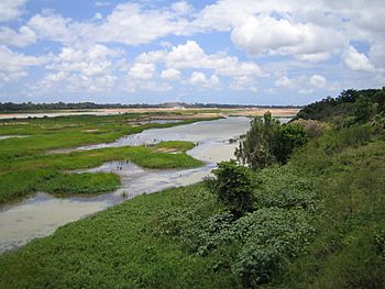
Burdekin River, 2005, taken from the Burdekin Bridge
|
|
|
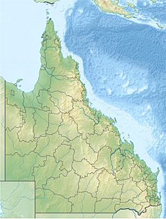
Location of Burdekin River mouth in Queensland
|
|
| Country | Australia |
| State | Queensland |
| Region | North Queensland, Far North Queensland |
| Settlements | Charters Towers, Home Hill |
| Physical characteristics | |
| Main source | Seaview Range near Ingham 620 m (2,030 ft) 18°42′12″S 145°44′23″E / 18.70333°S 145.73972°E |
| River mouth | Coral Sea Upstart Bay 0 m (0 ft) 19°38′49″S 147°29′14″E / 19.64694°S 147.48722°E |
| Length | 886 km (551 mi) |
| Basin features | |
| Basin size | 129,700 km2 (50,100 sq mi) |
| Tributaries |
|
| Reservoir and lakes | Lake Dalrymple; Lamonds Lagoon |
The Burdekin River is a very important river in Northern and Far North Queensland, Australia. It starts high up on Boulder Mountain near the Seaview Range. The river then flows into the Coral Sea at Upstart Bay. This journey covers over 200 kilometres (124 mi).
The area drained by the river, called its catchment area, is huge. It covers about 130,000 square kilometres (50,000 sq mi). The Burdekin River is known as Australia's largest river when it comes to the amount of water it can release during floods. Europeans first explored this river in 1845. It was named after Thomas Burdekin, who helped fund the expedition.
Contents
Where Does the Burdekin River Flow?
The Burdekin River begins on the western side of the Seaview Range. This range is part of the larger Great Dividing Range. Near its start, the river flows west and then south. It passes through Girringun National Park. This park is part of the UNESCO Wet Tropics World Heritage Area.
Many smaller rivers and creeks join the Burdekin. These include Lucy Creek, the Running River, Star River, and Keelbottom Creek. Further along, the Clarke, Basalt, and Dry rivers also add their waters. South of Charters Towers, the Fanning River joins. The river then flows through wetlands.
Eventually, the Burdekin River flows into Lake Dalrymple. This lake was created by the Burdekin Dam. Inside Lake Dalrymple, other rivers like the Cape and Suttor/Belyando rivers join. The Belyando River starts almost 500 kilometres (311 mi) away!
Irrigation and Water Use
Below the dam, the river helps water a large farming area. About 80,000 hectares (200,000 acres) of land is irrigated here. Farmers mostly grow sugarcane. This area uses water from the river and from underground sources. The Bowen and Bogie rivers also join the Burdekin in this lower section.
The Burdekin River drops 620 metres (2,030 ft) over its 886-kilometre (551 mi) course. There are four important wetland areas along the river. These wetlands are vital for many plants and animals.
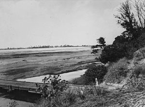
The Burdekin River is very important for Australia's economy. It has the fourth-largest watershed in Australia. It's also the fourth-largest river by water volume. However, its flow can change a lot. Sometimes it carries huge amounts of water, especially after cyclones. Other times, it can have no flow at all for months. This is because the rainfall in the area changes so much.
A Look Back: History of the Burdekin River
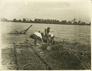
The Gugu Badhun and Yuru people are the traditional owners of the land around the Burdekin River. Their languages and culture are deeply connected to this region.
Europeans first saw the river in 1839. John Clements Wickham named it the Wickham River. Later, in 1849, Ludwig Leichhardt explored inland. He named the river after Thomas Burdekin, not knowing it was the same river Wickham had seen.
In the 1860s, pastoralists (people who raise livestock) started farms along the river. Some of these areas were later used for growing sugarcane.
Bridges and Dams
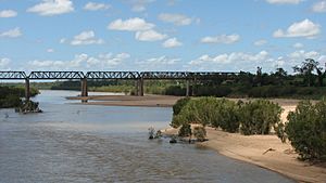
In 1899, the Burdekin River Rail Bridge was built. It carried the Great Northern railway over the river. Even though a new bridge was built in 1964, the old one is still there. It is now a protected heritage site.
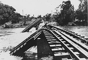
The towns of Ayr and Brandon were founded in 1882. Many sugar mills were built there. The North Coast railway had a bridge over the Burdekin River. This was the Inkerman Bridge, built in 1913. A road bridge followed in 1930. These bridges were often damaged by floods. So, a new, higher bridge called the Silver Link was built. It was started in 1947 and finished in 1957.
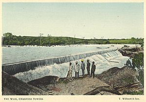
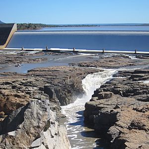
A weir (a small dam) was built in 1953. This helped provide water for farms growing tobacco. Later, in 1984, construction began on the Burdekin Falls Dam. This huge dam was finished in 1987. It created Lake Dalrymple, which holds a lot of water.
Flooding on the Burdekin
The Burdekin River often floods between December and March. Sometimes there are no floods, but other times there can be up to three floods a year.
In 1875, there was a very big flood. The river rose by 60 feet (18 m) in just a few hours. This washed away homes, fences, and animals. In 1917, another severe flood damaged the Inkerman Bridge. About a third of the bridge was washed away. More floods happened in 1927.
A massive flood occurred in 1974 due to Cyclone Wanda. During this flood, an estimated 25,000 tonnes (25,000 long tons; 28,000 short tons) of water flowed out of the river every second! This affected a huge area of the coastline.
Water Storage and Irrigation
The Burdekin Falls Dam is the largest dam in Queensland. It was finished in 1987. The lake it created is called Lake Dalrymple.
The dam helps with a large irrigation system. This system was set up in the early 1950s. Water from the dam and other sources helps irrigate about 2,560 square kilometres (990 sq mi) of land.
In the delta area near Ayr and Home Hill, farmers use underground water to grow sugar cane. This underground water supply is refilled naturally during big floods. Managing this water carefully is important. It ensures there is enough water during dry times. It also stops saltwater from getting into the fresh water.
The Burdekin River's Surroundings
The North Coast railway line and the Bruce Highway both cross the Burdekin River at Home Hill. Further west, the Flinders Highway also crosses it.
Most of the land around the Burdekin River is used for grazing. This means raising sheep and cattle. The rainfall here can be very unpredictable. So, growing crops like cotton or maize is risky. Grazing animals is a safer way to use the land.
The Valley of Lagoons Station was set up in 1862. It was first used for sheep, then for cattle. Inkerman Station was established in 1864. This area later became farmland for sugarcane.
The natural plants away from the coast are mostly grasslands. Near the coast, you can find dry eucalypt forests.
There are not many mines along the river. However, there is the Ben Lomond Uranium mine. It is currently not operating. In the past, there was an incident where water from the mine's dam overflowed into a creek that flows into the Burdekin. This highlighted the importance of careful environmental management.
Amazing Wildlife of the Burdekin
The Burdekin River is home to many different kinds of fish. One unique fish is the Neosilurus mollespiculum, a type of eeltail catfish.
You can also find many other species in the river. These include Agassiz's glassfish, Banded grunter, Barramundi, Black catfish, Eastern rainbowfish, Empire gudgeon, Freshwater longtom, Mangrove Jack, Tilapia, and Yellowbelly. The river's varied habitats support this rich aquatic life.
 | Tommie Smith |
 | Simone Manuel |
 | Shani Davis |
 | Simone Biles |
 | Alice Coachman |


