Bradda Hill facts for kids
Quick facts for kids Bradda Hill |
|
|---|---|
| Cronk Vradda | |

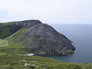
Bradda Hill from the north after a gorse fire
|
|
| Highest point | |
| Elevation | 233 m (764 ft) |
| Prominence | c. 205 m |
| Listing | Marilyn |
| Geography | |
| Location | Isle of Man |
| OS grid | SC193711 |
| Topo map | OS Landranger 95 |
Bradda Hill is a special hill that sticks out into the sea, also known as a headland. It's located on the Isle of Man, about 2 kilometers (1.2 miles) north of the village of Port Erin. In the Manx language, its name is Cronk Vradda. It's important not to mix it up with Bradda Head, which is another hill about 2 kilometers (1.2 miles) to the southwest.
Exploring Bradda Hill
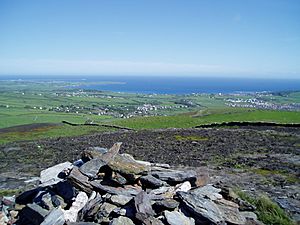
Bradda Hill is a great place for exploring! A path leads to the top from an area called Bradda West. This path is actually part of a much longer walking trail called the Raad ny Foillan. This trail goes all the way around the coast of the Isle of Man.
Views from the Top
When you reach the top of Bradda Hill, you'll see amazing views. The land drops sharply down to the sea, forming tall cliffs. Bradda Hill also helps to protect Fleshwick Bay from strong winds coming from the west.
The Gorse Fire of 2003
In October 2003, there was a large fire on Bradda Hill. It was a gorse fire. Gorse is a type of prickly bush with yellow flowers that grows commonly on hillsides. The fire was very big and took two days for firefighters to get under control. It then took five more days for the fire to completely die out. The fire left scars on Bradda Hill and other nearby headlands around Fleshwick Bay.


