Brava, Cape Verde facts for kids
 |
|
 |
|
| Geography | |
|---|---|
| Location | Atlantic Ocean |
| Coordinates | 14°52′N 24°42′W / 14.867°N 24.700°W |
| Area | 62.51 km2 (24.14 sq mi) |
| Length | 10.5 km (6.52 mi) |
| Width | 9.3 km (5.78 mi) |
| Highest elevation | 976 m (3,202 ft) |
| Highest point | Monte Fontainhas |
| Administration | |
| Municipality | Brava |
| Largest settlement | Nova Sintra |
| Demographics | |
| Population | 5,698 (2015) |
| Pop. density | 91.2 /km2 (236.2 /sq mi) |
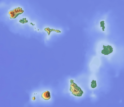
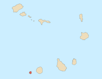
Brava is an island in Cape Verde, located in the central Atlantic Ocean. Its name means "wild" or "brave" in Portuguese. It is part of the Sotavento group.
Brava is the smallest inhabited island in Cape Verde. It covers about 62.5 square kilometers. It is also known as the greenest island in the archipelago. People first settled here in the early 1500s. Its population grew a lot after the Mount Fogo volcano erupted in 1680. This volcano is on the nearby island of Fogo. For over 100 years, whaling was the main business. Today, the island's economy mostly depends on agriculture.
Contents
- Island History: How Brava Was Settled
- Brava's Geography: Mountains and Islets
- Brava's Municipality and Parishes
- Brava's Population and Towns
- Brava's Economy: Farming and Fishing
- Fun Places to Visit on Brava
- Sports on Brava Island
- Getting Around Brava: Transport and Ports
- Famous People from Brava
- See also
Island History: How Brava Was Settled
Brava was found in 1462 by a Portuguese explorer named Diogo Afonso. There is no sign that people lived on the Cape Verde islands before the Portuguese arrived. Around 1620, settlers from Madeira and the Azores began to arrive on Brava.
More people came to Brava in 1680. Many refugees from the larger island of Fogo moved here. Their island was covered in ash after its volcano, Pico do Fogo, erupted. Frequent attacks by pirates forced people to move inland. This is how the town of Nova Sintra was founded around 1700.
Around 1720, a special fungus called Roccella tinctoria was found. It was used to make a dye for clothes. Later, in the late 1700s, whaling ships from North America started hunting whales near the Azores and Cape Verde. They used Brava's harbors, Fajã de Água and Furna, to get supplies and fresh water. Many men from Brava were hired as sailors. Some of these men later settled in New Bedford, a whaling port in Massachusetts.
Brava's Geography: Mountains and Islets
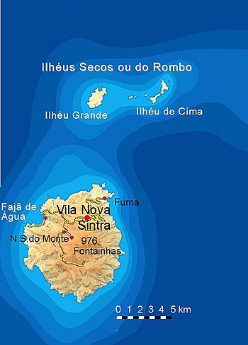
Brava island is about 10.5 kilometers long from north to south. It is 9.3 kilometers wide. Its total area is about 62.51 square kilometers. The island is mostly a stratovolcano, which is a tall, cone-shaped volcano. It sits behind the huge Fogo volcano.
Brava has not had any recorded volcanic eruptions in modern history. However, its young volcanic shape and small earthquakes show it could erupt again. Its last eruption was many thousands of years ago. About 13% of the island is covered in forests.
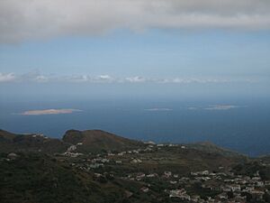
North of Brava, there are several small islands that no one lives on. The biggest ones are Ilhéu de Cima and Ilhéu Grande. The highest point on Brava is Monte Fontainhas. It reaches 976 meters above sea level.
Brava's Climate: Warm and Mild Weather
Because Brava is very mountainous, it has different types of weather. Along the coast, the climate is quite dry. In the mountains, it's a mild tropical climate with steady temperatures all year.
The average temperature on the coast is about 23 to 25 degrees Celsius (73-77°F). In the mountains, it's cooler, around 17 to 20 degrees Celsius (63-68°F). The island has a warmer, wet season from June to November. The colder, dry season lasts from December to May.
| Climate data for Cachaço, south of Nova Sintra, 800 metres ASL | |||||||||||||
|---|---|---|---|---|---|---|---|---|---|---|---|---|---|
| Month | Jan | Feb | Mar | Apr | May | Jun | Jul | Aug | Sep | Oct | Nov | Dec | Year |
| Mean daily maximum °C (°F) | 18.7 (65.7) |
18.6 (65.5) |
19.4 (66.9) |
19.8 (67.6) |
20.4 (68.7) |
21.0 (69.8) |
22.2 (72.0) |
23.1 (73.6) |
23.3 (73.9) |
22.6 (72.7) |
21.7 (71.1) |
19.6 (67.3) |
20.9 (69.6) |
| Daily mean °C (°F) | 16.2 (61.2) |
16.1 (61.0) |
16.6 (61.9) |
16.9 (62.4) |
17.6 (63.7) |
18.4 (65.1) |
19.4 (66.9) |
20.5 (68.9) |
20.8 (69.4) |
20.4 (68.7) |
19.1 (66.4) |
17.4 (63.3) |
18.3 (64.9) |
| Mean daily minimum °C (°F) | 13.8 (56.8) |
13.6 (56.5) |
13.8 (56.8) |
14.1 (57.4) |
14.9 (58.8) |
15.8 (60.4) |
16.7 (62.1) |
17.9 (64.2) |
18.4 (65.1) |
18.2 (64.8) |
16.5 (61.7) |
15.2 (59.4) |
16.9 (62.4) |
| Average rainfall mm (inches) | 11 (0.4) |
5 (0.2) |
1 (0.0) |
0 (0) |
0 (0) |
0 (0) |
17 (0.7) |
83 (3.3) |
123 (4.8) |
53 (2.1) |
33 (1.3) |
20 (0.8) |
346 (13.6) |
| Source: climate-data.org | |||||||||||||
Brava's Municipality and Parishes
Brava island is managed as one municipality, called Concelho da Brava. This municipality is divided into two freguesias, which are like civil parishes. These are São João Baptista and Nossa Senhora do Monte. The main administrative town is Nova Sintra.
Brava's Population and Towns
The main town on the island is Nova Sintra. The island's two parishes, São João Baptista and Nossa Senhora do Monte, are divided into 16 smaller areas for counting people.
São João Baptista
- Cachaço
- Cova Rodela
- Furna
- João da Noly
- Lem
- Mato Grande
- Nova Sintra (city)
- Santa Bárbara
- Vinagre
Nossa Senhora do Monte
- Campo Baixo
- Cova Joana
- Fajã de Água
- Mato
- Nossa Senhora do Monte (town)
- Tantum
- Tomé Barraz
Population Changes Over Time
In the 1830s, about 8,000 people lived on Brava. The population has changed over the years, as shown in the chart below.
| Year | Population |
|---|---|
| 1940 |
8,528
|
| 1950 |
7,937
|
| 1960 |
8,625
|
| 1970 |
7,756
|
| 1980 |
6,985
|
| 1990 |
6,975
|
| 2000 |
6,820
|
| 2010 |
5,995
|
| 2015 |
5,698
|
Brava's Economy: Farming and Fishing
The economy of Brava island mostly relies on farming and fishing. Farmers grow crops like coffee, potatoes (including sweet potatoes), corn, bananas, and sugar cane. Many of these farms use irrigation to water their plants.
Fun Places to Visit on Brava
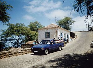
- Nova Sintra: This town has a museum, old Portuguese-style buildings, churches, and shops.
- Fajã de Agua: A small port on the west coast. It has a natural swimming pool where you can swim.
- Nossa Senhora do Monte: A village in the mountains with a church that people visit on pilgrimages.
- Cova Rodela: Another mountain village. It has a special dragon tree on its main street.
Sports on Brava Island
Brava island has several football (soccer) clubs. They are part of the Brava Regional Football Association.
Getting Around Brava: Transport and Ports
The Esperadinha Airport was opened in 1992 but closed in 2004. This was because of strong winds that made it unsafe for planes. The village of Furna has a port for commercial ships. The other port, Fajã de Água, is only used by fishing boats. Ferries to the islands of Fogo and Santiago leave from Furna.
On Brava, you can get to villages by "Aluguer" buses. These are shared taxis or minibuses. They don't have a set schedule; they leave when they have enough passengers. There are also a few regular taxis available.
Famous People from Brava
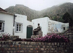
- Eugénio Tavares: A famous musician. He used traditional morna music and wrote songs in Cape Verdean Creole. There is a statue of him in the main square of Vila Nova Sintra. It is surrounded by a beautiful garden.
- Vinny deMacedo: He was born in Brava and later became a State Representative and State Senator in Massachusetts, USA.
- David Soares: He is the District Attorney for Albany County, New York, USA.
See also
 In Spanish: Isla Brava para niños


