Brazil–Paraguay border facts for kids
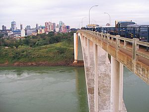
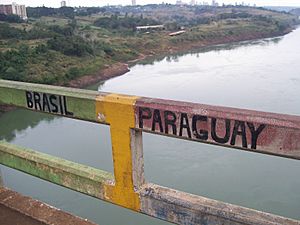
The Brazil–Paraguay border is a long line that separates the countries of Brazil and Paraguay. It stretches from Foz do Iguaçu in Brazil to Corumbá. This border goes through many different types of land. You can find big cities, dry deserts, and even wet marshlands along its path.
The border begins where three countries meet: Brazil, Paraguay, and Argentina. This point is between Foz do Iguaçu and President Franco. It ends where Brazil, Paraguay, and Bolivia meet, near the city of Bahía Negra in Paraguay. A very important landmark on this border is the Itaipu Dam. This huge dam is one of the biggest hydroelectric power plants in the world. It creates a lot of electricity every year.
How the Brazil-Paraguay Border Was Set
The exact location of the border was decided after a big conflict called the Paraguayan War. This war ended in 1870. A peace treaty was signed in 1872 between Brazil and Paraguay. This treaty officially set the limits for both countries.
According to historians, this agreement respected older deals from the time when the area was still under colonial rule. Brazil only claimed land that was already used or settled by Portuguese and Brazilians. This helped to create the border we see today.
See Also
 In Spanish: Frontera entre Brasil y Paraguay para niños
- Borders of Brazil
- Borders of Paraguay
- Friendship Bridge (Brazil–Paraguay)
 | John T. Biggers |
 | Thomas Blackshear |
 | Mark Bradford |
 | Beverly Buchanan |


