
Brightmoor, Detroit facts for kids
Quick facts for kids
Brightmoor
|
|
|---|---|
|
Neighborhood of Detroit
|
|
 |
|

Brightmoor
Location in Wayne County, Michigan

Brightmoor
Location in Michigan
|
|
| Country | |
| State | |
| County | |
| City | |
| Organized | 1922 |
| Annexed by Detroit | 1926 |
| Area | |
| • Total | 3.9 sq mi (10 km2) |
| • Land | 3.9 sq mi (10 km2) |
| • Water | 0.0 sq mi (0 km2) |
| Population
(2020)
|
|
| • Total | 11,099 |
| • Density | 2,845.8/sq mi (1,098.8/km2) |
| Time zone | UTC-5 (EST) |
| • Summer (DST) | UTC-4 (EDT) |
| ZIP code(s) |
48223
|
| Area code(s) | 313 |
Brightmoor is a neighborhood in Detroit, Michigan. It is located near the northwest edge of the city. The Brightmoor Alliance group says Brightmoor is bordered by Puritan Avenue to the north, the CSX railway to the south, Evergreen Road to the east, and West Outer Drive, Dacosta Street, and Telegraph Road to the west.
However, the population numbers for the neighborhood often include a larger area. This larger area is part of the city's official Master Plan Neighborhood area.
Contents
Brightmoor: A Detroit Neighborhood's Story
How Brightmoor Began
In 1921, a developer named Burt Eddy Taylor bought about 160 acres of land. This land was about one mile from Detroit's city limits back then. Taylor wanted to create Brightmoor as a planned community. He aimed to build affordable homes for people moving from the Southern United States in the early 1920s.
The new community opened in 1922. B. E. Taylor invited workers from Appalachia. He offered them jobs in Detroit's growing car factories. Between 1923 and 1924, another 2,913 acres were added to the community. Most people living in Brightmoor worked in the automobile industry. Many families could own a house and live comfortably. The City of Detroit officially added Brightmoor to the city in 1926.
Changes Over Time
Over 40 years, leading up to 2011, the number of people living in Brightmoor went down. Some residents also moved away in the 1990s and 2000s.
In June 2013, a group called Detroit Blight Authority started cleaning up trash. They focused on a 14-city block area. This area had about 70 empty buildings. Many of these buildings were damaged or broken into. The authority worked with other groups to organize a big cleanup event in August 2013.
Where is Brightmoor Located?
Brightmoor is in the northwest part of Detroit. Its general borders are Evergreen Road, Telegraph Road, Puritan Road, and Interstate 96.
The Brightmoor Alliance group says the neighborhood covers about 4 square miles. They define the borders as Puritan Road to the north, the CSX railway to the south, Evergreen Road to the east, and Telegraph Road, Dacosta Street, and Outer Drive West to the west.
The city's official master plan uses a slightly different definition. This definition includes a larger area. In this plan, Brightmoor is next to other neighborhoods like Redford to the north and Rosedale to the northeast. To the west is Redford Charter Township.
Who Lives in Brightmoor?
| Historical population | |||
|---|---|---|---|
| Census | Pop. | %± | |
| 1990 | 23,775 | — | |
| 2000 | 19,837 | −16.6% | |
| 2010 | 12,836 | −35.3% | |
| 2020 | 11,099 | −13.5% | |
| U.S. Decennial Census | |||
In 1990, about 23,775 people lived in Brightmoor. About 12% of them were senior citizens.
By 2000, the population had dropped to 19,837 residents. This was a 16.5% decrease from 1990. At that time, about 37.2% of Brightmoor's population was under 18 years old. About 5.3% were over 64 years old.
In 2010, the population fell even more to 12,836 people. This was a 35.3% drop in ten years. About 29.9% of the population was under 18 years old. About 12.7% were over 64 years old.
Parks and Fun in Brightmoor
Brightmoor has two parks: Eliza Howell Park and Stoepel Park. A greenway connects these two parks. Eliza Howell Park is near Fenkell and Telegraph. It has 250 acres of land, making it the fourth largest park in Detroit. This park is about one-fourth the size of Belle Isle.
The Cheyne family gave 138 acres of this land to the City of Detroit in the 1930s. The agreement from 1936 says the city must keep the land as a public park.
The Brightmoor Alliance
The Brightmoor Alliance is a group of community organizations. They work together to improve the neighborhood. The Alliance started in 2000. They meet regularly to plan programs, events, and partnerships. They also work with city officials and large foundations to help develop new programs for Brightmoor.
Learning in Brightmoor
Public Schools
Students in Brightmoor attend Detroit Public Schools. Gompers K-8 and Murphy K-8 schools are in Brightmoor. They serve students from kindergarten to 8th grade. All high school students go to Frank Cody High School, which is outside of Brightmoor.
The current Gompers Elementary-Middle School opened in 2011. It serves students from PreK to 8th grade. This new school cost $21.4 million to build. It has separate sections for elementary and middle school students.
Private Schools
City Mission Academy is a private Christian school in Brightmoor. Nicole Aikens started this school in the early 2000s.
Community Organizations
Many groups work to help Brightmoor. These include the Brightmoor Community Center, Motor City Blight Busters, Mt. Vernon Baptist Church, Northwest Detroit Neighborhood Development, and Neighbors Building Brightmoor. Other groups are The Detroit Partnership, NexusDetroit, and Redford Brightmoor Initiative. There are also 28 other local businesses, community centers, and churches involved. The current leader of the Brightmoor Alliance is Rev. Larry L. Simmons Sr.
Images for kids
-
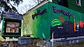
A home in Brightmoor painted with a map of the neighborhood. A community "free library" can be seen in the yard.

