Brixton Street Wetlands facts for kids
Quick facts for kids Designations |
|
|---|---|
| Official name | Brixton Street and Associated Wetlands |
| Type | Natural |
| Designated | 21 November 2000 |
| Reference no. | 19538 |
| Place File Number | 5/13/011/0004 |
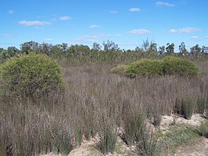
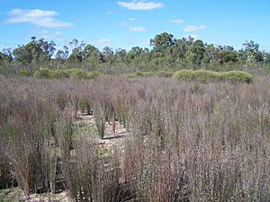
The Brixton Street Wetlands is a very special natural area in Perth, Western Australia. It's a type of wetland, which means it's land that is often covered with water. You can find it in the suburb of Kenwick, which is in the south-east part of Perth. It's also quite close to the bottom of the Darling Scarp, a large hill range.
The wetlands cover about 126 hectares. That's a huge area, like 300 football fields! It's right next to houses, schools, and some older rural properties. A big road called Roe Highway and a railway line run along one side of the wetlands.
Amazing Plants and Animals
The Brixton Street Wetlands are home to an incredible number of plant species. Even though the area isn't huge, it has over 400 different types of plants! This is about 20% of all the plant species found in the entire Perth area.
Many of these plants are rare or in danger of disappearing. About 80 types of flowering plants here are considered endangered. They are not often found on the Swan Coastal Plain, which is the flat area where Perth is built. In fact, the plant communities here are the last large wetland plant groups on the claypans of the plain.
Four of the plant species are so rare they are called "Declared Rare Flora." One example is the Purdie's donkey orchid (Diuris purdiei).
The wetlands also have many animals. You might spot frogs, snakes, and lots of different insects. But the wetlands are especially important for a rare animal called the southern brown bandicoot (Isoodon obesulus). This small marsupial is often known by its Nyoongar Aboriginal name, quenda.
Why These Wetlands Are Special
Because the Brixton Street Wetlands are so important for nature, they have been officially recognized. In 1992, they were added to A Directory of Important Wetlands in Australia. At that time, they were called the "Brixton Street Swamps."
Later, on November 21, 2000, they were placed on the Register of the National Estate. This register is a list of places in Australia that are very important for their natural or cultural value. This shows just how special and valuable the Brixton Street Wetlands are for everyone.
- Lua error in Module:EditAtWikidata at line 29: attempt to index field 'wikibase' (a nil value).
 | Valerie Thomas |
 | Frederick McKinley Jones |
 | George Edward Alcorn Jr. |
 | Thomas Mensah |


