Brock Island facts for kids

Brock Island, Northwest Territories
|
|
| Geography | |
|---|---|
| Location | Northern Canada |
| Coordinates | 77°51′N 114°27′W / 77.850°N 114.450°W |
| Archipelago | Queen Elizabeth Islands Canadian Arctic Archipelago |
| Area | 764 km2 (295 sq mi) |
| Length | 41 km (25.5 mi) |
| Width | 39 km (24.2 mi) |
| Administration | |
|
Canada
|
|
| Territory | Northwest Territories |
| Demographics | |
| Population | Uninhabited |
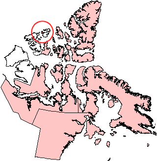
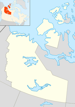
Brock Island is a quiet, empty island located in the far north of Canada. It is part of a large group of islands called the Canadian Arctic Archipelago. This island is found in the Northwest Territories. No one lives on Brock Island.
Contents
Exploring Brock Island
Brock Island covers an area of about 764 square kilometers. That's roughly the size of a large city! It is about 41 kilometers long and 39 kilometers wide. The island is located very close to another island called Mackenzie King Island.
Where is Brock Island?
You can find Brock Island way up north at 77°51'N latitude and 114°27'W longitude. This means it's in a very cold and remote part of the world. It is part of the Queen Elizabeth Islands, which are a group of islands in the Canadian Arctic.
Who Discovered Brock Island?
The first time a European explorer saw Brock Island was in 1915. This explorer was named Vilhjalmur Stefansson. He was a famous Arctic explorer.
How Did Brock Island Get Its Name?
Brock Island was named after a person called Reginald W. Brock. He was a very important person at the University of British Columbia. He was the Dean of Applied Science there. A "dean" is a leader in a university, often in charge of a specific department or faculty.
See also
 In Spanish: Isla Brock para niños
- Islands of the Queen Elizabeth Islands
- Uninhabited islands of the Northwest Territories
 | Anna J. Cooper |
 | Mary McLeod Bethune |
 | Lillie Mae Bradford |


