Mackenzie King Island facts for kids

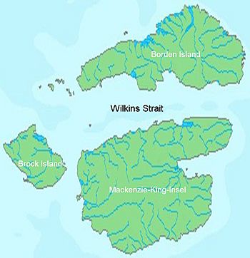
Mackenzie King Island with Brock and Borden Island
|
|
 |
|
| Geography | |
|---|---|
| Location | Northern Canada |
| Coordinates | 77°45′N 112°00′W / 77.750°N 112.000°W |
| Archipelago | Queen Elizabeth Islands Canadian Arctic Archipelago |
| Area | 5,048 km2 (1,949 sq mi) |
| Length | 61 mi (98 km) |
| Width | 60 mi (100 km) |
| Highest elevation | 112 m (367 ft) |
| Administration | |
| Territory | Northwest Territories Nunavut |
| Demographics | |
| Population | 0 |
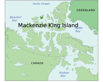
Mackenzie King Island is a large, uninhabited island located in the far northern part of Canada. It is one of the many islands that make up the Queen Elizabeth Islands, which are part of the larger Canadian Arctic Archipelago.
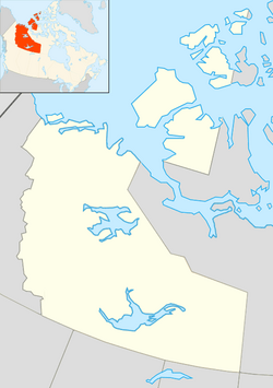
This island is found north of Melville Island and south of Borden Island. Interestingly, Mackenzie King Island is divided between two of Canada's territories. Most of the island belongs to the Northwest Territories, while its eastern side is part of Nunavut. The border between these two territories runs along the 110th meridian west.
Mackenzie King Island covers an area of about 5,048 square kilometers (1,949 square miles). It is roughly 97 kilometers (60 miles) long and 97 kilometers (60 miles) wide. This makes it the 116th largest island in the world and the 26th largest island in Canada.
Exploring Mackenzie King Island
Mackenzie King Island is a remote and icy place. It is part of the vast Canadian Arctic Archipelago, a group of islands in the Arctic Ocean. These islands are known for their cold climate and unique wildlife.
The island's landscape is mostly flat or gently rolling. The highest point on the island is only 112 meters (367 feet) above sea level. Because of its northern location, the island is covered in tundra vegetation. This means there are no trees, but rather small shrubs, grasses, and mosses.
History of Discovery
The first recorded visit to Mackenzie King Island happened in 1915. It was explored by a famous Arctic explorer named Vilhjalmur Stefansson. He was known for his expeditions to the Canadian Arctic.
The island was later named in honor of William Lyon Mackenzie King. He was a very important person in Canadian history. William Lyon Mackenzie King served as the Prime Minister of Canada for many years. He was the country's leader during significant times, including World War II.
See also
 In Spanish: Isla Mackenzie King para niños
 | James Van Der Zee |
 | Alma Thomas |
 | Ellis Wilson |
 | Margaret Taylor-Burroughs |


