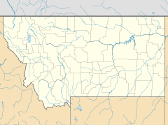
Brockway, Montana facts for kids
Quick facts for kids
Brockway, Montana
|
|
|---|---|
| Country | United States |
| State | Montana |
| County | McCone |
| Area | |
| • Total | 0.35 sq mi (0.91 km2) |
| • Land | 0.35 sq mi (0.91 km2) |
| • Water | 0.00 sq mi (0.00 km2) |
| Elevation | 2,577 ft (785 m) |
| Population
(2020)
|
|
| • Total | 14 |
| • Density | 39.77/sq mi (15.36/km2) |
| Time zone | UTC-7 (Mountain (MST)) |
| • Summer (DST) | UTC-6 (MDT) |
| ZIP code |
59214
|
| FIPS code | 30-10075 |
Brockway is a very small community in Montana, United States. It is located in McCone County, close to the Redwater River. In 2020, only 14 people lived there, making it a tiny place!
Every year, Brockway hosts a fun event called the Brockway Dairy Day Rodeo.
Contents
Discover Brockway's Past
Brockway got its name from three brothers who were early settlers, called homesteaders. The town opened its first post office in 1913. This helped people send and receive mail.
Later, in 1928, a train line called the Northern Pacific Railway's Redwater branch reached Brockway. This was a big deal for the town. It helped Brockway become a major place for shipping livestock, like cattle. In fact, in 1934, it was the number one livestock shipping point in the whole U.S.!
Where is Brockway Located?
Brockway is found in the state of Montana. It sits along Montana Secondary Highway 253. This road is about one mile south of Montana Highway 200. The community is also part of the Big Sky Back Country Byway, a scenic route.
Brockway is about 12 miles southwest of Circle. Circle is the main town and county seat of McCone County. The Redwater River flows just west and north of Brockway. This river eventually joins the big Missouri River.
Brockway's Size
The area of Brockway is quite small. It covers about 0.35 square miles. All of this area is land, with no large bodies of water.
How Many People Live in Brockway?
Brockway is a very small community. In the 2020 census, the population was recorded as 14 people. This was the first time Brockway was officially counted as a "census-designated place" (CDP).
| Historical population | |||
|---|---|---|---|
| Census | Pop. | %± | |
| 2020 | 14 | — | |
| U.S. Decennial Census | |||
Brockway's Weather
Brockway has a type of weather called a semi-arid climate. This means it's generally dry, but not a true desert. It gets some rain, but not a lot.
| Climate data for Brockway, Montana (1991–2020 normals, extremes 1959–present) | |||||||||||||
|---|---|---|---|---|---|---|---|---|---|---|---|---|---|
| Month | Jan | Feb | Mar | Apr | May | Jun | Jul | Aug | Sep | Oct | Nov | Dec | Year |
| Record high °F (°C) | 68 (20) |
71 (22) |
84 (29) |
91 (33) |
101 (38) |
110 (43) |
108 (42) |
108 (42) |
104 (40) |
94 (34) |
78 (26) |
68 (20) |
110 (43) |
| Mean daily maximum °F (°C) | 28.8 (−1.8) |
32.5 (0.3) |
44.5 (6.9) |
56.6 (13.7) |
66.7 (19.3) |
76.2 (24.6) |
85.2 (29.6) |
84.8 (29.3) |
73.3 (22.9) |
57.4 (14.1) |
42.6 (5.9) |
31.4 (−0.3) |
56.7 (13.7) |
| Daily mean °F (°C) | 18.0 (−7.8) |
21.5 (−5.8) |
32.6 (0.3) |
43.6 (6.4) |
53.5 (11.9) |
63.2 (17.3) |
70.5 (21.4) |
69.5 (20.8) |
58.7 (14.8) |
44.7 (7.1) |
31.1 (−0.5) |
20.8 (−6.2) |
44.0 (6.7) |
| Mean daily minimum °F (°C) | 7.2 (−13.8) |
10.5 (−11.9) |
20.7 (−6.3) |
30.7 (−0.7) |
40.4 (4.7) |
50.1 (10.1) |
55.8 (13.2) |
54.3 (12.4) |
44.0 (6.7) |
31.9 (−0.1) |
19.5 (−6.9) |
10.2 (−12.1) |
31.3 (−0.4) |
| Record low °F (°C) | −44 (−42) |
−47 (−44) |
−36 (−38) |
−9 (−23) |
12 (−11) |
24 (−4) |
33 (1) |
25 (−4) |
14 (−10) |
−10 (−23) |
−35 (−37) |
−43 (−42) |
−47 (−44) |
| Average precipitation inches (mm) | 0.24 (6.1) |
0.18 (4.6) |
0.29 (7.4) |
1.16 (29) |
2.48 (63) |
2.54 (65) |
2.07 (53) |
1.14 (29) |
1.08 (27) |
0.86 (22) |
0.21 (5.3) |
0.20 (5.1) |
12.45 (316) |
| Average precipitation days (≥ 0.01 in) | 2.4 | 2.2 | 2.6 | 4.7 | 7.2 | 7.8 | 5.7 | 3.6 | 3.6 | 3.0 | 1.7 | 1.5 | 46.0 |
| Source: NOAA | |||||||||||||
 | Madam C. J. Walker |
 | Janet Emerson Bashen |
 | Annie Turnbo Malone |
 | Maggie L. Walker |


