McCone County, Montana facts for kids
Quick facts for kids
McCone County
|
|
|---|---|

|
|

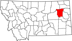
Location within the U.S. state of Montana
|
|
 Montana's location within the U.S. |
|
| Country | |
| State | |
| Founded | 1919 |
| Seat | Circle |
| Largest town | Circle |
| Area | |
| • Total | 2,683 sq mi (6,950 km2) |
| • Land | 2,643 sq mi (6,850 km2) |
| • Water | 40 sq mi (100 km2) 1.5% |
| Population
(2020)
|
|
| • Total | 1,729 |
| • Estimate
(2022)
|
1,709 |
| • Density | 0.64443/sq mi (0.24881/km2) |
| Time zone | UTC−7 (Mountain) |
| • Summer (DST) | UTC−6 (MDT) |
| Congressional district | 2nd |
|
|
McCone County is a county located in the state of Montana. In 2020, about 1,729 people lived there. The main town and county seat is Circle.
The county was created in 1919. It was named after George McCone, who was an important person in the state government. He was a State Senator and one of the first leaders of Dawson County.
Contents
Geography of McCone County
McCone County covers a total area of about 2,683 square miles. Most of this area, about 2,643 square miles, is land. The rest, about 40 square miles, is water.
Main Roads in McCone County
These are the most important roads that go through McCone County:
Neighboring Counties
McCone County shares its borders with these other counties:
- Valley County - to the west
- Roosevelt County - to the north
- Richland County - to the northeast
- Dawson County - to the east
- Prairie County - to the south
- Garfield County - to the west
Protected Natural Areas
Part of the Charles M. Russell National Wildlife Refuge is located in McCone County. This is a special area set aside to protect wildlife.
Population History
| Historical population | |||
|---|---|---|---|
| Census | Pop. | %± | |
| 1920 | 4,747 | — | |
| 1930 | 4,790 | 0.9% | |
| 1940 | 3,744 | −21.8% | |
| 1950 | 3,258 | −13.0% | |
| 1960 | 3,321 | 1.9% | |
| 1970 | 2,875 | −13.4% | |
| 1980 | 2,702 | −6.0% | |
| 1990 | 2,276 | −15.8% | |
| 2000 | 1,977 | −13.1% | |
| 2010 | 1,734 | −12.3% | |
| 2020 | 1,729 | −0.3% | |
| 2022 (est.) | 1,709 | −1.4% | |
| U.S. Decennial Census 1790–1960, 1900–1990, 1990–2000, 2010–2020 |
|||
The population of McCone County has changed over the years. In 1920, there were 4,747 people. By 2020, the population was 1,729.
Towns and Communities
McCone County has one main town and several smaller communities.
Main Town
- Circle is the county seat. This means it's where the county government is located.
Other Communities
These are smaller places where people live in McCone County:
Other Unincorporated Communities
These are even smaller places that don't have their own local government:
- Nickwall
- Weldon
See also
 In Spanish: Condado de McCone para niños
 | Aurelia Browder |
 | Nannie Helen Burroughs |
 | Michelle Alexander |


