
Richland County, Montana facts for kids
Quick facts for kids
Richland County
|
|
|---|---|

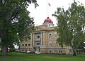
Richland County Courthouse in Sidney
|
|

Location within the U.S. state of Montana
|
|
 Montana's location within the U.S. |
|
| Country | |
| State | |
| Founded | May 27, 1914 |
| Seat | Sidney |
| Largest city | Sidney |
| Area | |
| • Total | 2,103 sq mi (5,450 km2) |
| • Land | 2,084 sq mi (5,400 km2) |
| • Water | 19 sq mi (50 km2) 0.9% |
| Population
(2020)
|
|
| • Total | 11,491 |
| • Estimate
(2022)
|
11,237 |
| • Density | 5.4641/sq mi (2.1097/km2) |
| Time zone | UTC−7 (Mountain) |
| • Summer (DST) | UTC−6 (MDT) |
| Congressional district | 2nd |
|
|
Richland County is a special area in the state of Montana, USA. It's like a large district with its own local government. In 2020, about 11,491 people lived here. The main town and center of the county is called Sidney.
Richland County was officially created in 1914 by the lawmakers of Montana. It was formed from a part of Dawson County. At first, they thought about naming it "Gate." But they chose "Richland" instead. This name was picked to encourage new people to move there. It suggested the land was rich and good for farming.
Contents
Exploring Richland County's Geography
This section tells us about the land and water in Richland County.
According to official measurements, Richland County covers a total area of about 2,103 square miles. Most of this area, about 2,084 square miles, is land. The rest, about 19 square miles, is water. This means water makes up less than 1% of the county's total area.
Main Roads You Can Drive On
Here are some of the important highways that go through Richland County:
 Montana Highway 16
 Montana Highway 23
 Montana Highway 200
Neighboring Counties Around Richland
Richland County shares its borders with several other counties and even another state.
- Roosevelt County – to the north
- Williams County, North Dakota – to the northeast
- McKenzie County, North Dakota – to the east
- Wibaux County - to the south
- Dawson County – to the southwest
- McCone County - to the west
Who Lives in Richland County? (Demographics)
This part talks about the people living in Richland County. It includes information like how many people there are and where they come from.
| Historical population | |||
|---|---|---|---|
| Census | Pop. | %± | |
| 1920 | 8,989 | — | |
| 1930 | 9,633 | 7.2% | |
| 1940 | 10,209 | 6.0% | |
| 1950 | 10,366 | 1.5% | |
| 1960 | 10,504 | 1.3% | |
| 1970 | 9,837 | −6.3% | |
| 1980 | 12,243 | 24.5% | |
| 1990 | 10,716 | −12.5% | |
| 2000 | 9,667 | −9.8% | |
| 2010 | 9,746 | 0.8% | |
| 2020 | 11,491 | 17.9% | |
| 2022 (est.) | 11,237 | 15.3% | |
| U.S. Decennial Census 1790–1960, 1900–1990, 1990–2000, 2010–2020 |
|||
Looking at the 2020 Census Numbers
In 2020, a count of all the people showed that 11,491 individuals lived in Richland County.
A Look at the 2010 Census
Back in 2010, there were 9,746 people living in the county. There were 4,167 households, which are groups of people living together. About 2,698 of these were families.
The population density was about 4.7 people per square mile. This means the county is not very crowded. Most people in the county (95%) were white. About 1.7% were American Indian.
Many people in Richland County have ancestors from Europe. For example, 37.8% had German roots. Also, 23.1% had Norwegian ancestors. About 13% had Irish family backgrounds.
In 2010, about 28.9% of households had children under 18. The average age of people in the county was 41.3 years old.
The average income for a household was about $52,516 per year. For families, it was about $60,236. About 13.5% of all people in the county lived below the poverty line. This included 16.6% of children under 18.
How People Make a Living (Economy)
Most of the land in Richland County is used for ranching. This means raising animals like cattle.
However, finding and producing oil became very important. This started around the year 2000. That's when the Elm Coulee Oil Field was discovered. This oil field is part of a larger area called the Bakken formation. Oil production has become a big part of the county's economy.
Towns and Places in Richland County
Here are the different types of communities you can find in Richland County:
Cities
- Sidney (This is the main town and county seat.)
Towns
Special Census Places
These are areas that are counted in the census but are not officially cities or towns:
Other Small Communities
These are other places in the county that are not officially organized as cities or towns:
- Andes
- Enid
- Lambert
- Ludington
- Girard
- Nohly
- Ridgelawn
- Sioux Pass
Images for kids
-
Richland County Courthouse in Sidney
See also
 In Spanish: Condado de Richland (Montana) para niños
